
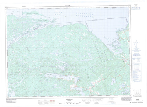
031L04 Nipissing Canada topo map, 1:50,000 scale
031L04 Nipissing NRCAN topographic map.
Includes UTM and GPS geographic coordinates (latitude and longitude). This 50k scale map is suitable for hiking, camping, and exploring, or you could frame it as a wall map.
Printed on-demand using high resolution, on heavy weight and acid free paper, or as an upgrade on a variety of synthetic materials.
Topos available on paper, Waterproof, Poly, or Tyvek. Usually shipping rolled, unless combined with other folded maps in one order.
- Product Number: NRCAN-031L04
- Parent Topo: TOPO-031L
- Map ID also known as: 031L04, 31L4, 31L04
- Unfolded Size: Approximately 26" high by 36" wide
- Weight (paper map): ca. 55 grams
- Map Type: POD NRCAN Topographic Map
- Map Scale: 1:50,000
- Geographical region: Ontario, Canada
Neighboring Maps:
All neighboring Canadian topo maps are available for sale online at 1:50,000 scale.
Purchase the smaller scale map covering this area: Topo-031L
Spatial coverage:
Topo map sheet 031L04 Nipissing covers the following places:
- Atkin Bay - Bobs Bay - Campbell Bay - Campbell's Bay - Crosspoint Bay - Crowbar Bay - Deep Bay - Durrell Bay - Durrell's Bay - Fish Bay - Frank Bay - Frank's Bay - Greening's Bay - Hardy Bay - Hinchberger Bay - Hunters Bay - Hunters Bay - Kervin's Bay - Long Wing - Marsh Bay - Meadow Bay - Muskie Bay - Sand Bay - Sandy Bay - Satchells Bay - Satchels Bay - Simms Bay - Simpson's Bay - South Bay - Stinking Bay - Sunlit Bay - Sunlit Cove - Sunset Cove - Twilight Bay - Waltonian Bay - Whitney Bay - Wigwam Bay - Angel's Point - Arthurs Point - Campbell Point - Campbell's Point - Cross Point - Durrell Point - Fishermans Point - Frank Point - Frank's Point - Gibraltar Point - Johnston Point - Lake Point - Pickerel Point - Stormy Point - Wabiscaunk Point - Wigwam Point - Windy Point - Brock's Channel - Canoe Pass - Canoe Passage - Nipissing Ouest - Chapman Chute - Chapman's Chute - Bertram - Gurd - Hardy - Nipissing - Nipissing - Parry Sound - Patterson - Pringle - Dokis Indian Reserve 9 - Réserve indienne Dokis 9 - #162 - Allison Island - Atcheson Island - Beacon Island - Bennett Island - Bingham Island - Blueberry Island - Blueberry Island - Boston Island - Bracken Island - Bragdon Island - Brills Island - Brownell Island - Browns Island - Burnt Island - Burnt Island - Cameron Island - Cleland Island - Comfort Island - Commanda Island - Dads Rest Island - Deelong Island - Doolittle Island - Droughton Island - Drunken Island - Dry Island - Duncan's Island - Elliot Island - Eureka Island - Fawn Island - Ferguson Island - Fishermans Island - Forestry Island - Fraser Island - Giesler Island - Green Island - Green Island - Greening Island - Greening's Island - Gull Islands - Hammond Islands - Hardy Island - Hendrie Island - Home Island - Homewood Island - Horseshoe Island - Hunt Island - Hunters Bay Island - Idlewylde Island - Îles Manitou - Jennings Island - Jessop Island - Jessup Island - Kawartha Island - Kennedy Island - Little Sandy Island - Loftus Island - Lonely Island - Lorne Island - Lucas Island - Manitou Islands - Marshall Island - Maw's Island - Merritt Island - Metapedia Island - Miller's Island - Minosin Island - Nivcent Island - Norris Island - North Jessup Island - Partridge Island - Perkins Island - Pine Island - Pine Knot Island - Porter Island - Rankin Island - Red Pine Island - Richardson Island - Robertson Island - Russell Island - Sandy Island - Schnaufer Island - Somerville Island - Spanner Island - Stark Island - Sumner Island - Sylvia May Island - Target Island - Three Pine Island - Three Sisters Islands - Torrance Island - Trescher Island - Twin Islands - Waldemar Island - Wanaki Island - Wigwam Island - Wilderslee Island - Wilson Island - Wright Island - Baldy Lake - Barton Lake - Bass Lake - Beatty Lake - Beaudry Lake - Beaver Lake - Bob's Lake - Brimson Lake - Broadwell Lake - Brownell Lake - Brown's Lake - Bruce Lake - Burnt Lake - Clear Lake - Commanda Lake - Crooked Lake - Dishaw Lake - Doland Lake - Duck Lake - Duncan Lake - First Lake - Fright Lake - Gerber Lake - Hazel Lake - Hicks Lake - Ibbitson Lake - Jinx Lake - Kidd Lake - Kilty Lake - La France Pond - Lac Nipissing - Lake Nipissing - Lennon Lake - Limbo Lost Lake - Little Clear Lake - Little Perch Lake - Little Rainy Lake - Long Lake - Lower Wiggins Lake - MacDonald Lake - Mayhew Lake - McQuaby Lake - McVeety Lake - Memesagamesing Lake - Migisi Lake - Mud Lake - Obashking Lake - Patterson Lake - Paul Lake - Perch Lake - Phantom Lake - Portage Lake - Porter Lake - Porter Lake - Rainy Lake - Rainy Lakes - Reserve Lake - Restoule Lake - Robin Lake - Ruth Lake - Sand Lake - Sandys Lake - Sandy's Lake - Satchells Lake - Satchels Lake - Scare Lake - Scud Lake - Second Lake - Secord Lake - Shoal Lake - Sloman Lake - Smallpox Lake - Spruce Lake - Stinking Lake - Stony Lake - Stormy Lake - Swalwell Lake - Tamarack Lake - Third Lake - Upper Wiggins Lake - Watt Lake - Wiggins Lake - Wolfe Lake - Woodcock Lake - Caldwell - Field - Nipissing - Springer - Fish Bay Conservation Reserve - French River Provincial Park - Manitou Islands Provincial Nature Reserve - Restoule Provincial Park - South Bay Provincial Park - West Sandy Island Provincial Nature Reserve - Grawbarger's Rapids - MacArthur's Rapids - Restoul Rapids - Restoule Rapids - Bear Creek - Beatty Creek - Beatty Creek - Beaudry Creek - Beaudry Creek - Burnt Lake Creek - Commanda Creek - Duncan Creek - Fraser Creek - French River - Hardy Creek - McQuaby Creek - Meadow Creek - Muskie Creek - Paul Creek - Portage Creek - Rainy Creek - Redpine Creek - Reserve Creek - Reserve Creek - Reserve Creek - Restoule River - Rivière des Français - Sand Creek - Satchels Creek - Shoal Creek - South River - Steels Creek - Steels Creek - Steel's Creek - Wades Creek - Wade's Creek - Wiggins Creek - Wolfe Creek - Woodcock Creek - Gull Rock - Gull Rock - Keystone Rock - Rusty Rock - Sugar Loaf Rock - West Nipissing - Alsace - Carr - Chapmans Landing - Chapman's Landing - Hotham - Keystone Camps - Nipissing - Nipissing Beach - Restoule - Wades Landing - Wade's Landing


