
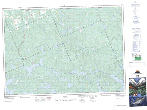
031L02 Kiosk Canada topo map, 1:50,000 scale
031L02 Kiosk NRCAN topographic map.
Includes UTM and GPS geographic coordinates (latitude and longitude). This 50k scale map is suitable for hiking, camping, and exploring, or you could frame it as a wall map.
Printed on-demand using high resolution, on heavy weight and acid free paper, or as an upgrade on a variety of synthetic materials.
Topos available on paper, Waterproof, Poly, or Tyvek. Usually shipping rolled, unless combined with other folded maps in one order.
- Product Number: NRCAN-031L02
- Parent Topo: TOPO-031L
- Map ID also known as: 031L02, 31L2, 31L02
- Unfolded Size: Approximately 26" high by 36" wide
- Weight (paper map): ca. 55 grams
- Map Type: POD NRCAN Topographic Map
- Map Scale: 1:50,000
- Geographical region: Ontario, Canada
Neighboring Maps:
All neighboring Canadian topo maps are available for sale online at 1:50,000 scale.
Purchase the smaller scale map covering this area: Topo-031L
Spatial coverage:
Topo map sheet 031L02 Kiosk covers the following places:
- Dismal Bay - Wolfe Bay - Brent Crater - Gravelle Chute - Bonfield - Boulter - Boyd - Calvin - Cameron - Deacon - Lauder - Lister - Nipissing - Osler - Papineau - Pentland - Wilkes - Gilmour Island - Pine Island - Rodkey Island - Arrow Lake - Ascalon Lake - Aura Lee Lake - Balsam Lake - Bay Lake - Big Swamp Lake - Boggy Lake - Boulter Lake - Boyd Lake - Brain Lake - Brant Lake - Bronson Lake - Bug Lake - Camp Five Lake - Carl Wilson Lake - Cauchon Lake - Cedar Lake - Chattahoochee Lake - Club Lake - Crookstick Lake - Curly Lake - Dahinda Lake - Dendroica Lake - Dumond Lake - East Thompson Lake - Erables Lake - Fork Lake - Gilmour Lake - Glacier Lake - Goosander Lake - Gouinlock Lake - Green Lake - Guilmette Lake - Gull Lake - Hurdman Lake - Ironwood Lake - Keswil Lake - Kioshkokwi Lake - Lac Guilmette - Lalonde Lake - Lalonde Lake - Landis Lake - Lauder Lake - Laurel Lake - Laurie Lake - Lismer Lake - Little Burnt Lake - Little Cauchon Lake - Little Cedar Lake - Little Crookstick Lake - Little Goosander Lake - Little Loxley Lake - Little Mink Lake - Little Pautois Lake - Little Sturgeon Lake - Little Thompson Lake - Little Villeneuve Lake - Loxley Lake - MacGibbon Lake - Manitou Lake - Maple Lake - Mink Lake - Mouse Lake - Muir Lake - Nebanawbaig Lake - North Sylvia Lake - Papineau Lake - Parisien Lake - Perch Lake - Pieurot Lake - Rainy Lake - Rankin Lake - Ratrap Lake - Red Pine Lake - Reindeer Lake - Richard Lake - Sable Lake - Scud Lake - Sears Lake - Sheldrake Lake - Solitaire Lake - South Long Lake - Spotter Lake - Stretch Lake - Sylvia Lake - Thompson Lake - Three Mile Lake - Threemile Lake - Ukalet Lake - Unktahee Lake - Upper Boom Lake - Upper Johnston Lake - Varley Lake - Villeneuve Lake - Waterclear Lake - Weeharry Lake - West Aumond Lake - West Corbeau Lake - Whisper Lake - Whitebirch Lake - Widgeon Lake - Wildgoose Lake - Wilkes Lake - Windermere Lake - Bonfield - Calvin - Cameron - Papineau - Papineau-Cameron - Algonquin Provincial Park - Amable du Fond Provincial Park - Amable du Fond River - Bastien Creek - Boom Creek - Boulter Creek - Brain Creek - Bronson Creek - Burritt's Creek - Cauchon Creek - Crookstick Creek - Gilmour Creek - Hawkesbury Creek - Hurdman Creek - Keswil Creek - Landis Creek - Lantern Creek - Lauder Creek - Little Pautois Creek - Loxley Creek - Maple Creek - Mink Creek - Nipissing River - North Sylvia Creek - Parisien Creek - Pautois Creek - Rainbow Creek - Solitaire Creek - Thompson Creek - Villeneuve Creek - West Aumond Creek - Ascalon - Coristine - Daventry - Eau Claire - Galston - Government Park - Kiosk - Mink Lake


