
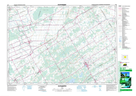
031G07 Alexandria Canada topo map, 1:50,000 scale
031G07 Alexandria NRCAN topographic map.
Includes UTM and GPS geographic coordinates (latitude and longitude). This 50k scale map is suitable for hiking, camping, and exploring, or you could frame it as a wall map.
Printed on-demand using high resolution, on heavy weight and acid free paper, or as an upgrade on a variety of synthetic materials.
Topos available on paper, Waterproof, Poly, or Tyvek. Usually shipping rolled, unless combined with other folded maps in one order.
- Product Number: NRCAN-031G07
- Parent Topo: TOPO-031G
- Map ID also known as: 031G07, 31G7, 31G07
- Unfolded Size: Approximately 26" high by 36" wide
- Weight (paper map): ca. 55 grams
- Map Type: POD NRCAN Topographic Map
- Map Scale: 1:50,000
- Geographical region: Ontario, Canada
Neighboring Maps:
All neighboring Canadian topo maps are available for sale online at 1:50,000 scale.
Purchase the smaller scale map covering this area: Topo-031G
Spatial coverage:
Topo map sheet 031G07 Alexandria covers the following places:
- Alfred - Caledonia - Charlottenburgh - East Hawkesbury - Glengarry - Kenyon - Lancaster - Lochiel - North Plantagenet - Plantagenet - Prescott - Roxborough - Russell - South Plantagenet - Stormont - West Hawkesbury - Allan McCuaig Drain - C. Beaulien Drain - Charles A. Leduc Drain - Chenier-Girard Drain - Chenier-Jeaurond Drain - Chisholm Drain - Cumming Drain - D.B. Chisholm Drain - Eddie St. Denis Drain - Fraser Drain - Harland Drain - Henry Drain - J.K. MacLeod Drain - James McDougall Drain - Joanette-Brunet Drain - K.D. Campbell Drain - Kenyon Dam - Lacombe Drain - Lanthier Drain - Lanthier-Cadieux Drain - Lauzon Creek Drain - Lochinvar Drain - Lundie Drain - MacDonald-Sabourin Drain - MacDougald Drain - MacDougall Drain - MacGillivray-MacLeod Drain - MacKenzie Drain - Marcoux Drain - McDougall Drain - McGillivray Drain - McMillan Drain - Morrison Drain - Quigley Drain - R.G. Scott Drain - Seguin Drain - Smith-Jamieson Drain - South La Graisse Drain - South La Graisse Drain - St-Denis Drain - Tayside-Legault Drain - Munroes Island - Alexandria Lake - Black Lake - Loch Garry - Middle Lake - Mill Pond - Mud Lake - Bonnie Hill - United Counties of Prescott and Russell - United Counties of Stormont, Dundas and Glengarry - Alfred - Alfred and Plantagenet - Caledonia - Cambridge - Champlain - Charlottenburgh - East Hawkesbury - Finch - Kenyon - Lancaster - Lochiel - Longueuil - North Glengarry - North Plantagenet - North Stormont - Roxborough - South Glengarry - South Plantagenet - The Nation - West Hawkesbury - Baudet River - Beaver Creek - Black Creek - Bradley Creek - Caledonia Creek - Cat Creek - Crystal Spring Creek - East Branch Scotch River - East Rigaud River - Garry River - Horse Creek - Moose Creek - Munroe Branch - Paxton Creek - Rigaud River - Rivière au Baudet - Rivière Beaudette - Rivière Delisle - Rivière Garry - Rivière Nation - Rivière Scotch - Ruisseau Caledonia - Scotch River - South Nation River - Spring Creek - West Branch Scotch River - Smiths Ferry - Aberdeen - Alexandria - Athol - Baltic Corners - Baltics Corners - Bloomington - Breadalbane - Brodie - Curran - Dalkeith - Dominionville - Dornie - Dunvegan - Dyer - Fairview - Fassifern - Fenaghvale - Fiskes Corners - Fournier - Franklins Corners - Glen Andrew - Glen Norman - Glen Robertson - Glen Sandfield - Green Valley - Greenfield - Guaytown - Kirkhill - Laggan - Lalonde - Lochiel - Lochinvar - Lorne - MacDonalds Grove - Maple Row - Maxville - McCormick - McCrimmon - Moose Creek - Parkers Corners - Pine Grove - Proulx - Riceville - Rose Corner - Routhier - Sandown - Sandringham - Skye - Springhill - St. Amour - St. Bernardin - St. Elmo - St. Isidore - St-Amour - St-Bernardin - Ste. Rose de Prescott - Ste-Rose - Ste-Rose-de-Prescott - Stewarts Glen - Tayside - Valfranc - Valleys Corners - Alfred Bog - Moose Creek Bog - La Nation - St. Isidore de Prescott


