
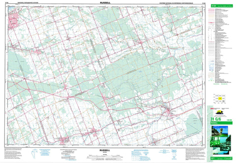
031G06 Russell Canada topo map, 1:50,000 scale
031G06 Russell NRCAN topographic map.
Includes UTM and GPS geographic coordinates (latitude and longitude). This 50k scale map is suitable for hiking, camping, and exploring, or you could frame it as a wall map.
Printed on-demand using high resolution, on heavy weight and acid free paper, or as an upgrade on a variety of synthetic materials.
Topos available on paper, Waterproof, Poly, or Tyvek. Usually shipping rolled, unless combined with other folded maps in one order.
- Product Number: NRCAN-031G06
- Parent Topo: TOPO-031G
- Map ID also known as: 031G06, 31G6, 31G06
- Unfolded Size: Approximately 26" high by 36" wide
- Weight (paper map): ca. 55 grams
- Map Type: POD NRCAN Topographic Map
- Map Scale: 1:50,000
- Geographical region: Ontario, Canada
Neighboring Maps:
All neighboring Canadian topo maps are available for sale online at 1:50,000 scale.
Purchase the smaller scale map covering this area: Topo-031G
Spatial coverage:
Topo map sheet 031G06 Russell covers the following places:
- Clarence-Rockland - Ottawa - High Falls - Buckingham - Cambridge - Clarence - Cumberland - Finch - Gloucester - National Capital Region - North Plantagenet - Osgoode - Plantagenet - Prescott - Région de la Capitale nationale - Roxborough - Russell - Russell - South Plantagenet - Stormont - Fraser Drain - Moose Creek Drain - Roxborough-Cambridge Drain - Stewart Drain - Petrie Island - Petrie Islands - Cobb Lake - Canaan Hill - Carleton - Ottawa-Carleton - United Counties of Prescott and Russell - United Counties of Stormont, Dundas and Glengarry - Alfred - Alfred and Plantagenet - Caledonia - Cambridge - Clarence - Finch - Fitzroy - Goulbourn - Huntley - Marlborough - North Gower - North Plantagenet - North Stormont - Osgoode - Rideau - Roxborough - Russell - South Plantagenet - The Nation - Torbolton - West Carleton - Bear Brook - Beckett Creek - Becketts Creek - Black Creek - Black Creek - Black Creek - Bradley Creek - Butternut Creek - Cardinal Creek - Castor River - Cobbs Lake Creek - Dickinson Creek - East Castor River - Harris Creek - Leonard Creek - Little Castor River - McKinnons Creek - Middle Castor River - Moose Creek - North Branch North Indian Creek - North Castor River - North Indian Creek - Ottawa River - Rivière des Outaouais - Rivière Nation - Ruisseau Butternut - Shaws Creek - South Branch North Indian Creek - South Castor River - South Indian Creek - South Nation River - Springbrook Creek - Taylors Creek - Whissell Creek - Wolf Creek - Bearbrook - Benoit - Borromée - Bourget - Bradley Creek - Brisson - Cambridge Forest Estates - Canaan - Carlsbad Springs - Chartrand - Cheney - Clarence Creek - Cumberland - Daniston - Edwards - Embrun - Ettyville - Forest Park - French Hill - Gagnon - Glenburn - Hammond - Johnsons Ferry - Lemieux - Leonard - Limoges - Longtinville - Martel - Martels Corners - Mayerville - Navan - North Osgoode - North Russell - Notre-Dame-des-Champs - Pana - Pendleton - Pendleton Station - Queenswood Heights - Russell - Sarsfield - St. Albert - St. Felix - St. Onge - St. Paschal Baylon - St-Albert - St-Onge - St-Pascal - St-Paschal-Baylon - Vars - Vinette - Westminster - Mer Bleue - Moose Creek Bog - Casselman - La Nation


