
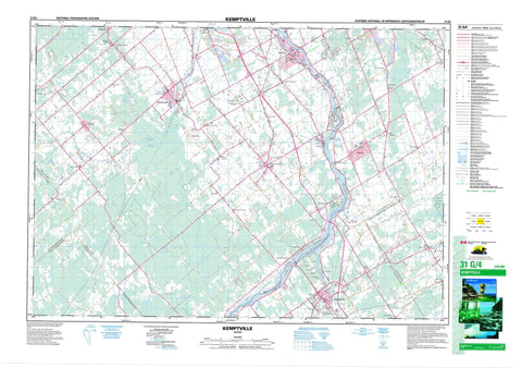
031G04 Kemptville Canada topo map, 1:50,000 scale
031G04 Kemptville NRCAN topographic map.
Includes UTM and GPS geographic coordinates (latitude and longitude). This 50k scale map is suitable for hiking, camping, and exploring, or you could frame it as a wall map.
Printed on-demand using high resolution, on heavy weight and acid free paper, or as an upgrade on a variety of synthetic materials.
Topos available on paper, Waterproof, Poly, or Tyvek. Usually shipping rolled, unless combined with other folded maps in one order.
- Product Number: NRCAN-031G04
- Parent Topo: TOPO-031G
- Map ID also known as: 031G04, 31G4, 31G04
- Unfolded Size: Approximately 26" high by 36" wide
- Weight (paper map): ca. 55 grams
- Map Type: POD NRCAN Topographic Map
- Map Scale: 1:50,000
- Geographical region: Ontario, Canada
Neighboring Maps:
All neighboring Canadian topo maps are available for sale online at 1:50,000 scale.
Purchase the smaller scale map covering this area: Topo-031G
Spatial coverage:
Topo map sheet 031G04 Kemptville covers the following places:
- Mahogany Harbour - Collins Point - The Catchall - Ottawa - Beckwith - Carleton - Dundas - Gloucester - Goulbourn - Grenville - Huntley - Lanark - Marlborough - Montague - Mountain - National Capital Region - Nepean - North Gower - Osgoode - Oxford - Région de la Capitale nationale - South Gower - McDermott Drain - Milton-Hoy Drain - Murphy Drain - Barnes Island - James Island - Libby Island - Little Island - Long Island - Nicholl Island - Nicolls Island - Sanders Island - Champ de manoeuvre Richmond - Richmond Training Area - Hyndmans Ridge - Kerrs Ridge - Loughlin Ridge - Carleton - Lanark - Ottawa-Carleton - United Counties of Leeds and Grenville - United Counties of Stormont, Dundas and Glengarry - Beckwith - Fitzroy - Goulbourn - Huntley - Marlborough - Montague - Mountain - North Dundas - North Gower - North Grenville - Osgoode - Oxford-on-Rideau - Rideau - South Gower - Torbolton - West Carleton - Winchester - Canal Rideau - Lieu historique national du Canada du Canal-Rideau - Rideau Canal National Historic Site of Canada - Rideau Canal World Heritage Site - Rideau River Provincial Park - Allen Creek - Brassils Creek - Cranberry Creek - Jock River - Kemptville Creek - Kings Creek - Mahoney Creek - Middle Castor River - Mud Creek - Nichols Creek - North Branch South Nation River - North Castor River - Rideau River - Rideau River & Canal - Rivière Rideau - Silver Creek - South Castor River - South Kemptville Creek - Steven Creek - Stevens Creek - West Branch Rideau River - Wylie Creek - Long Reach - McGahey's Bend - Baxters Corners - Becketts Landing - Bray - Carsonby - Dalmeny - Dwyer Hill - Dwyerhill - Enniskerry - Goodstown - Hallville - Healey's Heath - Herbert Corners - Kars - Kemptville - Malakoff - Manotick - Mansfield - Maple Hill - Marlmont - Mills Corners - Moores Corners - Mountain - Munster - North Gower - North Montague - North Mountain - North Rideau - Osgoode - Osgoode Station - Pierces Corners - Pooles Corners - Prospect - Reeve Craig - Reevecraig - Reid Mills - Reids Mills - Richmond - Sabourin - Sabourins Crossing - South Gower - Stanley Corners - Stapledon - Stittsville - Twin Elm - Waller - Watterson Corners - West Osgoode


