
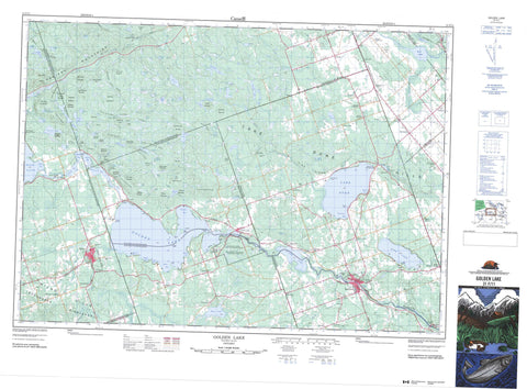
031F11 Golden Lake Canada topo map, 1:50,000 scale
031F11 Golden Lake NRCAN topographic map.
Includes UTM and GPS geographic coordinates (latitude and longitude). This 50k scale map is suitable for hiking, camping, and exploring, or you could frame it as a wall map.
Printed on-demand using high resolution, on heavy weight and acid free paper, or as an upgrade on a variety of synthetic materials.
Topos available on paper, Waterproof, Poly, or Tyvek. Usually shipping rolled, unless combined with other folded maps in one order.
- Product Number: NRCAN-031F11
- Parent Topo: TOPO-031F
- Map ID also known as: 031F11, 31F11
- Unfolded Size: Approximately 26" high by 36" wide
- Weight (paper map): ca. 55 grams
- Map Type: POD NRCAN Topographic Map
- Map Scale: 1:50,000
- Geographical region: Ontario, Canada
Neighboring Maps:
All neighboring Canadian topo maps are available for sale online at 1:50,000 scale.
Purchase the smaller scale map covering this area: Topo-031F
Spatial coverage:
Topo map sheet 031F11 Golden Lake covers the following places:
- Grassy Bay - Harris Bay - Hoffmans Bay - Kranzs Bay - Millers Bay - Mundts Bay - O'Connors Bay - Ruby Bay - Sand Bay - Sicards Bay - Skellys Bay - Smiths Bay - Square Bay - Turpins Bay - Wilsons Bay - Black Point - Church Point - Hoffmans Point - Lafleurs Point - Long Point - MacDonalds Point - Thomas Point - Bonnechere Caves - Boyles Narrows - Griffins Narrows - Harris Narrows - Algona - Alice - Bromley - Brudenell - Fraser - Grattan - Hagarty - North Algona - Renfrew - Richards - South Algona - Stafford - Westmeath - Wilberforce - Golden Lake Indian Reserve 39 - Pikwakanagan - Réserve indienne Golden Lake 39 - Réserve indienne Pikwakanagan - Beattys Island - Big Island - Centre Island - Umber Island - Big Swawell Lake - Biggs Lake - Brewster Lake - Browns Lake - Buck Lake - Bullfrog Pond - Clear Lake - Crooked Lake - Dans Lake - Devils Lake - Dunns Lake - Eadys Lake - Edward Lake - Foley Lake - Golden Lake - Goose Lake - Grabers Lake - Green Lake - Jack Lakes - Jacks Lakes - Jeffrey Lake - Johns Lake - Jonsons Lake - Kelly Lake - Kidds Lake - Killaloe Pond - Lake Doré - Landrys Lake - Little Johns Lake - Little Redpine Lake - Little Round Lake - Little Swawell Lake - Long Lake - Long Lake - Lower Long Lake - Mackeys Lake - Meath Lake - Michigan Lakes - Middle Long Lake - Millers Lake - Mink Lake - Mud Lake - Mud Lake - Mud Lake - Mud Pond - Partridge Lake - Perrigo Lake - Petznick Lake - Pike Lake - Quacle Lake - Quades Lake - Rattrays Lake - Red Rock Lake - Red Rock Mountain Lake - Redpine Lake - Remus Lake - Rock Lake - Rock Lake - Rock Pond - Round Lake - Sams Lake - Scharfe Lake - Schwanns Lake - Shaws Pond - Silver (Zadow) Lake - Silver Lake - Silver Pond - St. Patricks Lake - Teapot Lake - Tous Sainte Lake - Touseants Lake - Upper Long Lake - Wilber Lake - Zadow Lake - Badhams Mountain - Big Hardwood Mountain - Big Mountain - Big Oak Mountain - Bluff Rock - Bluff Rock Mountain - Brewster Lake Mountain - Buck Hill - Camboose Mountain - Campbells Camp Mountain - Cherry Hill Mountain - Chicot Mountain - Cowies Hill - Devils Lake Range - Doe Hill - Eadys Mountain - Foley Lake Ridge - French Hill - Gardez Pieds Mountains - Gariepy Mountains - Goose Egg Mountain - Goulets Hill - Gully Hill - Hardwood Mountain - Higginsons Hill - Jackpine Mountain - Jacks Mountains - Jonsons Lake Mountain - Kilbys Mountain - Kilbys Mountains - Lake Doré Hills - Little Oak Mountain - Long Lake Range - Lower Long Lake Range - Madawaska Highlands - McDougalls Mountain - Meath Hill - Mount Edna - Oak Hill - O'Connors Hill - Old Shed Hill - Pauls Hill - Pine Ridge - Pine Ridge - Pinetree Mountain - Pinnacle Mountain - Pranges Hills - Red Rock Mountain - Redpine Mountain - Reinkes Hill - Rock Lake Mountain - Sand Hill - Sauers Mountain - Shed Hill - Shed Hill Range - Shellhorn Mountain - Smiths Shanty Hill - Sugarbush Mountain - Summers Mountain - Thomas Mountain - Thompson Pond Ridge - Topping Off Hill - Trace Hill - Wilno Hills - Renfrew - Admaston - Admaston/Bromley - Alice and Fraser - Bonnechere Valley - Bromley - Brudenell and Lyndoch - Brudenell, Lyndoch and Raglan - Grattan - Hagarty and Richards - Killaloe, Hagarty and Richards - Laurentian Valley - North Algona - North Algona Wilberforce - Pembroke - Raglan - Ross - Sebastopol - South Algona - Stafford - Stafford and Pembroke - Westmeath - Whitewater Region - Wilberforce - Foy Property Provincial Park - Mud Lake/Creek Conservation Reserve - Silver Creek Peatland Conservation Reserve - Crooked Rapids - Jessups Rapids - Beaudrys Creek - Biedermans Creek - Black Creek - Bonnechere River - Brennan Creek - Brennans Creek - Browns Creek - Brudenell Creek - Cochrane Creek - Cold Creek - Coles Creek - Crooked Lake Creek - Devines Creek - Eadys Creek - Fish Creek - Gardez Pieds Creek - Gariepy Creek - Hennessys Creek - Hurds Creek - Indian River - Jack Creek - Jacks Creek - Kelly Lake Creek - Little Cranberry Creek - Locksley Creek - Manions Creek - McKeys Creek - Mink Creek - Mud Creek - Muskrat River - Perrigo Creek - Pollocks Creek - Sauers Creek - Scharfe Creek - Silver Creek - Snake River - Spring Creek - Zummachs Creek - Allans Corners - Augsburg - Budd Mills - Bulger - Bulgers Corners - Connaught - Deacon - Donegal - Doré Bay - Eganville - Fourth Chute - French Settlement - German Settlement - Germanicus - Golden Lake - Green Lake - Griersford - Howard - Huckabones Corners - Kellys Corner - Killaloe - Killaloe - Knightington - Lake Doré - Letts Corners - Locksley - Lower Stafford - Micksburg - Mink Lake - Misksburg - Mud Lake - Old Killaloe - Rankin - Ruby - Silver Lake - Slabtown - Stafford - Tramore - Woito - Zadow - Gardez Pieds Ravine - Gariepy Ravine - Big Marsh - Feeleys Marsh - Gores Meadow - Long Meadow - McDougalls Marsh - Sunken Meadow - Killaloe Station


