
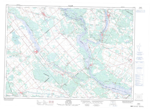
031F10 Cobden Canada topo map, 1:50,000 scale
031F10 Cobden NRCAN topographic map.
Includes UTM and GPS geographic coordinates (latitude and longitude). This 50k scale map is suitable for hiking, camping, and exploring, or you could frame it as a wall map.
Printed on-demand using high resolution, on heavy weight and acid free paper, or as an upgrade on a variety of synthetic materials.
Topos available on paper, Waterproof, Poly, or Tyvek. Usually shipping rolled, unless combined with other folded maps in one order.
- Product Number: NRCAN-031F10
- Parent Topo: TOPO-031F
- Map ID also known as: 031F10, 31F10
- Unfolded Size: Approximately 26" high by 36" wide
- Weight (paper map): ca. 55 grams
- Map Type: POD NRCAN Topographic Map
- Map Scale: 1:50,000
- Geographical region: Ontario, Canada
Neighboring Maps:
All neighboring Canadian topo maps are available for sale online at 1:50,000 scale.
Purchase the smaller scale map covering this area: Topo-031F
Spatial coverage:
Topo map sheet 031F10 Cobden covers the following places:
- Baie à Armstrong - Baie à Crawford - Baie à Heath - Baie à John - Baie à Pryer - Baie à Wickens - Baie Cowley - Baie de Campbell's Bay - Baie de Georges - Baie de Letts - Baie Féline - Baie Harmony - Baie Indian - Baie Miller - Baie Sand - Baie Thompson - Black Bay - Blackburn Bay - Boyds Bay - Browns Bay - Bruces Bay - Bulmers Bay - Chenal Letts - Conroy Bay - Crique à Lasalle - Crique à McDowell - Crique à Rouleau - Crique à Scott - Crique à Smith - Dead Bay - Dickson Bay - Dicksons Bay - Farrell Bay - Farrells Bay - Ferguson Bay - Fergusons Bay - Johnston Bay - Johnstons Bay - Killoran Bay - Lac à Campbell - Lesters Bay - Lily Bay - McNaughton Bay - Toweys Bay - Les Sables - Plage de Le Roy - Bices Point - Bisset Point - Bulless Point - Byces Point - Codies Point - Coffeys Point - Coties Point - Farrells Point - McConeghys Point - McCourters Point - McCrearys Point - McEwans Point - McEwens Point - Pointe à McCuaig - Pointe Green - Canal Slide - Chenal du Grand Calumet - Chenal du Rocher Fendu - Chenal du Rocher-Fendu - Chenal Raft - Raft Channel - The Narrows - Chute à Desjardins - Chute à Garvin - Chute Beauchamp - Chute du Grand Calumet - First Chute - Admaston - Bromley - Clarendon - Grand-Calumet - Horton - L'Immaculée-Conception - L'Immaculée-Conception - Litchfield - McNab - Ross - Sainte-Anne - Saint-James - Saint-John-the-Evangelist - Stafford - Thorne - Westmeath - Wilberforce - Barrage de Bryson - Centrale de Bryson - Big Elbow Island - Cedar Island - Chenaux Island - Hazelton Island - Île à Cowley - Île à Everill - Île à Griffin - Île à Lawn - Île à Payne - Île à Rouleau - Île à Tom - Île Armstrong - Île Boom - Île Channel - Île de la Compagnie - Île Dog - Île du Calumet - Île du Chicot - Île du Grand Calumet - Île du Rocher Fendu - Île Elliott - Île Fox - Île French - Île Green - Île Hemlock - Île Lafontaine - Île Lasalle - Île Limerick - Île Reid - Île Snake - Île Victoria - Île Wickens - Îles à Cole - Îles Kennedy - Lorne Island - Petite île Limerick - Rocher à Gillis - Astrolabe Lake - Baie Default - Baie Dufault - Baie Worrell - Barrs Lake - Bennetts Lake - Blanchards Lake - Catharine Lake - Champlain Trail Lakes - Clubhouse Lake - Coldingham Lake - Crique à Bertrand - Dump Lake - Eadys Lake - Edmunds Lake - Étang de Hart - Étang Neville - Galilee Lake - Garden Lake - Gibsons Lake - Jeffreys Lake - Jeffreys Lake - Johnstons Lake - Lac à Armstrong - Lac à Chamberlain - Lac à Horner - Lac à Martin - Lac à McArthur - Lac à Prendergast - Lac Clark - Lac des Chats - Lac des Chats - Lac du Don - Lac du Don - Lac du Rocher Fendu - Lac du Rocher-Fendu - Lac Ebert - Lac Elliott - Lac Kelly - Lac Lett - Lac Marcel - Lac McNally - Lac Mill Dam - Lac Paul - Lac Richardson - Lac Richardson - Lac Schwartz - Lac Smiley - Lac Spring - Lac Towell - Little Lakes - McCarrolls Lake - Muskrat Lake - Obreys Lake - Olmstead Lake - Olmsted Lake - Olmsted Lake - Porter Lake - Pumphouse Lake - Roubles Lake - Shea Lake - Smiths Lake - Stones Lake - Town Lake - Waites Lake - Yuills Lake - Halte de Campbell's Bay - Bonnechere Ridge - Byers Hill - Colline Brûlée - Dunns Hill - Grants Ridge - Harris Hill - Lake Doré Hills - MacKenzies Hill - McPetes Hill - Montagne à Chevalier - Montagne à Jolicoeur - Montagne Corriveau - Pigeon Hill - Quarry Hill - Rocher Blanc - Smugglers Hill - Spences Hill - Sturgeon Mountain - Outaouais - Pontiac - Admaston - Admaston/Bromley - Alice and Fraser - Bonnechere Valley - Bromley - District judiciaire de Pontiac - Grattan - Horton - Laurentian Valley - McNab - McNab/Braeside - North Algona - North Algona Wilberforce - Pembroke - Ross - Sebastopol - South Algona - Stafford - Stafford and Pembroke - Westmeath - Whitewater Region - Wilberforce - Hawkins Property Conservation Reserve - Ottawa River Provincial Park - Parc Brosseau - Parc Cadieux - Parc de la Jeunesse - Snake River Marsh Conservation Reserve - Ontario - Quebec - Black Rapids - Chute à Mulroney - Chute de la Montagne - Chute du Rocher Fendu - Flat Rapids - La Barrière - La Barriere Rapids - Le Tombereau - Long Rapids - Mice Rapids - Muskrat Rapids - Norman Rapids - Rapide du Rocher-Fendu - Rapides Black - Rapides Butcher's Knife - Rapides Dargis - Rapides D'Argis - Rapides des Chenaux - Rapides du Rocher Fendu - Rapides du Sable - Rapides Flat - Rapides Long - Rapides Mice - Rapides Muskrat - Rapides Norman - Bonnechere River - Broomes Creek - Buttermilk Creek - Crique à Chevalier - Crozier Creek - Harris Creek - Kasaboski Creek - Little Halliday Creek - Locha Creek - Lochay Creek - Lochiel Creek - McLarens Creek - Mink Creek - Muskrat River - Ottawa River - Pettigrews Creek - Rivière des Outaouais - Rivière des Outaouais - Rivière Ottawa - Ruisseau à Birch - Ruisseau à McCord - Ruisseau à Prendergast - Ruisseau à Pryer - Ruisseau Armstrong - Ruisseau Beauchamp - Ruisseau Black - Ruisseau Carswell - Ruisseau Desclaches - Ruisseau du Moulin - Ruisseau McLennan - Ruisseau Mill Dam - Ruisseau Stevenson - Ruisseau Wilson - Snake River - Pont du Ruisseau-à-Birch - Pont Monseigneur-Martel - Sentier John-Carmen-McCallum - Bryson - Campbell's Bay - Portage-du-Fort - Shawville - Beachburg - Bromley - Bryson - Campbell's Bay - Castleford - Chenaux - Chute-du-Grand-Calumet - Clarendon - Clarendon Front - Clarendon Station - Cobden - Connaught - Dardanelles - Douglas - Duffyville - Dunmore - Dunraven - Fergusons Beach - Foresters Falls - Garden of Eden - Grants Settlement - Haley Station - Hills - Kerr Line - La Montagne - Larawls - Lawn - Le Faubourg - Le Rocher-Fendu - Ledgerwoods Corner - L'Île-du-Grand-Calumet - L'Île-du-Grand-Calumet - McLarens Settlement - Meath - Millars Corner - Morehead - Murrell - North Clarendon - Northcote - Osceola - Pastime - Pied-du-Calumet - Pine Valley - Portage-du-Fort - Portage-du-Fort - Queens Line - Radford - Rapides-du-Rocher-Fendu - Rosebank - Ross - Rox - Sand Bay - Shawville - Shields - Shields Crossing - Snake River - Starks Corners - Tancredia - The Glen - Wolftown - Zion Line - La Plaine - Marais Lunam - Snake River Marsh - Upper Osceola Marsh - Bryson - Campbell's Bay - Clarendon - Clarendon - Grand-Calumet - Grand-Calumet - L'Île-du-Grand-Calumet - Litchfield - Litchfield - Shawville - Thorne


