
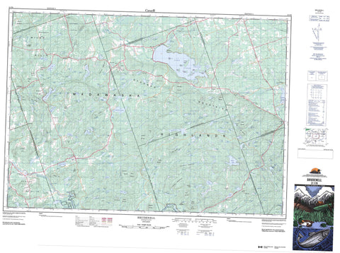
031F06 Brudenell Canada topo map, 1:50,000 scale
031F06 Brudenell NRCAN topographic map.
Includes UTM and GPS geographic coordinates (latitude and longitude). This 50k scale map is suitable for hiking, camping, and exploring, or you could frame it as a wall map.
Printed on-demand using high resolution, on heavy weight and acid free paper, or as an upgrade on a variety of synthetic materials.
Topos available on paper, Waterproof, Poly, or Tyvek. Usually shipping rolled, unless combined with other folded maps in one order.
- Product Number: NRCAN-031F06
- Parent Topo: TOPO-031F
- Map ID also known as: 031F06, 31F6, 31F06
- Unfolded Size: Approximately 26" high by 36" wide
- Weight (paper map): ca. 55 grams
- Map Type: POD NRCAN Topographic Map
- Map Scale: 1:50,000
- Geographical region: Ontario, Canada
Neighboring Maps:
All neighboring Canadian topo maps are available for sale online at 1:50,000 scale.
Purchase the smaller scale map covering this area: Topo-031F
Spatial coverage:
Topo map sheet 031F06 Brudenell covers the following places:
- Aumonds Bay - Hardwood Bay - Highland Falls - Algona - Brougham - Brudenell - Grattan - Griffith - Hagarty - Lyndoch - Matawatchan - Radcliffe - Raglan - Renfrew - Sebastopol - South Algona - Blueberry Island - Cherry Island - Frenchs Island - Green Island - Hanes Island - Muddy Island - Salmon Island - Turners Island - Acton Pond - Addington Lake - Anderson Lake - Archies Lake - Axe Lake - Basils Lake - Beardwood Lake - Beaver Lake - Bebees Lake - Big Eneas Lake - Blind Lake - Bolands Lake - Brinnen Lake - Britches Lake - Britchless Lake - Brock Lake - Brougham Lake - Bruchardt Pond - Brudenell Lake - Brule Lake - Buck Lake - Buckskin Lake - Bucky Pond - Burns Lake - Burns Long Lake - Callaghan Lakes - Cameron Lake - Cameron Lake - Canoe Lake - Cedar Lake - Charlotte Lake - Chattersons Pond - Clontarf Lake - Connor Lake - Constan Lake - Constant Lake - Cox Lake - Crest Lake - Crutch Lake - Cuddys Lake - Deep Lake - Dellaires Lake - Dent Lake - Dicks Lake - Dillons Pond - Donahue Lake - Donahue Long Lake - Donovans Lake - Dools Lake - Dooners Pond - Doyle Lake - Drefkes Lake - Dry Lake - Duffys Lake - Dugan Lake - Dupuis Lake - Edkelly Lake - Eleanor Lake - Eneas Lake - First Kargus Lake - Fox Lake - Foys Lake - Garvin Lake - Godin Lake - Goose Pond - Gorman Lake - Graham Lake - Grant Lake - Granzies Lake - Grassy Lake - Green Lake - Guiney Lake - Haley Lake - Handkes Lake - Hardwood Lake - Hartwick Lake - Heiderman Lake - Hermitage Lake - Highland Lake - Hogan Lake - Hughes Lake - Hyne Lake - Jeffers Lake - Jeffreys Lake - Jessups Lake - Jims Lake - Jocko Lake - Joyces Lake - Kargus Lake - Kauffeldt Lake - Kauffeldt Lake - Kelly Lake - Kellys Lake - Kennellys Lake - Kitts Lake - Kuehl Lake - Lake Clear - Lake Hardwood - Lamberts Lake - Lapointe Lake - Little Eneas Lake - Little Garvin Lake - Little Graham Lake - Little Green Lake - Little Hardwood Lake - Little Lake Clear - Little Pine Lake - Little Trout Lake - Long Lake - Lorwall Lake - Louies Lake - Lower Leidtke Lake - Lower Twin Lake - Lyndoch Lake - MacDonald Lake - Marguardt Lake - Marquardt Lake - McDonalds Lake - McDonoughs Lake - McHale Lake - McLaughlin Lake - McMaster Lake - Meadow Lake - Merchands Lake - Michaelis Lake - Mosie Lake - Mountain Lake - Mud Lake - Mullen Lake - Murk Lake - Murphys Lake - Musclow Lake - Muskrat Lake - Neumans Lake - Neumans Lake - O'Brien Lake - O'Grady Lake - Perrault Lake - Philips Lake - Piettes Lake - Pilgrims Lake - Pilons Lake - Printy Lake - Proven Lake - Puddle Lake - Quinn Lake - Reid Lake - Remus Pond - Rileys Lake - Rileys Pond - Roche Lake - Rock Lake - Rock Lake - Ryan Lake - Ryan Lake - Schavens Lake - Schroeders Lake - Second Kargus Lake - Serpent Lake - Shavings Lake - Sheedy Lake - Shortcut Lakes - Sims Lake - Skunk Pond - Stipz Lake - Stonedam Lake - Stoughton Lake - Strain Lake - Strains Lake - Sullivan Lake - Sypes Lake - Tennants Lake - Tincamp Lake - Tooey Lake - Tooeys Lake - Trout Lake - Troutling Lake - Turcott Lake - Two Islands Lake - Upper Twin Lake - Vanbrugh Lake - Voldock Lake - Watson Lake - Welks Lake - West Lake - West Perrault Lake - Wingle Lake - Wolf Lake - Yukes Lake - Buck Mountain - Buck Mountain - Bunkers Hill - Cardiffs Mountain - Casey Hill - Davidsons Hill - Devlins Mountain - Foymount Mountain - Godin Mountain - Graham Mountain - Guineys Hill - Icy Hills - Jamiesons Mountain - Jims Mountain - Jocko Mountain - Joyces Mountain - Kinders Hill - Lake Mountain - Lamberts Mountain - Line Hill - Madawaska Highlands - McDonalds Mountain - McIntomneys Mountain - Mine Hill - Mining Mountain - Moran Mountain - Mount Jamieson - Mount St. Patrick Mountains - Oak Hills - Oak Mountain - O'Briens Hill - O'Hare Mountain - O'Malleys Hill - Opeongo Mountains - Pine Ridge - Plaunts Mountain - Raglan Hills - Rock Hill - Ryans Mountain - Spring Mountain - Sypes Mountain - Teeples Hill - The Notch - Three Mountains - Tooeys Hill - Valiquettes Hill - Wadsworth Mountain - Waterfall Mountain - Wilno Hills - Wingle Hill - Woodhouse Mountain - Renfrew - Bagot and Blythfield - Bagot, Blythfield and Brougham - Bonnechere Valley - Brougham - Brudenell and Lyndoch - Brudenell, Lyndoch and Raglan - Grattan - Greater Madawaska - Griffith and Matawatchan - Hagarty and Richards - Killaloe, Hagarty and Richards - Madawaska Valley - Radcliffe - Raglan - Sebastopol - Sherwood, Jones and Burns - South Algona - Lower Madawaska River Provincial Park - Aumonds Rapids - Buck Ledge - Little Rapids - Stoney Swift - Black Donald Creek - Blind Creek - Brennan Creek - Brennans Creek - Brudenell Creek - Byers Creek - Constan Creek - Constant Creek - Crutteys Creek - Devines Creek - Doorley Creek - Dupuis Creek - Eneas Creek - Foran Creek - Godin Creek - Gormans Creek - Graham Creek - Highland Creek - Hurds Creek - Kargus Creek - Khartum Creek - Kregurs Creek - Leidtke Creek - Little Eneas Creek - Madawaska River - Malotte Creek - Manions Creek - McDougalls Creek - Neilan Creek - Perrault Creek - Pilgrims Creek - Rockingham Creek - Rodden Creek - Schimmens Creek - Schweigerts Creek - Scully Creek - Silver Creek - Tooeys Creek - Wadsworth Creek - Yourths Creek - Big Rock - Sharbert Rock - Balvenie - Brudenell - Castile - Clontarf - Constant Creek - Copp - Cormac - Donahue - Emmet - Esmonde - Foymount - Guiney - Harriets Corners - Khartum - Lake Clear - Latchford Bridge - Letterkenny - Lost Nation - McGrath - Newfoundout - O'Grady Settlement - Perrault - Quadeville - Rochefort - Rockingham - Rosenthal - Strathtay - Vanbrugh - Wingle - Woermke - Wolfe - Coghlans Meadow


