
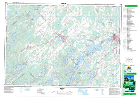
031C16 Perth Canada topo map, 1:50,000 scale
031C16 Perth NRCAN topographic map.
Includes UTM and GPS geographic coordinates (latitude and longitude). This 50k scale map is suitable for hiking, camping, and exploring, or you could frame it as a wall map.
Printed on-demand using high resolution, on heavy weight and acid free paper, or as an upgrade on a variety of synthetic materials.
Topos available on paper, Waterproof, Poly, or Tyvek. Usually shipping rolled, unless combined with other folded maps in one order.
- Product Number: NRCAN-031C16
- Parent Topo: TOPO-031C
- Map ID also known as: 031C16, 31C16
- Unfolded Size: Approximately 26" high by 36" wide
- Weight (paper map): ca. 55 grams
- Map Type: POD NRCAN Topographic Map
- Map Scale: 1:50,000
- Geographical region: Ontario, Canada
Neighboring Maps:
All neighboring Canadian topo maps are available for sale online at 1:50,000 scale.
Purchase the smaller scale map covering this area: Topo-031C
Spatial coverage:
Topo map sheet 031C16 Perth covers the following places:
- Bartlett Bay - Bennett Bay - Bests Bay - Beveridge Bay - Briton Bay - Coutts Bay - Davidsons Bay - Echo Bay - Garvins Bay - Hawse Bay - Hogg Bay - Hoggs Bay - Houghton Bay - Jacklins Bay - Johnsons Bay - Kellys Bay - Little Otty - McLeans Bay - McManus Bay - McVeetys Bay - Miller Bay - Miller's Bay - Noble Bay - Nobles Bay - O'Mearas Bay - Pettys Bay - Petty's Bay - Sawlog Bay - Spring Bay - Station Bay - Bests Point - Black Ance Point - Cedar Point - Chisamores Point - Chismores Point - Danners Point - Davidsons Point - DeSalvos Point - Frost Point - Gallaghers Point - Gallaghers Point - Goulds Point - Johnsons Point - Lower Petty's Point - McCoys Point - McManus Point - McVeetys Point - Mile Point - Murphys Point - Naud's Point - Noads Point - Ottawa Point - Pethern Point - Petty's Point - Picnic Point - Pine Point - Scotch Point - Squaw Point - Stewart Point - Stonehouse Point - Stuarts Point - Whippoorwill Point - McCoys Narrows - McKay Narrows - Mud Cut - Rocky Narrows - Bastard - Bathurst - Beckwith - Burgess - Drummond - Elmsley - Grenville - Kitley - Lanark - Lanark - Leeds - Montague - North Burgess - North Crosby - North Elmsley - Peterborough - South Burgess - South Elmsley - South Sherbrooke - Wolford - Adams Dam - Bowes Dam - Alans Island - Bacchus Island - Beech Island - Big Island - Big Island - Birch Island - Blueberry Island - Blueberry Island - Bluff Island - Box Island - Briggs Island - Buck Island - Burnt Island - Caulfields Island - Cherrie Island - Clegg Island - Cloverleaf Island - Codes' Island - Conlon Island - Covells Island - Covill Island - Division Island - Drop Anchor Island - Fairchilds Island - Fairclough Island - Farrens Island - Farry Island - Ferguson Island - Fox Island - Gem Island - Greers Island - Hazard Island - Hicks Island - Hog Island - Hogg Island - Indian Island - Iona Island - Isle of Man - Little John Island - Long Island - McLaren Island - McVeetys Island - Phillips Island - Pickerel Island - Pine Island - Ravensdale Island - Reid Island - Rock Island - Rose Island - Rothwells Island - Round Island - Ruby Island - Ruby Island - Sand Island - Sentinel Island - Slab Island - Star Island - Stewart's Island - Stonehouse Island - Sunken Island - Taggarts Island - Tar Island - The Three Sisters - Watch Island - Whiskey Island - Whisky Island - Adam Lake - Adams Lake - Adams Pond - Andrew Lake - Bacchus Mud Lake - Bass Lake - Bennett Lake - Big Mud Lake - Big Rideau Lake - Black Lake - Canton Lake - Christie Lake - Crosby Lake - Doctor Lake - Fagan Lake - Farrell Lake - Farren Lake - Little Crosby Lake - Little Silver Lake - Long Lake - Loon Lake - Lower Mud Lake - Lower Rideau Lake - McCullochs Mud Lake - McGowan Lake - McLaren Lake - Mill Pond - Mills Lake - Mud Lake - Mud Lake - O'Brien Lake - Otter Lake - Otty Lake - Pike Lake - Purdons Mud Lake - Rainbow Lake - Rideau Lake - Rideau Lake - Rock Lake - Round Lake - Silver Lake - Silvery Lake - South Mud Lake - Thoms Mud Lake - Upper Mud Lake - Poonamalie Cut - Tay Canal - Stanleys Hill - Lanark - United Counties of Leeds and Grenville - Bastard and South Burgess - Bathurst - Bathurst Burgess Sherbrooke - Beckwith - Darling - Drummond - Drummond/North Elmsley - Elizabethtown - Elizabethtown-Kitley - Kitley - Lanark - Lanark Highlands - Lavant, Dalhousie and North Sherbrooke - Montague - North Burgess - North Crosby - North Elmsley - North West Lanark - Rideau Lakes - South Crosby - South Elmsley - South Sherbrooke - Tay Valley - Wolford - Canal Rideau - Lieu historique national du Canada du Canal-Rideau - Murphys Point Provincial Park - Rideau Canal National Historic Site of Canada - Rideau Canal World Heritage Site - Dorans Rapids - Playfairville Rapids - Sheridans Rapids - Black Creek - Black Creek - Bolton Creek - Campbell's Creek - Cedar Brook - Clyde River - Cockburn Creek - Fall River - Grant Creek - Grants Creek - Hutton Creek - Jebb Creek - Jebbs Creek - Limekiln Creek - Long Sault Creek - Lousy Creek - McIntyre Creek - Mississippi River - North Creek - Otter Creek - Rideau River - Rideau River & Canal - Rivière Rideau - Scotts Snye - Tay River - Agnes Rock - Cheese Boat Shoals - Elswood Rock - Enterprise Shoal - Hunter Rock - Loretta Rock - Maggie May Shoal - Morris Rock - Olivers Rock - Peerless Shoal - Pumper Rock - Red Rock - Rideau King Rock - Rideau Queen Rock - Sly Rock - Swan Rock - Voyageurs Shoal - Perth - Smiths Falls - Smith's Falls - Allan Mills - Althorpe - Armstrongs Corners - Atironto - Balderson - Bathurst - Bathurst Station - Bell Corners - Bells Corners - Beveridge Locks - Blanchards Hill - Brooke - Caroline Village - Christie Lake - Christie Lake Station - Dewitt Corners - Dewitts Corners - DeWitts Corners - Drummond - Drummond Centre - Elliott - Elmgrove - Elmsley - Fairholme Park - Fallbrook - Frayn's Landing - Glen Tay - GlenElm - Glenview - Greenly's Corners - Harper - Jamesville - Judgeville - Lombardy - Lombardy Station - McCue - McGarry - McPhail - Motts Mills - Numogate - Playfair - Playfairville - Port Elmsley - Richardson - Rideau Ferry - Scotch Line - Scotch Point - Shanes - Sheridan Rapids - Stanleyville - Wayside - Welsh - Wemyss - Bacchus Marsh - Beveridge Marsh - Blueberry Marsh - Long Swamp - Tay Marsh - The Swale - Merrickville-Wolford


