
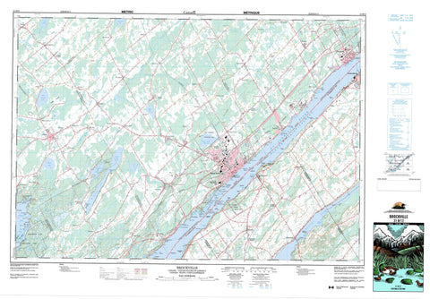
031B12 Brockville Canada topo map, 1:50,000 scale
031B12 Brockville NRCAN topographic map.
Includes UTM and GPS geographic coordinates (latitude and longitude). This 50k scale map is suitable for hiking, camping, and exploring, or you could frame it as a wall map.
Printed on-demand using high resolution, on heavy weight and acid free paper, or as an upgrade on a variety of synthetic materials.
Topos available on paper, Waterproof, Poly, or Tyvek. Usually shipping rolled, unless combined with other folded maps in one order.
- Product Number: NRCAN-031B12
- Parent Topo: TOPO-031B
- Map ID also known as: 031B12, 31B12
- Unfolded Size: Approximately 26" high by 36" wide
- Weight (paper map): ca. 55 grams
- Map Type: POD NRCAN Topographic Map
- Map Scale: 1:50,000
- Geographical region: Ontario, Canada
Neighboring Maps:
All neighboring Canadian topo maps are available for sale online at 1:50,000 scale.
Purchase the smaller scale map covering this area: Topo-031B
Spatial coverage:
Topo map sheet 031B12 Brockville covers the following places:
- Anchorage Bay - Big Water - Blue Church Bay - Claybank Bay - Cole Bay - Dixons Bay - Eastern Water - Frog Cove - Gailies Bay - Huckleberry Hollow Bay - Kellys Bay - Lily Bay - Little Church Bay - Maitland Bay - McDonald Bay - Sallys Hole - Sand Bay - Sapbush Bay - Sunset Bay - Tunnel Bay - Warren Bay - Blakeys Point - Blockhouse Island - Crawford Point - Fulford Point - Heathers Point - Hillcrest Point - Hudsons Point - Hudson's Point - Lemon Point - Lemons Point - Lookout Point - Maple Point - McDonald Point - Sand Bay Point - Watch Hill Point - Weatherheads Point - Brockville Narrows - Mollys Gut - Narrows Channel - Brockville - Augusta - Bastard - Edwardsburgh - Elizabethtown - Escott - Front of Escott - Front of Yonge - Grenville - Kitley - Lansdowne - Leeds - Rear of Yonge and Escott - Rear of Yonge and Escott - Yonge - Battersby Island - Big Bluff Island - Brock Group - Brown Island - Browns Island - Cedar Island - Chub Island - Cockburn Island - Conran Island - Crow Island - Crozier Island - Croziers Island - De Rottenburg Island - De Watteville Island - Everest Island - Fawn Island - Fisher Island - Flat Island - Freds Island - Green Island - Hard Island - Harvey Island - Hathaway Island - Jay Ells Island - Little Bluff Island - Long Island - Macnair Island - McCoy Island - McNair Island - Mile Island - Murray Island - Myers Island - Needles Eye Island - Oriental Island - Prince Alfred Island - Princess Island - Raleigh Island - Refugee Island - Rock Island - Royal Island - Savage Island - Sheaffe Island - Silver Island - Skelton Island - Small Bluff Island - Smith Island - Snake Island - Sparrow Island - Spong Island - Stovin Island - Sugar Loaf Island - Three Sisters Islands - Twin Sisters Islands - Victoria Island - Wolf Island - Wolfe Island - Atkins Lake - Basin Lake - Buells Creek Reservoir - Centre Lake - Charleston Lake - Graham Lake - Irish Lake - Lake Eloida - Lambs Pond - Lees Pond - Loyada Lake - Lyn Pond - Mud Lake - Mud Lake - Mud Lake - Temperance Lake - Wiltse Lake - Fells Hill - Painted Rocks - United Counties of Leeds and Grenville - Athens - Augusta - Bastard and South Burgess - Edwardsburgh - Edwardsburgh/Cardinal - Elizabethtown - Elizabethtown-Kitley - Front of Escott - Front of Leeds and Lansdowne - Front of Yonge - Kitley - Leeds and the Thousand Islands - North Crosby - Rear of Leeds and Lansdowne - Rear of Yonge and Escott - Rideau Lakes - South Crosby - South Elmsley - Buell's Creek Conservation Area - Charleston Lake Provincial Park - Fort Wellington National Historic Site of Canada - Lieu historique national du Canada du Fort-Wellington - Parc national du Canada des Îles-du-Saint-Laurent - St. Lawrence Islands National Park of Canada - Ontario - Beales Creek - Bradleys Creek - Buells Creek - Butlers Creek - Charleville Creek - Cole Creek - Elbe Creek - Fleuve Saint-Laurent - Fosters Creek - Golden Creek - Grants Creek - Hard Island Creek - Johnstown Creek - Jones Creek - Leaders Creek - Leeders Creek - Lemons Creek - Little Mud Creek - Lyn Creek - MacIlhennys Creek - Marsh Creek - Marshalls Creek - Mud Creek - North Wiltse Creek - Plum Hollow Creek - Rivière Nation - Smades Creek - South Branch Plum Hollow Creek - South Kemptville Creek - South Nation River - St. Lawrence River - Wells Creek - Wiltse Creek - Cole Ferry Shoal - Cole Shoal - Coronation Shoal - Eagle Rock - McDonald Point Shoal - North McNair Shoal - South McNair Shoal - Union Park Shoal - Prescott - Addison - Algonquin - Anoma Lea - Athens - Ballycanoe - Beales Mills - Bellamys - Bethel - Bisseltown - Blue Church - Butternut Bay - Caintown - Charleston - Charleville - Clark - Eloida - Fairfield - Fairfield East - Fernbank - Flanders Heights - Forthton - Frankville - Glen Buell - Glen Elbe - Glen Morris - Glenmore - Golf Side Gardens - Greenbush - Hallecks - Hawken - Hawkes - Hayes Corners - Herrons Corners - Hillcrest - Jelly - Jellyby - Junetown - Lehighs Corners - Lillies - Lord Mills - Lords Mills - Loyalist Park - Lyn - Maitland - Manhard - Maynard - McIntosh Mills - New Dublin - Redan - Riverview Heights - Rocksprings - Rows Corners - Seeley - Sheatown - Sheridan Park - Sherwood Spring - Sherwood Springs - South Augusta - Sparkle City - Spring Valley - Stones Corners - Tincap - Toledo - Trevelyan - Wexford - Wights Corners - Wiltsetown - Windsor Heights - Woodridge - Yonge Mills - Long Swamp - Fairfield


