
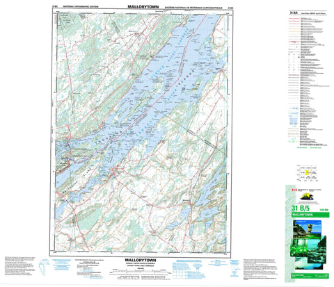
031B05 Mallorytown Canada topo map, 1:50,000 scale
031B05 Mallorytown NRCAN topographic map.
Includes UTM and GPS geographic coordinates (latitude and longitude). This 50k scale map is suitable for hiking, camping, and exploring, or you could frame it as a wall map.
Printed on-demand using high resolution, on heavy weight and acid free paper, or as an upgrade on a variety of synthetic materials.
Topos available on paper, Waterproof, Poly, or Tyvek. Usually shipping rolled, unless combined with other folded maps in one order.
- Product Number: NRCAN-031B05
- Parent Topo: TOPO-031B
- Map ID also known as: 031B05, 31B5, 31B05
- Unfolded Size: Approximately 26" high by 36" wide
- Weight (paper map): ca. 55 grams
- Map Type: POD NRCAN Topographic Map
- Map Scale: 1:50,000
- Geographical region: Ontario, Canada
Neighboring Maps:
All neighboring Canadian topo maps are available for sale online at 1:50,000 scale.
Purchase the smaller scale map covering this area: Topo-031B
Spatial coverage:
Topo map sheet 031B05 Mallorytown covers the following places:
- Browns Bay - Bucks Bay - Eye Harbour - Patterson Bay - Senecal Bay - Smugglers Cove - Thompson's Bay - Bridge Island - Buell's Point - Cherry Point - Cook Point - Eliot Point - Elliott Point - Fermans Point - Patterson Point - Pitch Pine Point - Sifton Point - Swiftwater Point - Vansittart Point - Whitney Point - Whitney Point - Blacksnake Passage - Lost Channel - Needles Eye - Raft Narrows - Tar Island Narrows - Escott - Front of Escott - Front of Leeds and Lansdowne - Front of Yonge - Lansdowne - Leeds - Rear of Leeds and Lansdowne - Rear of Yonge and Escott - Rear of Yonge and Escott - Yonge - Adelaide Island - Amateur Islands - Ash Island - Aspasia Island - Baby Tar Island - Baggage Island - Bagot Island - Ball Island - Beaulieu Island - Berry Island - Bloomfield Island - Bobs Island - Bonnie View Island - Bratt Island - Bridge Island - Broadbill Island - Broughton Island - Brown Island - Bryce's Island - Buck Island - Carnegie Island - Channel Island - Chichester Island - Chimney Island - Cleopatra Island - Club Island - Constance Island - Cook Island - Cordwood Island - Corn Island - Corn Islands - Dashwood Island - Doctor Island - Dromedary Island - Duck Island - Fancy Rock Island - Fishdam Island - Flying Mallard Islands - Ganawaga Island - Georgina Island - Goose Island - Grape Island - Grass Island - Grassy Point - Grenadier Island - Griswold Island - Gull Island - Harrowsmith Island - Hill Island - Himes Island - Hog Island - Honey Bee Island - Hooper Island - Hopper Island - Huckleberry Island - Ice Island - Indian Island - Ingall Island - Jeroy Island - Little Corn Islands - Little Grenadier Island - Lone Tree Island - Long Schooner Island - Lynedoch Island - Madawaska Island - Manomin Island - Marsh Island - McMahon Island - Miller Island - Needle Island - Niddery Islands - O'Neil Island - Palm Island - Peel Island - Pilot Island - Pine Island - Poole Island - Poverty Island - Princess Island - Rabbit Island - Reciprocity Island - Redstone Isle - Renny Island - Retreat Island - Reveille Island - Robert Island - Robinson Island - Rolleston Island - Rose Island - Rough Island - Round Island - Shanty Island - Slim Island - Squaw Island - St. Helena Island - Surveyor Island - Tar Island - Thousand Islands - Trident Island - Twin Islands - Van Buren Island - Vansittart Island - Virgin Island - Wallace Island - Watch Island - Whirlpool Island - Willoughby Island - Wood Island - Yeo Island - Zavikon Island - Lake of the Isles - Quabbin Hill - United Counties of Leeds and Grenville - Front of Escott - Front of Leeds and Lansdowne - Front of Yonge - Leeds and the Thousand Islands - Rear of Leeds and Lansdowne - Charleston Lake Provincial Park - Parc national du Canada des Îles-du-Saint-Laurent - St. Lawrence Islands National Park of Canada - Ontario - Beaver Meadow Creek - Bensons Rift - Brooker's Creek - Fleuve Saint-Laurent - International Rift - Jones Creek - Landons Rift - Larue Creek - LaRue Creek - Little Mud Creek - Mud Creek - Polly Creek - St. Lawrence River - The Rift - Fiddlers Elbow - Broughton Island Shoals - Corn Island Shoals - Duck Island Shoal - Duck Rock - Eliot Shoal - Elliott Shoal - Empire Shoal - Grenadier Shoals - Griswold Shoals - Haffie Shoal - Haskell Shoal - Hog Island Shoal - Johnny Buck Rock - Lower Ice Island Shoals - Peel Island Shoal - Poole Island Shoal - Poverty Island Lower Shoal - Reveille Shoal - Upper Ice Island Shoals - Van Buren Island Shoals - Bowell - Darlingside - Escott - Escott Centre - Grenadier Island - Holland - La Rue Mills - LaRue Mills - Mallorytown - Mallorytown Landing - Mitchellville - Narrows - Pooles Resort - Quabbin - Quabbin Hill - Rockfield - Rockport - Selton - Tilley - Union - Waterton


