
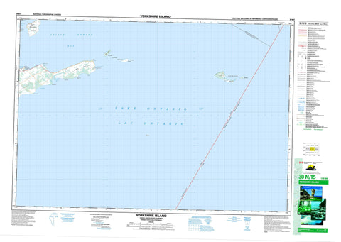
030N15 Yorkshire Island Canada topo map, 1:50,000 scale
030N15 Yorkshire Island NRCAN topographic map.
Includes UTM and GPS geographic coordinates (latitude and longitude). This 50k scale map is suitable for hiking, camping, and exploring, or you could frame it as a wall map.
Printed on-demand using high resolution, on heavy weight and acid free paper, or as an upgrade on a variety of synthetic materials.
Topos available on paper, Waterproof, Poly, or Tyvek. Usually shipping rolled, unless combined with other folded maps in one order.
- Product Number: NRCAN-030N15
- Parent Topo: TOPO-030N
- Map ID also known as: 030N15, 30N15
- Unfolded Size: Approximately 26" high by 36" wide
- Weight (paper map): ca. 55 grams
- Map Type: POD NRCAN Topographic Map
- Map Scale: 1:50,000
- Geographical region: Ontario, Canada
Neighboring Maps:
All neighboring Canadian topo maps are available for sale online at 1:50,000 scale.
Purchase the smaller scale map covering this area: Topo-030N
Spatial coverage:
Topo map sheet 030N15 Yorkshire Island covers the following places:
- Big Sand Bay - Gravelly Bay - Halfmoon Bay - Long Point Harbour - Prince Edward Bay - Smith Bay - Gravelly Point - Halfmoon Point - Little Poplar Point - Long Point - Morrison Point - Ostrander Point - Point Traverse - Poplar Point - Prince Edward Point - Rocky Point - Prince Edward - Athol - Marysburgh - North Marysburgh - South Marysburgh - False Ducks Island - False Ducks Islands - Main Duck Island - Swetman Island - The Ducks - Timber Island - Waupoos Island - Waupoos Island - Yorkshire Island - Lac Ontario - Lake Ontario - Little Bluff - Lennox and Addington - Ameliasburgh - Athol - Hallowell - Hillier - Marysburgh - North Marysburgh - Sophiasburgh - South Marysburgh - Prince Edward Point National Wildlife Area - Réserve nationale de faune de la Pointe-Prince-Edward - Timber Island Provincial Nature Reserve - Timber Island Wilderness Area - Ontario - Duck-Galloo Ridge - Duckling Reef - False Ducks Bank - Gull Bar - Harris Shoal - Poplar Bar - Preston Reef - Psyche Shoal - Traverse Shoal - William Shoal - Balfour - Point Traverse - Waupoos - Waupoos Island


