
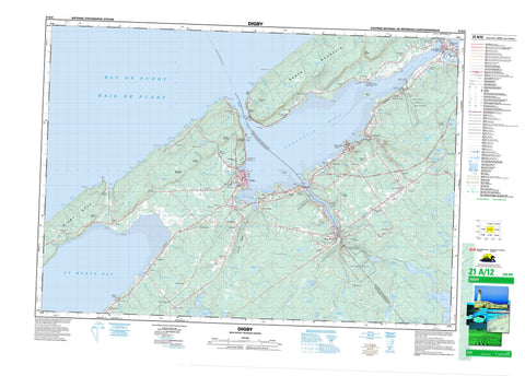
021A12 Digby Canada topo map, 1:50,000 scale
021A12 Digby NRCAN topographic map.
Includes UTM and GPS geographic coordinates (latitude and longitude). This 50k scale map is suitable for hiking, camping, and exploring, or you could frame it as a wall map.
Printed on-demand using high resolution, on heavy weight and acid free paper, or as an upgrade on a variety of synthetic materials.
Topos available on paper, Waterproof, Poly, or Tyvek. Usually shipping rolled, unless combined with other folded maps in one order.
- Product Number: NRCAN-021A12
- Parent Topo: TOPO-021A
- Map ID also known as: 021A12, 21A12
- Unfolded Size: Approximately 26" high by 36" wide
- Weight (paper map): ca. 55 grams
- Map Type: POD NRCAN Topographic Map
- Map Scale: 1:50,000
- Geographical region: Nova Scotia, Canada
Neighboring Maps:
All neighboring Canadian topo maps are available for sale online at 1:50,000 scale.
Purchase the smaller scale map covering this area: Topo-021A
Spatial coverage:
Topo map sheet 021A12 Digby covers the following places:
- Adams Cove - Annapolis Basin - Awkward Cove - Baie de Fundy - Balcoms Cove - Bay of Fundy - Big Joggins - Blockhouse Cove - Broad Cove - Caldwells Cove - Culloden Cove - Dark Cove - Deep Cove - Gooseberry Cove - Grays Cove - Griffin Cove - Gulliver Cove - Gullivers Cove - Haights Cove - House Cliff Cove - Johnson Cove - Little Joggins - Lower Shelburne Cove - Mill Cove - Mill Cove - Murphy Cove - Rogers Cove - Smiths Cove - Specht Cove - Spechts Cove - St. Mary Bay - St. Marys Bay - St. Mary's Bay - The Joggins - The Raquette - Thorne Cove - Thornes Cove - Tidds Cove - Upper Shelburne Cove - Indian Beach - Rattling Beach - Stoney Beach - Battery Point - Black Point - Burns Point - Condons Point - Digby Neck - Fleet Brook Head - Green Point - Green Point - Gulliver Point - Gullivers Head - Marsh Point - McWhinnies Point - Mill Cove Point - Oak Point - Pinkneys Point - Point Prim - Pollys Point - Prim Point - Red Head - Robinsons Point - Roop Point - Schafner Point - Schafners Point - Shaws Point - Theriaults Point - Tommys Point - Winchester Point - Deepwater Channel - Digby Gut - Red Bluff - Shag Cliffs - The Seawall - Annapolis - Digby - Bear River 6 - Bear Island - Goat Island - Barnes Lake - Beeler Lake - Beelers Lake - Big Stillwater Lake - Bogart Lake - Cady Lake - Charlotte Lake - Ellison Lake - Fed Lake - Fleet Lake - Fred Lake - Grand Lake Flowage - Haines Lake - Harris Lake - Hill Lake - Lac Le Marchant - Lake Cady - Lake Mulgrave - Loud Lake - Lower Beaver Lake - Mallette Lake - Mill Lake - Mistake Lake - Mulgrave Lake - O'Brien Lake - Porters Lake - Porter's Lake - Potter Lake - Range Corner Lake - Range-corner Lake - Salt Pond - Simpson Lake - Skull Lake - Smalls Lake - Upper Beaver Lake - Upper Lake - Van Tassel Lake - Worcester Lake - Base des Forces canadiennes Greenwood - Canadian Forces Base Greenwood - Champ de tir et champ de manoeuvre Granville Ferry - Granville Ferry Range and Training Area - Beamans Mountain - Hendersons Mountain - Johnson Hill - Lynchs Mountain - North Mountain - North Mountain Range - Post Mountain - Seawall Hill - Annapolis - Digby - Annapolis Basin Look Off Provincial Park - Charles Fort National Historic Site of Canada - Fort Anne National Historic Site of Canada - Lieu historique national du Canada de l'Établissement-Melanson - Lieu historique national du Canada de Port-Royal - Lieu historique national du Canada du Fort-Anne - Lieu historique national du Canada du Fort-Charles - Lieu historique national du Canada du Fort-Scots - Melanson Settlement National Historic Site of Canada - Port-Royal National Historic Site of Canada - Savary Provincial Park - Scots Fort National Historic Site of Canada - Smiths Cove Look Off Provincial Park - Upper Clements Game Sanctuary - Upper Clements Provincial Park - Turner Eddy - Turners Eddy - Acacia Brook - Acacia Brook - Acacia Valley Brook - Allain River - Allains Creek - Allains River - Annapolis River - Bacon Brook - Balcolm Brook - Bear River - Berry Brook - Bingay Brook - Bingays Brook - Bogart Brook - Bogart Brook - Bohaker Brook - Bohaker Brook - Boudreau Brook - Boyce Brook - Budd Brook - Budds Brook - Burke Brook - Campbell Brook - Charlies Brook - Chisholm Brook - Clarke Brook - Cossaboom Brook - Croscup Brook - Deep Brook - Ditmars Brook - Dixon Brook - Dunbar Brook - East Moose River - Elmtree Brook - Fleet Brook - Franklin Brook - Franklin River - Griffin Brook - Haight Brook - Handspiker Brook - Harris Brook - Harris Meadow Brook - Henderson Brook - Hennessy Brook - Hillman Brook - Holdsworth Brook - Jefferson Brook - Jim Wallaces Camp Brook - Johnson Brook - Kennedy Brook - Kniffen Brook - Loud Brook - McCall Brook - Micmac Brook - Mill Brook - Mink Brook - Mink Brook - Moose Hollow Brook - Moose River - Morgan Brook - Negro Line Brook - Negro-line Brook - O'Connor Brook - Perry Brook - Perrys Brook - Pine Brook - Pine Brook - Post Brook - Potter Brook - Purdy Brook - Rice Brook - Roach Brook - Roop Brook - Ryerson Brook - Sandy Bottom Brook - Saunders Brook - Seely Brook - Sloan Brook - Sloans Brook - Smelt Brook - Specht Brook - Spechts Brook - Taylor Brook - Thomas Brook - Thorne Brook - Thornes Brook - Turnbulls Brook - Wade Brook - Wallace Branch Sissiboo River - Wallace River - Walsh Brook - West Branch Bear River - West Moose River - Winchester Brook - Woodland Brook - Worcester Brook - Young Brook - Youngs Brook - Big Bend Deadwater - Tuppers Deadwater - Adams Ledge - Awkward Ledge - Black Rock - Cow and Calf - Fannan Ledge - Haights Ledge - Hannams Ledge - Lobster Ledge - Low Water Rocks - Man of War Rock - Middletons Ledge - Paddys Rock - Porters Ledges - St. Mary Shoal - St. Marys Bay Shoal - Annapolis Royal - Digby - Acaciaville - Allains Creek - Barton - Bay View - Bear River - Bear River East - Bear River Station - Bloomfield - Brighton - Clementsport - Clementsvale - Conway - Cornwallis - Cornwallis Park - Culloden - Deep Brook - Frasertown - Granville Beach - Granville Ferry - Greenland - Guinea - Gullivers Cove - Hillgrove - Imbertville - Joggin Bridge - Jordantown - Karsdale - Lansdowne - Lighthouse Road - Marshalls Town - Marshalltown - Morganville - Mount Pleasant - North Range - North Range Corner - Plympton - Port Royal - Port Wade - Princedale - Rossway - Roxville - Seabrook - Seaview - Smiths Cove - Thomas Brook - Thorne Cove - Thornes Cove - Upper Clements - Victoria Beach - Virginia East - Waldeck - Waldeck East - Waldeck Line - Waldeck West - Waterford - Acacia Valley - Annapolis Valley - Kniffen Hollow - Raymonds Hollow - The Hollow - Brians Meadow - Dentabella Marsh - Queen Anne Marsh - Saunders Meadow


