
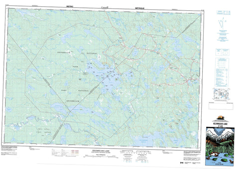
021A06 Kejimkujik Lake Canada topo map, 1:50,000 scale
021A06 Kejimkujik Lake NRCAN topographic map.
Includes UTM and GPS geographic coordinates (latitude and longitude). This 50k scale map is suitable for hiking, camping, and exploring, or you could frame it as a wall map.
Printed on-demand using high resolution, on heavy weight and acid free paper, or as an upgrade on a variety of synthetic materials.
Topos available on paper, Waterproof, Poly, or Tyvek. Usually shipping rolled, unless combined with other folded maps in one order.
- Product Number: NRCAN-021A06
- Parent Topo: TOPO-021A
- Map ID also known as: 021A06, 21A6, 21A06
- Unfolded Size: Approximately 26" high by 36" wide
- Weight (paper map): ca. 55 grams
- Map Type: POD NRCAN Topographic Map
- Map Scale: 1:50,000
- Geographical region: Nova Scotia, Canada
Neighboring Maps:
All neighboring Canadian topo maps are available for sale online at 1:50,000 scale.
Purchase the smaller scale map covering this area: Topo-021A
Spatial coverage:
Topo map sheet 021A06 Kejimkujik Lake covers the following places:
- Bull Cove - Carrigan Bay - Fairbanks Bay - Fairy Bay - Gaspar Bay - Hat Cove - Honeymoon Cove - Jeremy Bay - Jeremys Bay - Lacey Bay - Low Bay - Luxie Cove - Mill Bay - Minard Bay - Minards Bay - Mount Tom Bay - Merrymakedge Beach - Slapfoot Beach - Cape Split - Clary Point - Glode Point - Indian Point - Jim Charles Point - Jim-Charles Point - Peter Point - Rowters Point - Eastern Run - Hemlock Run - The Narrows - Dukeshires Lower Falls - Dukeshires Upper Falls - Granite Falls - Granite Lake Falls - Indian Falls - Kempton Falls - Loon Falls - Loon Lake Falls - Mill Falls - Poison Ivy Falls - Taylors Falls - Annapolis - Digby - Queens - Bear Island - Big Island - Big Muise Island - Dark Island - Dukeshire Island - Ell Island - Ford Island - Forest Island - Forrest Island - Freeman Island - Glode Island - Grass Island - Hemlock Island - Hog Island - Île de l'Orignal - Isle de l'Orignal - Little Muise Island - Loon Island - McLean Island - Minard Island - Mink Island - Moose Island - Morgan Island - Norway Island - Peale Island - Richie Island - Ritchie Island - The Sisters - Apple Tree Lake - Back Lake - Barney Lake - Barnie Lake - Beach Pond - Beaver Lake - Beaverhead Lake - Beaverskin Lake - Ben Lake - Beverley Lake - Big Dam Lake - Big Dispatch Lake - Big Red Lake - Big Rocky Lake - Bradley Lake - Bryden Lake - Bull Moose Lake - Cannon Lake - Carrigan Lake - Central Lake - Central Lake - Channel Lake - Charity Lake - Charlotte Lake - Christopher Lakes - Coblielle Lake - Cobrielle Lake - Cofan Lake - Cook Lake - Daniels Lake - Dean Lake - DeLong Lake - Dennis Boot Lake - Donnellan Lake - Duck Pond - Duck Pond Lake - Dunn Lake - East Spectacle Lakes - Eel Lake - Fairbanks Lake - Faith Lake - First Lake - Flinn Lake - Ford Lake - Fourth Christopher Lake - Freeman Lake - Frozen Ocean Lake - Frozen-ocean Lake - George Lake - Glode Lake - Gludogan Lake - Grafton Lake - Granite Lake - Harlow Lake - Harmony Lake - Harry Lake - Hen Lake - High Lake - Hilchemakaar Lake - Holdrights Lake - Hope Lake - Horseshoe Lake - House Lake - Hunt Lake - Inness Lake - Irving Lake - Joe Tom Lake - Joe-Tom Lake - Joudrey Lake - Kejimkujik Lake - Kempt Lake - Kempton Lake - Lake Franklin - Lake Mulgrave - Lake Rossignol - Lake Torment - Laurel Lake - Liberty Lake - Little Bullmoose Lake - Little Cofan Lake - Little Cook Lake - Little Despatch Lake - Little Kempton Lake - Little Liberty Lake - Little Loon Lake - Little Mud Lake - Little Peskowesk Lake - Little Red Lake - Little Rocky Lake - Loon Lake - Lower Silver Lake - Luxion Lake - Luxton Lake - Martin Lake - Mary Lake - McBride Lake - McGinty Lake - McGowan Lake - McGuire Lake - Meagher Lake - Menchan Lake - Menchan Lake - Mill Lake - Minard Lake - Mississippi Lake - Moccasin Lake - Moosehead Lake - Moosehide Lake - Morton Lake - Mount Tom Lake - Mountain Lake - Mud Lake - Mud Lake - Mud Pond - Mudflat Lake - Mulgrave Lake - Murphy Lake - North Cranberry Lake - Pat Kempton Lake - Payzant Lake - Pebbleloggitch Lake - Perch Lake - Peskawa Lake - Peskowesk Lake - Pollock Lake - Poplar Lake - Pretty Mary Lake - Puzzle Lake - Red Lake - Ring Lakes - Rocky Daniels Lake - Round Lake - Russell Lake - Sand Beach Lake - Sand Lake - Sand-beach Lake - Scott Lake - Second Christopher Lake - Second McGinty Lake - Seven Mile Lake - Siskech Lake - Snake Lake - South Mud Lake - Spar Lake - Spectacle Lake - Stave Lake - Taylors Lake - Telfer Lake - Third Christopher Lake - Torment Lake - Tupper Lake - Turnpike Lake - Turtle Lake - Twin Lakes - Two Fan Lake - Upper Silver Lake - Boyles Hill - Carrigan Hill - Douglas Hill - Mount Tom - Murphy Hill - Pat McBride Hill - Annapolis - Digby - Queens - Annexe côtière du parc national Kejimkujik - Kejimkujik National Historic Site of Canada - Kejimkujik National Park of Canada - Kejimkujik National Park Seaside Adjunct - Lieu historique national du Canada Kejimkujik - Parc national du Canada Kejimkujik - Tobeatic Wildlife Management Area - Black Rattle - Eel Weir - Rattle Rapids - Western Run - Atkins Brook - Atkins Meadow Brook - Back Hill Brook - Baxters Meadow Brook - Bear River - Bear River - Beaverskin Brook - Bull Moose Brook - Butler Meadow Brook - Cannon Brook - Carver Brook - Cashman Meadow Brook - Cobrielle Brook - Cole Brook - Duck Pond Brook - Flanders Meadow Brook - Fraser Brook - Frog Lake Stream - Grafton Brook - Heber Meadow Brook - Henry Brook - Inness Brook - Joudrey Brook - Lewis Brook - Liberty Brook - Little Liberty Brook - Little River - Little River - Little River - Liverpool River - London Brook - Loon Lake Stream - Lucifee Brook - Lucifer Brook - Luxion Brook - Luxton Brook - Luxtons Meadow Brook - McBride Brook - McBride Brook - Meagher Brook - Medway River - Mersey River - Mill Brook - Minard Brook - Mississippi Brook - Mississippi River - Moose Pit Brook - Moose-pit Brook - Mount Merit Brook - Mount Merrit Brook - Mount Tom Brook - Nixon Meadow Brook - North West River - Northwest Branch West River - Otter Brook - Paddy Brook - Peskowesk Brook - Porcupine Brook - Prince John Brook - Red Brook - Red Brook - Red Brook - Red Lake Brook - Rogers Brook - Shelburne River - Siskech Brook - Square Camp Brook - Stewart Brook - Still Brook - Sweeney Brook - Thomas Meadow Brook - Torment Brook - West River - Westfield River - Whiteburn Brook - Channel Lake Stillwater - Dukeshires Stillwater - Four Mile Stillwater - Orde Stillwater - Pebbleloggitch Stillwater - Big Hardwood Portage - Coade Carry - Gull Rock - Haystack Rock - Lantern Rock - Oak Point Ledges - Caledonia - Harmony Mills - Jacques Landing - Jake Landing - Jakes Landing - Kedge Lodge - Kedgemakooge - Kempt - Lakeview - Low Landing - Maitland Bridge - Meagher - Mount Merrit - New Albany - New Grafton - Northfield - Northfield Queens - West Caledonia - Westfield - Whiteburn Mines - Atkins Meadows - Burnaby Meadow - Caribou Bog - Cashman Meadows - Heber Meadows - Iles Bog - Joe Tom Bog - Lewis Meadows - Liberty Bog - Luxtons Meadow - McGinty Bog - Moosebone Bogs - Newell Bog - Snake Lake Bog - Thomas Meadows


