
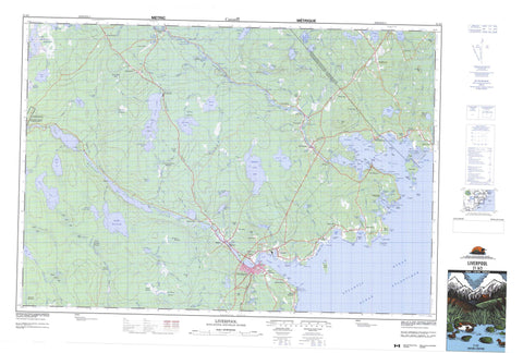
021A02 Liverpool Canada topo map, 1:50,000 scale
021A02 Liverpool NRCAN topographic map.
Includes UTM and GPS geographic coordinates (latitude and longitude). This 50k scale map is suitable for hiking, camping, and exploring, or you could frame it as a wall map.
Printed on-demand using high resolution, on heavy weight and acid free paper, or as an upgrade on a variety of synthetic materials.
Topos available on paper, Waterproof, Poly, or Tyvek. Usually shipping rolled, unless combined with other folded maps in one order.
- Product Number: NRCAN-021A02
- Parent Topo: TOPO-021A
- Map ID also known as: 021A02, 21A2, 21A02
- Unfolded Size: Approximately 26" high by 36" wide
- Weight (paper map): ca. 55 grams
- Map Type: POD NRCAN Topographic Map
- Map Scale: 1:50,000
- Geographical region: Nova Scotia, Canada
Neighboring Maps:
All neighboring Canadian topo maps are available for sale online at 1:50,000 scale.
Purchase the smaller scale map covering this area: Topo-021A
Spatial coverage:
Topo map sheet 021A02 Liverpool covers the following places:
- Beach Cove - Bees Cove - Big Cove - Big Sixteen Mile Bay - Blueberry Bay - Conrad Cove - Dogs Hole - Eagle Bay - Eagle Head Bay - East Berlin Bay - East Brook Bay - Faders Cove - Fox Creek - Fralick Cove - Froelich Cove - Hell Bay - Herring Cove - Hubleys Creek - Indian Bay - Indian Cove - Little Sixteen Mile Bay - Liverpool Bay - Liverpool Harbour - Long Bay - Long Cove - Medway Harbour - Minister Cove - Ministers Cove - Moose Harbour - Moshers Cove - Northwest Bay - Oak Hill Creek - Parks Cove - Privateer Cove - Puddingpan Bay - Ragged Harbour - Rugged Harbour - Sandy Cove - Scott Bay - Southwest Cove - The Cove - The Guzzle - Voglers Cove - Beach Meadows Beach - Conrad Beach - Southwest Breaker - Western Breaker - Andrew Head - Andrews Head - Banges Point - Black Point - Blueberry Point - Calf Point - Coopers Point - Dollivers Point - Eagle Head - Eagle Point - Eastern Head - Flagstaff Point - Forbes Point - Fort Point - Indian Point - Lohnes Head - Long Cove Point - Long Point - MacDonalds Point - Martins Point - Medway Head - Mersey Point - Moose Point - Neil Point - Seligs Point - Smiths Point - Tuppers Point - Wagner Point - Wolfs Point - Hells Gates - The Gut - Toby Island Passage - Bangs Falls - Bear Falls - Big Falls - Buggy Hole Falls - Cowie Falls - Glode Falls - Guzzle Falls - Heron Falls - Island Fall - Island Falls - Little Salmon Falls - Lower Lake Falls - MacLeods Falls - Poltz Fall - Poltz Falls - Rocky Falls - Salmon Fall - Salmon Falls - Salter Falls - Salters Falls - Upper Lake Falls - Lunenburg - Queens - Ponhook Lake 10 - Bark Island - Bass Island - Bear Island - Bear Island - Beaver Island - Big Cat Island - Big Guzzle Island - Birch Island - Birch Island - Cahoon Island - Cat Island - Cattle Island - Clam Island - Coffin Island - Dog Island - Fosters Islands - Fosters Islets - Fryingpan Island - Great Island - Green Island - Little Cat Island - Mattie Island - Middle Island - Mink Island - Mortons Island - Oak Island - Puddingpan Island - Ragged Harbour Great Island - Selig Island - Sheep Island - Stage Island - Teals Island - Thrum Cap - Timber Island - Toby Island - Whynacht Island - Wild Pear Island - Wynacht Island - Bar Pond - Beach Meadows Lake - Big Bon Mature Lake - Big Winnifred Lake - Black Lake - Blueberry Pond - Branch Lake - Burnaby Lake - Charlotte Lake - China Lake - Conrad Lake - Cranberry Lake - Crane Lake - Doctors Pond - Dolliver Lake - Duck Pond - Duck Pond - Duck Pond - Eagle Lake - Eight Mile Lake - First Beaverdam Lake - First Lake - George Lake - Georges Lake - Glode Lake - Hell Lake - Herring Cove Lake - Hills Bog Lake - Hills Lake - Hirtle Mill Pond - Horse Lake - Horse Pond - Island Lake - Johns Millpond - Kempton Lake - Lake Rossignol - Lily Pond - Lily Pond - Little Bon Mature Lake - Little Ten Mile Lake - Long Lake - Lower Fall Pond - Manthorn Lake - Meadow Pond - Neck Pond - Nickersons Pond - Rocky Lake - Round Lake - Round Pond - Salter Lake - Salters Lake - Second Beaverdam Lake - Sheep Lake - Solnow Lake - Solnow Pond - Ten Mile Lake - Toney Lake - Town Lake - Trout Pond - Upper Fall Pond - Victoria Lake - Vogler Lake - Voglers Lake - Wagners Lake - Wentworth Lake - Beech Hill - Betty Hill - Great Hill - Hog Hill - Humphs Hill - Kenney Hill - Moose Hill - Parks Hill - Lunenburg - Queens - Ten Mile Lake Provincial Park - Black Rattle - Black Rattle Rapid - Black Rattle Rapids - Upper Black Rattle - Allens Brook - Beach Meadows Brook - Beaverdam Brook - Birch Point Brook - Black Meadow Brook - Boggy Hole Brook - Bon Mature Brook - Broad River - Brown Branch - Brown Branch Brook - Buggy Hole Brook - Burnaby Brook - Cahoon Brook - Cameron Brook - Cohoon Brook - De Wolfe Brook - Dean Brook - Deep Brook - Ditch Brook - Dolliver Brook - Dutch Brook - Eagle Lake Brook - East Branch Five Rivers - East Broad River - East Brook - East Brook Five Rivers - Eleven Mile Brook - Fifteen Mile Brook - Five River Creek - Five Rivers - Five Rivers Creek - Freeman Meadow Brook - Freemans Brook - Freemans Run - George Brook - Georges Brook - Glode Meadow Brook - Hagan Brook - Hagen Meadow Brook - Halfway Brook - Halfway Brook - Halfway Brook - Heatherington Brook - Hemeon Brook - Hemlock Run - Herring Cove Brook - Hirtle Brook - Hogan Brook - Hollow Log Brook - Humtagut Creek - Humtagut Creek - Humtagut Creek - Humtagut Creek - Hunsegut Brook - Hypocrite Brook - Kempton Brook - Kempton Meadow Brook - Knowles Meadow Brook - Lily Brook - Lily Pond Brook - Limestone Brook - Little Hemlock Run - Little Mountain Run - Lower Great Brook - Martin Brook - McAlpine Brook - McAlpines Brook - Meadow Pond Brook - Medway River - Mersey River - Mink Trap Brook - Morton Brook - Mortons Brook - Munroe Brook - Murley Brook - Murray Brook - Nine Mile Brook - Number Two Brook - Oakes Mill Brook - Otter Pond Brook - Ox Brook - Parke Brook - Parks Brook - Payzant Brook - Petite Brook - Quarterway Brook - Salter Brook - Salters Brook - Sewards Brook - Shingle Mill Brook - Six Mile Brook - Slabpile Brook - Smith Brook - Solomon Brook - Solomon Brook - Ten Mile Brook - The Branch - Tumblingdown Brook - Twelve Mile Brook - Two Inch Brook - Upper Great Brook - Vogler Brook - Voglers Brook - Wentworth Brook - West Brook - West Deep Brook - Buggy Hole - Reef Pool - Blueberry Bay Reef - Dog Ledge - Dogs Hole Ledge - Dry Ledge - Eagle Rock - Garretts Rocks - Green Ledge - Halfway Rocks - Jasons Ledges - Jonathan Rock - Medway Ledge - Middle Island Rock - Middle Ledge - Nautilus Rock - Ragged Rock - Rugged Rock - Seal Rock - Sow and Pigs - Stonehorse Rock - Stoney Ridge - Stony Ridge - Bangs Falls - Beach Hill - Beach Meadows - Beech Hill - Bristol - Brooklyn - Charleston - Cherry Hill - County Line - Danesville - Eagle Head - East Berlin - East Port Medway - Great Hill - Indian Gardens - Lake Rossignol - Liverpool - Medway - Mersey Point - Middlefield - Middlewood - Mill Village - Milton - Moose Harbour - Moose Hill - Mount Pleasant - New Courage - Pleasantfield - Port Medway - Potanook - Riversdale - Sandy Cove - Somerset - Voglers Cove - West Berlin - Clancys Meadow - Clear Bog - Eleven Mile Bog - Five Rivers Meadow - Flake Woods Bog - Flakeswood Bog - Freeman Meadows - Hagen Meadow - Hayes Pan - Kempton Meadow - Long Lake Bog - Lower Great Brook Meadows - McGintys Meadows - Murray Meadows - Payzant Meadows - Six Mile Bog - The Meadow - Tom Knowles Meadow


