
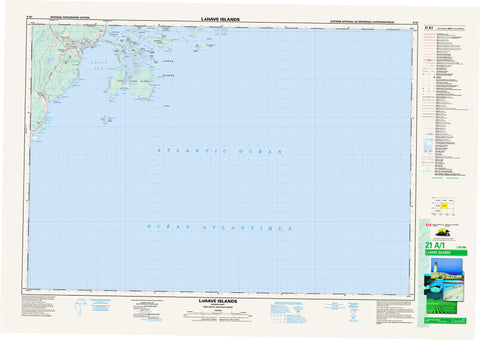
021A01 Lahave Islands Canada topo map, 1:50,000 scale
021A01 Lahave Islands NRCAN topographic map.
Includes UTM and GPS geographic coordinates (latitude and longitude). This 50k scale map is suitable for hiking, camping, and exploring, or you could frame it as a wall map.
Printed on-demand using high resolution, on heavy weight and acid free paper, or as an upgrade on a variety of synthetic materials.
Topos available on paper, Waterproof, Poly, or Tyvek. Usually shipping rolled, unless combined with other folded maps in one order.
- Product Number: NRCAN-021A01
- Parent Topo: TOPO-021A
- Map ID also known as: 021A01, 21A1, 21A01
- Unfolded Size: Approximately 26" high by 36" wide
- Weight (paper map): ca. 55 grams
- Map Type: POD NRCAN Topographic Map
- Map Scale: 1:50,000
- Geographical region: Nova Scotia, Canada
Neighboring Maps:
All neighboring Canadian topo maps are available for sale online at 1:50,000 scale.
Purchase the smaller scale map covering this area: Topo-021A
Spatial coverage:
Topo map sheet 021A01 Lahave Islands covers the following places:
- Apple Cove - Arties Cove - Back Cove - Back Cove - Back Harbour - Bantam Bay - Beartrap Cove - Broad Cove - Bull Cove - Butter Cove - Cape Bay - Cherry Cove - Crow Hole - Currie Cove - Deep Cove - Dublin Bay - Foggy Islands Cove - Front Cove - Green Bay - Halibut Bay - Hartling Bay - Hell Bay - Hirtles Bay - Little Harbour - McLeod Harbour - Mosher Harbour - Moshers Bay - Moshers Harbour - Sand Cove - Sandy Cove - Sloop Cove - The Creek - Upper Butter Cove - Western Cove - Yankee Cove - Bay Beach - Cape Bay Beach - Crescent Beach - Ironbound Breaker - Little Rissers Beach - Rissers Beach - Sperrys Beach - Brown Point - Cape La Have - Cape Lahave - Cape LaHave - Gaff Point - Green Point - Green Point - Halibut Head - Jenkins Point - Johnson Point - Long Point - McNeil Point - Moshers Head - North Head - Northern Head - Pollock Point - Rissers Point - Rocky Head - Seal Point - Sharp Head - The Point - Turner Point - Western Head - Western Point - Bakers Gut - Bell Channel - Crooked Channel - False La Have - False Lahave - False LaHave - Folly Channel - Little Channel - Ships Channel - The Squam - Wolfe Gut - Lunenburg - Bear Island - Bell Island - Bush Island - Cabbage Island - Camp Islands - Cape La Have Island - Cape LaHave Island - Covey Island - Coveys Island - East Spectacle Island - Foggy Islands - Fox Island - George Island - Hirtle Island - Indian Island - Jenkins Island - La Have Islands - LaHave Island - LaHave Islands - Lahave Islands - Madners Island - Middle Island - Mink Island - Mosher Island - Moshers Island - Outer Hirtle Island - Outer Island - Overalls Island - Rabbit Island - Round Island - Spectacle Islands - The Knob - Thrum Cap - Thrum Caps - Tumblin Island - West Ironbound Island - West Spectacle Island - Wolfe Island - Apple Tree Pond - Arties Pond - Bickles Pond - Crab Pond - Fence Pond - Frog Pond - Green Point Pond - Hebbs Pond - Long Point Ponds - Purgatory Ponds - Roomsailor Pond - Sperry Lake - Stage Ponds - Whynachts Pond - Beech Hill - Drews Hill - Oak Hill - Romkey Hills - Spikes Hill - Rissers Beach Provincial Park - Broad Cove Brook - Brown Branch - Brown Branch Brook - Fence Pond Brook - Halfway Brook - Mad Brook - Petite Rivière - Romkey Brook - Smelt Brook - Wamback Mill Brook - Bantam Shoal - Black Rock - Calf Rock - Cape Rock - Duck Shoal - Eastern Reef - February Rock - French Rock - Goose Rock - Green Ledge - Green Point Rock - Halfway Rock - Ironbound Bank - Mad Rock - Mosher Ledge - Moshers Ledge - Pollock Shoal - Shag Rock - The Point Rocks - Broad Cove - Bush Island - Cherry Hill - Crescent Beach - Green Bay - La Have Island - LaHave Island - Lahave Island - Mosher Island - Moshers Island - Petite Rivière - Petite Rivière Bridge


