
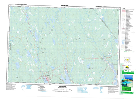
020P14 Shelburne Canada topo map, 1:50,000 scale
020P14 Shelburne NRCAN topographic map.
Includes UTM and GPS geographic coordinates (latitude and longitude). This 50k scale map is suitable for hiking, camping, and exploring, or you could frame it as a wall map.
Printed on-demand using high resolution, on heavy weight and acid free paper, or as an upgrade on a variety of synthetic materials.
Topos available on paper, Waterproof, Poly, or Tyvek. Usually shipping rolled, unless combined with other folded maps in one order.
- Product Number: NRCAN-020P14
- Parent Topo: TOPO-020P
- Map ID also known as: 020P14, 20P14
- Unfolded Size: Approximately 26" high by 36" wide
- Weight (paper map): ca. 55 grams
- Map Type: POD NRCAN Topographic Map
- Map Scale: 1:50,000
- Geographical region: Nova Scotia, Canada
Neighboring Maps:
All neighboring Canadian topo maps are available for sale online at 1:50,000 scale.
Purchase the smaller scale map covering this area: Topo-020P
Spatial coverage:
Topo map sheet 020P14 Shelburne covers the following places:
- Barrack Cove - Jordan Bay - Lockeport Harbour - Shelburne Bay - Shelburne Harbour - Louis Head Beach - Beaverhouse Point - Enslow Point - Enslows Point - Basin Falls - Big Falls - Cranes Neck Falls - Hemlock Island Falls - Little Beech Hill Falls - Whites Falls - Queens - Shelburne - Craigs Island - Green Island - Hemlock Island - John Island - Josies Islands - Sandys Island - Shepherds Island - Back Lake - Beaverdam Lake - Beaverdam Pond - Beech Hill Lake - Beech-hill Lake - Birchtown Lake - Birchtown Lakes - Burns Pond - Campbells Lake - Canada Hill Lake - Colin Lake - Colins Lake - Cooper Trap - Courtney Lake - Courtneys Lake - Deception Lake - Dexters Millpond - Fiddler Lake - Fiddlers Lake - Gibsons Pond - Gold Lake - Green Harbour Lake - Green-harbour Lake - Haley Lake - Harper Lake - Harpers Lake - Hayden Lake - Hemlock Lake - John Lake - John Lake - Jones Lake - Lake George - Lake John - Little Birchtown Lake - Little Pug Lake - Little Ryers Lake - Long Lake - McKay Lakes - Millers Pond - Misery Lake - Mountain Pond - Mud Lake - Ogden Lake - Ogdens Lake - Philip Lake - Porterfield Lakes - Pug Lake - Robarts Pond - Robs Lake - Ryers Lake - Ryers Pond - Stokes Lake - Tidney Lake - Tigney Lake - Veitch Lake - Veitchs Lake - Vidler Lake - Wall Lake - Walls Lake - Welshtown Lake - Wentworth Lake - West Beech Hill Lake - West Beech-hill Lake - West Birchtown Lake - Westerly Lake - Western Lake - White Lake - Whites Lake - Wilkins Lake - Campbells Hill - Canada Hill - Dumpling Ridge - East Beech Hill - Fox Ridges - Hardwood Hill - Little Beech Hill - Moose Hill - Oak Hill - Oak Hill - Pine Hill - Reids Hill - South Blue Hill - Thompsons Ridge - West Beech Hill - Barrington - Queens - Shelburne - Refuge d'oiseaux de la rivière du Sable - Sable River Bird Sanctuary - Sable River Provincial Park - The Islands Provincial Park - Big Eddy - Ryers Rip - Ackers Brook - Barren Brook - Birchtown Brook - Black Brook - Blacks Brook - Blue Hill Bog Brook - Blue Hill Brook - Bluehill Brook - Clyde River - Colins Lake Brook - Courtneys Lake Brook - Devils Back - East Branch - East Brook - East River - Egypt Brook - Eight Mile Brook - Eightmile Brook - Fiddlers Lake Brook - Four Mile Brook - Fourmile Brook - Freshwater Brook - Hackmatack Brook - Haley Lake Brook - Harper Creek - Hemlock Creek - Indian Brook - Indian Creek - Irvings Mill Run - Jordan River - Krautknife Brook - Log Brook - Long Bridge Brook - Mahaney Creek - Mahoney Creek - Mark Brook - Marks Brook - Millers Pond Brook - Millpond Brook - Misery Lake Brook - Northwest Brook - Oak Hill Brook - Ogden Creek - Ogdens Creek - Owlhill Brook - Owls Hill Brook - Pine Hill Brook - Pinehill Brook - Pumpkinvine Brook - Purney Brook - Roseway River - Sable River - Six Mile Brook - Sixmile Brook - Stewarts Brook - Stoney Brook - Stony Brook - Sucker Creek - Sunken Brook - Tidney River - Tigney River - Tobacco Brook - Turtle Creek - Wall Brook - Walls Brook - Wentworth Brook - West Branch - West Branch Sable River - West Brook - West River - West Sable River - Western Extension - Western Extension Brook - Devils Stillwater - Krautknife Stillwater - Oak Hill Stillwater - The Basin - The Elbow - The Wide Place - Tidney Stillwater - Walls Stillwater - Hero Shoal - Long Shoals - West Branch Shoals - Shelburne - Allendale - Birchtown - East Jordan - East Sable River - Jordan Branch - Jordan Falls - Jordan Ferry - Lower Ohio - Middle Ohio - Sable River - Sable River Station - Sable River West - Upper Clyde River - Upper Ohio - Welshtown - West Middle Sable - Alex Snows Hay Meadow - Bearden Lake Bog - Beatons Meadow - Blacks Dam Meadow - Blue Hill Bog - Bluehill Bog - Canada Hill Bog - Drinking Hole Barren - Dumpling Savannah - Green Bunch Meadow - Haydens Hay Meadows - Little Ryers Lake Meadows - MacCourtreys Barrens - MacKenzies Barren - North Division Bog - Payzant Meadows - Quays Hay Meadow - Stillwater Meadow - Tidney Meadows


