
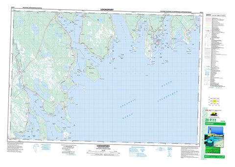
020P11 Lockeport Canada topo map, 1:50,000 scale
020P11 Lockeport NRCAN topographic map.
Includes UTM and GPS geographic coordinates (latitude and longitude). This 50k scale map is suitable for hiking, camping, and exploring, or you could frame it as a wall map.
Printed on-demand using high resolution, on heavy weight and acid free paper, or as an upgrade on a variety of synthetic materials.
Topos available on paper, Waterproof, Poly, or Tyvek. Usually shipping rolled, unless combined with other folded maps in one order.
- Product Number: NRCAN-020P11
- Parent Topo: TOPO-020P
- Map ID also known as: 020P11, 20P11
- Unfolded Size: Approximately 26" high by 36" wide
- Weight (paper map): ca. 55 grams
- Map Type: POD NRCAN Topographic Map
- Map Scale: 1:50,000
- Geographical region: Nova Scotia, Canada
Neighboring Maps:
All neighboring Canadian topo maps are available for sale online at 1:50,000 scale.
Purchase the smaller scale map covering this area: Topo-020P
Spatial coverage:
Topo map sheet 020P11 Lockeport covers the following places:
- Back Harbour - Berrys Bay - Bills Cove - Birchtown Bay - Black Point Bay - Blackbeards Cove - Blanche Cove - Clam Creek - Clarks Cove - Dung Cove - East Cove - Front Harbour - Green Harbour - Gunning Cove - Hagars Cove - Hell Hole - Jordan Bay - Little Harbour - Lockeport Harbour - Lyles Bay - Malcolms Cove - McGrath Cove - Myrtle Cove - Negro Harbour - North East Harbour - Northeast Harbour - Northwest Creek - Osborne Harbour - Paddys Cove - Pauls Cove - Pond Cove - Port La Tour - Port Latour - Roaches Cove - Roseway Harbour - Round Bay - Sheep Bar Cove - Shelburne Bay - Shelburne Harbour - Slates Creek - Stephens Cove - Stoney Cove - Swaines Cove - The Anchorage - Townsends Harbour - Upper Island Bay - West Cove - Black Point Beach - Blacksmiths Beach - Blow Breaker - Blow Breaker (Eastern Bull) - Carleton Village Shore - Crescent Beach - Egg Beach - Emulous Breakers - Hales Beach - Long Beach - Long Beach - Lower Beach - MacKenzies Breaker - Pierces Beach - Pollys Meadow Beach - Rood Head Breaker - Roseway Beach - Sheep Bar - Southeast Breaker - Southwest Breaker - Southwest Breakers - The Bar - The Horseshoe - The Marsh Bar - West Point Breaker - Abbotts Point - Bethels Point - Black Point - Bony Point - Burnt Head - Cape Negro - Cape Roseway - Captain Jones Point - Conrads Point - Cranes Point - Cumming Point - Dahls Point - Days Point - East Point - East Point - Fish Flake Point - Fort Point - Fort Point - Government Point - Hart Point - Harts Point - Haystack Head - Hemeon Head - Hemeons Head - Hemeons Point - Isaac Ackers Point - Jenkins Head - Jennys Point - John Point - Jordan Point - Locke Point - Louis Head - Middle Head - Northwest Spit - Northwest Spit - Oak Point - Patterson Point - Pattersons Point - Pleasant Point - Pompee Point - Purgatory Point - Raspberry Head - Red Head - Rood Head - Sams Point - Sand Point - Sandy Point - Sarah Lees Point - Seal Point - Shingle Point - Shooting Point - Southwest Point - Sperrys Point - Stokes Head - Stoney Point - Surf Point - Surf Point - Wallaces Point - West Point - Western Head - Western Head - Bangays Hole - East Entrance - Eastern Way - Fairway Passage - Lockeport Western Way - Narrow Passage - Ram Island Passage - Ram-island Passage - The Gut - The Guzzle - The Haulover - The Passageway - West Entrance - Western Way - Wide Passage - Northeast Bluff - Red Bank - Nelsons Falls - Quinns Falls - Shelburne - Ambers Island - Apple Island - Benham Island - Berrys Island - Big Island - Blue Gull Island - Blue Island - Boxing Island - Brant Thrum - Bruce Island - Bull Island - Cape Negro Island - Carter Island - Carters Island - Clam Island - Clarks Island - Cranberry Island - Davis Island - De Mings Island - Demings Island - Douglas Island - Firth Island - Fox Island - Gooseberry Island - Green Island - Grey Island - Hughes Island - Jenkins Island - John Island - Johns Island - Kenney Island - Locke Island - Lockes Island - MacKays Island - McLean Island - McNutt Island - McNutts Island - Mink Island - Mink Island - Nicholson Island - Potato Island - Rain Island - Ram Island - Ram Island - Round Island - Round Island - Snows Thrum - Spectacle Island - Squaw Island - Stephens Island - Sugar Loaf Island - Tea Chest Island - Tea-chest Island - The Nubble - Thrum Cap - Thrum Island - Tony Island - William Island - Williams Island - Alvin Lake - Alvins Lake - Beaverdam Lake - Church Over Lakes - Churchover Lakes - Dexter Lake - Dirty Creek Lake - Dirty-creek Lake - Five River Lake - Fresh Pond - Gibsons Pond - Gooseberry Pond - Greenwood Lake - Hardys Millpond - Jobs Pond - Lily Pond - Little Harbour Lake - Little Lake - Long Beach Pond - Mangum Lake - Matthews Lake - Morris Lake - North Churchover Lake - Pulpmill Pond - Rodney Lake - Salt Pond - South Churchover Lake - Swims Iceponds - Church Hill - Fox Ridges - Ginger Hill - Reids Hill - Barrington - Shelburne - Ackers Brook - Alvins Lake Brook - Beaverdam Brook - Birchtown Brook - Bowers Brook - Clyde River - Dexter Lake Brook - Dirty Creek - East Brook - East River - Goose Creek - Judas Creek - Kens Brook - Little Goose Creek - MacDonalds Creek - Mill Creek - Old Barn Brook - Reuben Meisners Brook - Round Bay River - Round-bay River - Sandy Point Brook - South Churchover Lake Brook - Stewarts Brook - Stokes Brook - Thurstons Creek - West Brook - West River - Western Extension - Western Extension Brook - Abundance Rock - Adamant Rock - Adamant Shoal - Alicks Rock - Bartletts Ledge - Bell Rock - Big Dick - Big Flat Rock - Big Ledge - Big Ledge - Bird Rock - Black Point Ledges - Black Point Rock - Black Rock - Black Rocks - Blind Dick - Boxing Rock - Brig Georges Ledge - Budget Rock - Bull Rock - Chain Ledge - Clay Bank - Collupy Rock - Cottmans Rock - Cove Rock - Dumpling Rock - Dunns Rock - Emulous Reef - Evelyns Rock - Farm Ledge - Five Fathom Shoal - Fort Rock - Fox Bar - Franks Ledge - Georges Rock - Gids Ledge - Grey Rocks - Grog Rock - Gull Rock - Gull Rock - Halibut Tail Shoal - Hart Point Rock - Harts Point Rock - Jaw Lock - Jig Rock - John Smiths Ledge - Johns Island Rock - Jordan Bay Gull Rock - Kelp Shoal - Laurier Rock - Little Dick - Little Flat Rock - Long Rock - Long Shoal - Lower Wharf Rock - Mackerel Rock - Mackerel Rock - Mad Rocks - Man of War Rock - McKay Rock - Middle Ground - Middle Ledge - Middle Rock - Middle Rock - Mohawk Ledge - Net Rock - Old Cow Reef - Old Mother Slate Rock - Outer Farm Ledge - Peppers Rock - Potter Ledge - Potters Ledge - Round Rock - Round Rock - Round Shoal - Sams Rock - Scalp Rock - Sea Dogs - Sea-dogs - Seal Ledge - Seal Ledges - Seal Point Ledge - Seal Rocks - Shag Rock - Soldiers Ledge - South Ledge - Southeast Reef - Southwest Rock - Southwest Rocks - Spoon Ledge - Strap Tub Rock - Strap-tub Rock - Sunken Ledge - Teakettle Rocks - The Doughboy - The Hummock - The Jolt - The Sisters - The Sisters - Three Fathom Shoal - Thrum Rock - Thrumcap Ledge - Thrumcap Rock - Tickey Shoal - Tickeys Shoal - Triangle Rocks - Trinidad Rock - Upper Ledge - Upper Wharf Rock - Whale Rock - Wharf Rock - Lockeport - Allendale - Arnold - Atlantic - Birchtown - Blanche - Brighton - Cape Negro - Cape Negro Island - Carleton Village - Church Over - Churchover - Clyde River - Crowell - East Green Harbour - East Side of Ragged Island - Green Harbour - Greenwood - Gunning Cove - Ingomar - Jordan Bay - Jordan Ferry - Little Harbour - Lockeport Station - Louis Head - Lower Jordan Bay - Lower Sandy Point - Lydgate - McNutt Island - McNutts Island - North East Harbour - North West Harbour - Osborne Harbour - Pleasant Point - Port Clyde - Port La Tour - Port Latour - Port Saxon - Reynoldscroft - Rockland - Roseway - Round Bay - Sandy Point - Swansburg - Thomasville - Upper Port La Tour - Upper Port Latour - West Green Harbour - West Port Clyde - Western Head - Bowers Meadows - Dirty Creek Bog - Quinns Meadow - The Bog - The Marsh


