
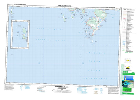
020P05 Cape Sable Island Canada topo map, 1:50,000 scale
020P05 Cape Sable Island NRCAN topographic map.
Includes UTM and GPS geographic coordinates (latitude and longitude). This 50k scale map is suitable for hiking, camping, and exploring, or you could frame it as a wall map.
Printed on-demand using high resolution, on heavy weight and acid free paper, or as an upgrade on a variety of synthetic materials.
Topos available on paper, Waterproof, Poly, or Tyvek. Usually shipping rolled, unless combined with other folded maps in one order.
- Product Number: NRCAN-020P05
- Parent Topo: TOPO-020P
- Map ID also known as: 020P05, 20P5, 20P05
- Unfolded Size: Approximately 26" high by 36" wide
- Weight (paper map): ca. 55 grams
- Map Type: POD NRCAN Topographic Map
- Map Scale: 1:50,000
- Geographical region: Nova Scotia, Canada
Neighboring Maps:
All neighboring Canadian topo maps are available for sale online at 1:50,000 scale.
Purchase the smaller scale map covering this area: Topo-020P
Spatial coverage:
Topo map sheet 020P05 Cape Sable Island covers the following places:
- Baker Inlet - Barrington Bay - Camerons Cove - Clam Point Cove - Clarks Harbour - Clark's Harbour - Cripple Creek - Crowell Cove - East Cove - East Side Cove - Eastern Creek - Garrons Cove - Graveyard Cove - Indian House Cove - Inner Harbour - Jacks Cove - Kelp Cove - Lower Shag Harbour - McGray Cove - McGrays Cove - Round Bay - Sand Cove - Scalloping Cove - Seine Cove - Shag Harbour - Shag Harbour - South Side Inlet - Stoddart Cove - Stoney Island Harbour - The Slip - The Sound - West Head Bend - West Side Cove - Whiteway Cove - Kelp Cove Bar - Middle Breaker - Absalom Point - Barrel Point - Bear Point - Bill Kenneys Point - Black Head - Black Point - Bulls Head - Burks Point - Burk's Point - Cape Sable - Cat Rock Point - Clam Point - Cook Point - Cranberry Pond Point - Daniel Head - Division Head - Donald Head - Dougalls Point - East End - Flea Head - Gairdners Point - Garrons Point - Goose Point - Green Head - Gulch Point - Hawk Point - Hueys Head - Lime Head - Long Point - Maggie Garrons Point - Mikes Point - Mother Owens Point - Newell Head - Northern End - Northern End - Old Houses Point - Percys Point - Pilgrims Point - Point of Beach - Prospect Point - Race Point - Scratch All Point - Southeast Head - Southern End - Southwest Point - Split Point - Squaw Point - Stonewall Head - Swim Point - Swims Point - Toots Point - West Head - Barrington Passage - Cape Channel - Doctors Channel - Eastern Passage - Fish Inlet - Hawk Channel - Hawk Inlet - Little Inlet - The Gulch - The Sluice - Western Passage - High Bank - High Bank - Shelburne - Yarmouth - Apps Island - Bear Point Thrums - Bell Island - Big Milightie Island - Bohakers Island - Bon Portage Island - Brook Islands - Cape Sable Island - Dans Island - Deadmans Island - Devils Limb - Dog Islands - Double Island - Duck Island - Fish Island - Flat Island - Fumeroy Islands - Georges Island - Good Landing Island - Great Calf Island - Green Island - Green Island - Gull Island - Inner Island - Isle in the Harbour - Lees Island - Limbs Limb - Little Calf Island - Little Green Island - Little Island in the Harbour - Little Milightie Island - Little Stoney Island - Little Stony Island - Long Island - Mouse Island - Mud Island - Newlight Island - Noddy Island - Outer Island - Pomeroy Islands - Prospect Island - Rabbit Island - Ram Island - Rat Island - Round Island - Round Island - Round Island - Salmon Island - Salmon Island - Seal Island - Sheep Island - Stoddart Island - Stony Island - Tree Island - Bakers Flats - Flag Pond - Salt Water Pond - The Ponds - West Side Pond - Woody Pond - Ratcliffe Hills - Parker Brook - Dicks Rip - Long Rip - Pollock Rip - Shag Harbour Rip - Short Rip - Tail of the Rip - The Hospital - The Overfalls - The Rip - Wilsons Rip - Alcor Rock - Apple Rock - Arnolds Shoal - Aunt Edies Ledge - Ball Bar - Ball Ledge - Big Ledge - Black Head Ledge - Black Ledge - Black Rock - Black Rock - Blonde Rock - Cameron Shoal - Cape Ledge - Cat Rock - Charlie Atkins Shoal - Columbia Rock - Congress Shoal - Connors Ridge - Cook Ledge - Cook Point Ledges - Cooks Ledge - Cooks Rock - Cornwall Rock - Cross Ledge - Daniel Shoal - Dans Rock - Doan Rock - Doane Rock - Doddys Shoal - Dog Ledge - Donald Shoal - Dry Ledge - Dry Ledge - Duncan Shoals - East Bear Point Ledge - Elbow Rock - Fish Island Ledge - Flat Rocks - Forfeit Rocks - Gids Buoy Rock - Goodwins Ledge - Grannies Brunt - Green Island Ledge - Green Island Rock - Green Ledge - Green Ledge - Green Ledges - Gunning Rocks - Halftide Ledge - Herring Ledge - Herring Ledge - High Ledge - Horse Race - Hospital Ledge - Hospital Reef - Hospital Reef - Houses Ground - Hungarian Rock - Inner Cross Ledge - Inner Overfalls - Inner Shoal - Isaacs Ledge - Jefferey Ledge - Jeffereys Ledge - John Nix Shoal - John X Shoal - Kelp Ledge - Kelp Shoal - Kelp Shoal - Lamb Died Rock - Lens Rock - Little Horse Race - Lizzie Ledge - Locks Aloy Shoal - Lone Rock - Long Ledge - Long Ledge - Lovetts Shoal - Low Ledges - Lower Bar - Mackerel Rock - Mother Owens Rocks - Murdocks Shoal - Murray Shoal - Myra Crowells Shoal - Newellton Reef - Noddy Island Bar - Noddy Island Ground - Old Man Rock - Outer Island Bar - Outer Shoal - Ox Eye Rock - Passage Ground - Peaked Rock - Phinneys Rock - Pinnacle Rock - Placeway Rock - Pork Ledge - Purdy Rock - Raytons Shoal - Rock on the Rip - Round Shoal - Ryders Ledge - Ryders Ledge - Salt Ledge - Salt Rock - Salt Rock - Sand Bar - Sandys Ledge - Scot Rock - Seal Island Ridge - Seal Ledge - Seal Ledges - Seal Rocks - Seal Rocks - Seal Rocks - Seal Rocks - Seine Cove Rock - Shag Rock - Shag Rock - Sloop Rock - Smith Shoal - Southwest Ledge - Southwest Point Rocks - Split Rock - Steves Shoal - Stocking Leg Shoal - Stoddart Ledges - Stoney Island Shoal - Stony Island Shoal - The Elbow - The Flat - The Hay Cock - The Reef - Three Rocks - Tom Doddys Rock - Tommys Rock - Toots Shoal - Turbine Shoal - Uncle Barrys Shoal - Underpinning Ledge - Vermont Rock - Webbs Shoal - West Bear Point Ledge - West Head Shoal - Whale Back - Whales Back - White Knoll Ledge - Wraytons Shoal - Zetland Shoal - Clark's Harbour - Atwood Brook - Atwoods Brook - Atwood's Brook - Bear Point - Cape Sable Island South Side - Centreville - Clam Point - East Side - Lower Clarke Harbour - Lower Clarks Harbour - Lower Clark's Harbour - McGray - Newellton - Seal Island - Shag Harbour - South Side - Stoney Island - Stony Island - The Hawk - West Head - West Side


