
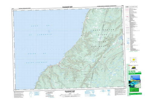
011K15 Pleasant Bay Canada topo map, 1:50,000 scale
011K15 Pleasant Bay NRCAN topographic map.
Includes UTM and GPS geographic coordinates (latitude and longitude). This 50k scale map is suitable for hiking, camping, and exploring, or you could frame it as a wall map.
Printed on-demand using high resolution, on heavy weight and acid free paper, or as an upgrade on a variety of synthetic materials.
Topos available on paper, Waterproof, Poly, or Tyvek. Usually shipping rolled, unless combined with other folded maps in one order.
- Product Number: NRCAN-011K15
- Parent Topo: TOPO-011K
- Map ID also known as: 011K15, 11K15
- Unfolded Size: Approximately 26" high by 36" wide
- Weight (paper map): ca. 55 grams
- Map Type: POD NRCAN Topographic Map
- Map Scale: 1:50,000
- Geographical region: Nova Scotia, Canada
Neighboring Maps:
All neighboring Canadian topo maps are available for sale online at 1:50,000 scale.
Purchase the smaller scale map covering this area: Topo-011K
Spatial coverage:
Topo map sheet 011K15 Pleasant Bay covers the following places:
- Big Cove - Black Point Cove - Bucks Cove - Fishing Cove - Fort Cove - Golfe du Saint-Laurent - Gulf of St. Lawrence - Moores Cove - North Harbour - Phillips Cove - Pigeon Cove - Pleasant Bay - Pollett Cove - Polletts Cove - Ramseys Cove - Seal Cove - Wreck Cove - Polletts Cove Beach - Big Head - Black Point - Delaneys Point - Fishing Cove Head - Fishing Cove Point - High Capes - Kerrs Point - Mackenzie Point - MacKenzies Point - Red Cape - Red Head - Shag Roost - The Chimney - White Capes - Wreck Cove Point - French Gulch - Black Cliffs - Beulach Ban Falls - Inverness - Juste au Corps - Victoria - Cape Breton Island - Carters Island - Daisleys Island - Île du Cap-Breton - Baldwin Lake - Beal Lake - Bear Lakes - Beulach Lake - Black Lake - Boot Lake - Burton Lake - Campbells Lake - Chain Lakes - Deer Lake - Doherty Lake - Five Island Lakes - Fox Back Lake - Fox Lakes - Glasgow Lakes - Gwinn Lake - Hill Top Lake - John Dee Lake - Little Round Lake - Lobster Lake - MacEacherns Lake - MacGregor Lake - MacIntosh Lake - Morrisons Lake - Muskrat Lake - North Pond - Otter Lakes - Pike Lake - Pute Lake - Red River Lakes - Ridge Lake - Round Lake - Roundhill Lakes - Spar Lake - Squirrel Lake - Sugar Brook Lakes - The Pond - Three Mile Lake - Twin Lakes - Andrews Mountain - Baldy - Bear Hill - Black Brook Mountain - Boarsback - Fox Back Ridge - Grey Hill - Icy Mountain - Mackenzie Mountain - MacKenzies Mountain - Moores Hill - North Mountain - Roberts Mountain - South Mountain - Tenerife Mountain - Theodore Fricker Mountain - Inverness - Victoria - Cape Breton Highlands National Park of Canada - Parc national du Canada des Hautes-Terres-du-Cap-Breton - Archies Brook - Archies Brook - Bear Brook - Benjies Lake Brook - Big Southwest Brook - Black Brook - Black Brook - Black Brook - Black Point Brook - Blair River - Delaney Brook - Doherty Brook - Donaldsons Brook - Donovan Brook - Eastern Brook - Fishing Cove River - George Brook - Georges Brook - Glasgow Brook - Grande Anse River - Gray Glen Brook - Grays Hollow Brook - Halfway Brook - Jessies Brook - Johns Brook - Line Brook - Little Southwest Brook - Lockhart Brook - Lower Delaneys Brook - Lowland Brook - MacGregor Brook - MacIntosh Brook - Mackenzie River - MacKenzies River - Malcolms Brook - McIntosh Brook - Meat Cove Brook - Middle Aspy River - North Aspy River - North Aspy River North Branch - North Aspy River South Branch - North Branch Brook - Otter Brook - Phillips Cove Brook - Pigeon Cove Brook - Pine Brook - Polletts Cove River - Red River - Rorys Brook - Rorys Brook - Sailor Brook - Sallys Brook - Salmon River - South Aspy River - South Blair River - South Fishing Cove River - Southwest Branch Brook - Spring Brook - Sugar Brook - Sutherlands Brook - Upper Delaneys Brook - Warren Brook - Whiskey Den Brook - Wilkie Brook - Wreck Brook - Wreck Cove Brook - Malcolms Rock - Pillar Rocks - Big Intervale Cape North - Cape North - Pleasant Bay - Red River - Sunrise - Grays Hollow - Big Intervale - McEvoys Barren - Sammys Barren


