
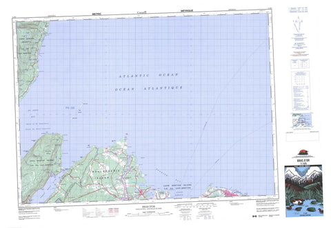
011K08 Bras D Or Canada topo map, 1:50,000 scale
011K08 Bras D Or NRCAN topographic map.
Includes UTM and GPS geographic coordinates (latitude and longitude). This 50k scale map is suitable for hiking, camping, and exploring, or you could frame it as a wall map.
Printed on-demand using high resolution, on heavy weight and acid free paper, or as an upgrade on a variety of synthetic materials.
Topos available on paper, Waterproof, Poly, or Tyvek. Usually shipping rolled, unless combined with other folded maps in one order.
- Product Number: NRCAN-011K08
- Parent Topo: TOPO-011K
- Map ID also known as: 011K08, 11K8, 11K08
- Unfolded Size: Approximately 26" high by 36" wide
- Weight (paper map): ca. 55 grams
- Map Type: POD NRCAN Topographic Map
- Map Scale: 1:50,000
- Geographical region: Nova Scotia, Canada
Neighboring Maps:
All neighboring Canadian topo maps are available for sale online at 1:50,000 scale.
Purchase the smaller scale map covering this area: Topo-011K
Spatial coverage:
Topo map sheet 011K08 Bras D Or covers the following places:
- Arsenault Creek - Aulds Cove - Breton Cove - Briton Cove - Crawley Creek - Fairy Hole - First Cove - French River Cove - Golfe du Saint-Laurent - Graces Cove - Gulf of St. Lawrence - Kelly Cove - Kellys Cove - Lloyd Cove - MacLean Cove - MacPhees Cove - McCready Creek - McLean Cove - Micks Hole - Mill Creek - Plants Creek - Port Shoal - Ribbys Cove - Second Cove - Spanish Bay - St. Ann Bay - St. Anns Bay - St. Ann's Bay - Stewarts Cove - Sydney Harbour - Big Grappling Beach - Broken Grounds - Florence Beach - Gooseberry Beach - Little Grappling Beach - Munroe Beach - Plaster Shore - Sandy Beach - Alder Point - Aulds Point - Bentinck Point - Berry Head - Birch Point - Black Point - Black Rock Point - Blackrock Point - Blue Nose Point - Bonar Head - Breton CovePoint - Cape Dauphin - Carey Point - Careys Point - Chain Point - Cowdy Point - Cranberry Point - Devoe Point - Duffus Point - Flat Point - French River Point - Gooseberry Point - Hectors Point - High Cape - Jessom Point - Jessome Point - Kelly Point - Kellys Point - Little River Point - Low Point - MacKenzie Point - Merritt Point - Noir Point - Oxford Point - Point Aconi - Point Jane - Sullivan Point - Swivel Point - Table Head - Great Bras d'Or - Little Bras d'Or - St. Andrew Channel - St. Andrews Channel - St. Andrew's Channel - Squatter Bluff - Cape Breton - Victoria - Aconi Island - Bird Islands - Boularderie Island - Cape Breton Island - Ciboux Island - Hertford Island - Île du Cap-Breton - Big Pond - Breton Cove Pond - Briton Cove Pond - Careys Pond - Colin Ponds - Dalem Lake - Edwards Pond - Hectors Pond - Hortons Pond - Kellys Cove Pond - Kennys Pond - Little MacDermids Pond - Little Mill Pond - Little Pond - MacDermids Pond - MacDonalds Pond - MacInnis Pond - MacLeans Pond - MacLeod Lake - McLeod Lake - Mill Pond - Mill Pond - Morrison Pond - Pit Pond - Rocheal Pond - Smiths Ponds - Spinnigan Lakes - Spinnigan Lakes - The Barachois - Urquharts Lake - Cape Dauphin Mountain - Cape Breton - Victoria - Dalem Lake Provincial Park - Plaster Provincial Park - Aconi (Fifes) Brook - Aconi Brook - Arsenault Brook - Arsenault Brook - Bains Brook - Big Brook - Buchanan Brook - Conn Creek - Crawley Brook - Dunphy Brook - Fifes Brook - French River - Graces Brook - Gracie Brook - Grappling Brook - Irish Brook - Little River - MacAskill Brook - MacAuley Brook - MacDonald Brook - MacDonalds Brook - MacInnis Brook - MacLennans Brook - MacQueen Brook - McAskill Brook - McDonald Brook - McQueen Brook - Meadow Brook - Mill Brook - Mill Creek - Morrisons Brook - Ratchford Brook - Red Brook - Rocky Brook - Sallys Brook - Smelt Brook - Smiths Brook - Sullivan Creek - Urquharts Brook - Waterford Brook - Black Rock - Black Rock Shoal - Blackrock Shoal - Bonar Rock - Ciboux Shoal - Ciboux Shoals - Cran Rock - David Head Shoal - Davies Head Shoal - Eddy Rock - Flower Pot - Haddock Bank - Hertford Ledge - Kings Rock - Little Shoal - Livingstone Shoal - Mary Rocks - Marys Rocks - Middle Shoal - Outer Table Rock - Petrie Reef - Petries Ledge - Shag Rock - Table Rock - The Bar - Three Fathom Shoal - White Rock - Alder Point - Big Bras d'Or - Black Rock - Bras d'Or - Breton Cove - Briton Cove - Cape Dauphin - Florence - French River - Gannon - Kaneville - Little Bras d'Or South Side - Little Pond - Little River - McCreadyville - Mill Creek - Mill Pond - Millville Boularderie - New Campbellton - New Dominion - New Harris Forks - New Victoria - New Waterford - North Shore - Point Aconi - Rear Little River - Skir Dhu - Sydney Mines


