
011K03 Lake Ainslie Canada topo map, 1:50,000 scale
011K03 Lake Ainslie NRCAN topographic map.
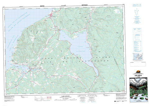
Includes UTM and GPS geographic coordinates (latitude and longitude). This 50k scale map is suitable for hiking, camping, and exploring, or you could frame it as a wall map.
Printed on-demand using high resolution, on heavy weight and acid free paper, or as an upgrade on a variety of synthetic materials.
Topos available on paper, Waterproof, Poly, or Tyvek. Usually shipping rolled, unless combined with other folded maps in one order.
- Product Number: NRCAN-011K03
- Parent Topo: TOPO-011K
- Map ID also known as: 011K03, 11K3, 11K03
- Unfolded Size: Approximately 26" high by 36" wide
- Weight (paper map): ca. 55 grams
- Map Type: POD NRCAN Topographic Map
- Map Scale: 1:50,000
- Geographical region: Nova Scotia, Canada
Neighboring Maps:
All neighboring Canadian topo maps are available for sale online at 1:50,000 scale.
Purchase the smaller scale map covering this area: Topo-011K
Spatial coverage:
Topo map sheet 011K03 Lake Ainslie covers the following places:
- Big Cove - Doherty Cove - Golfe du Saint-Laurent - Gulf of St. Lawrence - Inverness Harbour - Mabou Harbour - Mabou Inlet - MacEacherns Cove - MacLeans Cove - MacPhees Cove - Northeast Cove - Port Ban Cove - Ranalds Cove - Sams Cove - The Flats - Ainslie Point - Beaton Point - Cape Mabou - Cape Mabou - Coal Mine Point - Coalmine Point - Dunbars Point - Finlay Point - Goose Point - Green Point - Howard MacLeans Point - Hughes Point - Indian Point - MacIsaac Point - MacLean Point - MacLeans Point - MacMillans Point - Mason Point - McIsaac Point - McKeens Point - McLean Point - Murphy Point - Priest Point - Sams Point - Sight Point - Détroit de Northumberland - Northumberland Strait - Hogs Back - Inverness - Juste au Corps - Victoria - Cape Breton Island - Île du Cap-Breton - Larreby Island - MacPhees Island - Nicholsons Island - Christie Ponds - Denas Pond - Johnny Bans Ponds - Lake Ainslie - Loch Ban - MacLellans Pond - MacPhedrans Lake - McIsaac Pond - Narrows Pond - The Pond - Egypt Mountain - Gairloch Mountain - Gillanders Mountain - Godfreys Mountain - Johnson Mountain - Lewis Mountain - Mabou Harbour Mountain - Mabou Highlands - Mabou Mountain - MacIsaacs Mountain - MacMillans Mountain - Masons Mountain - Mount King - Mount Pleasant - Shaws Mountain - The Sand Dunes - Whycocomagh Mountain - Inverness - Victoria - Mabou Provincial Park - West Mabou Beach Provincial Park - Ainslie Glen Brook - Allan Brook - April Brook - Argyle Brook - Beaton Brook - Beatons Brook - Big Brook - Big Brook - Black Brook - Black River - Blacksmiths Brook - Bridgend Brook - Broad Cove River - Brook Village Brook - Burkes Brook - Cameron Brook - Camerons Brook - Camerons Brook - Camerons Brook - Campbell Brook - Campbell Brook - Captain Allan Brook - Captain Allans Brook - Coady Brook - Cobb Brook - Cobb Brook - Collins Brook - Cooper Brook - Dan MacDonalds Brook - Delhanty Brook - Dunbar Brook - East Mabou River - East Trout Brook - Egypt Brook - Elgin Brook - Finlay MacDonald Brook - Frasers Brook - Gillis Brook - Gillis Brook - Gillis Brook - Glendyer Brook - Glenmore Brook - Hays River - Hectors Brook - Hectors Brook - Hugh MacQuarries Brook - Hume River - Humes River - Indian Brook - Indian River - Jack MacQuarries Brook - John MacDougall Brook - John MacLeans Brook - Johnny Angus Brook - Johnson Brook - Johnsons Brook - Kennedys Brook - Lewis Brook - Little Camerons Brook - Little River - Mabou River - MacDonalds Brook - MacDonalds Brook - MacDonalds Glen Brook - MacDonalds Glen Brook - MacDonnell Brook - MacEachern Brook - MacEacherns Brook - MacFarlanes Brook - MacInnis Brook - MacIntosh Brook - MacIsaacs Brook - MacIsaacs Glen Brook - MacKays Brook - MacKays Brook - MacKays Brook - MacKenzie Brook - MacKinnons Brook - MacKinnons Brook - MacLellan Brook - MacMillan Brook - MacMillans Brook - MacNeils Brook - MacPhails Brook - MacPhees Brook - MacPhersons Brook - MacQuarrie Brook - MacRae Brook - MacSweens Brook - Malcolm Brook - Matheson Glen Brook - Matheson Glen Brook - McAulay Brook - McKay Brook - McKenzie Brook - McKinnon Brook - McLellan Brook - McMillan Brook - McQuarrie Brook - Mill Brook - Mill Creek - Miramichi Brook - More Brook - Mount Pleasant Brook - Mull River - Mullach Brook - Mullin Creek - Mullins Brook - Murdoch MacLeans Brook - Murphy Brook - Northeast Mabou River - Ottawa Brook - Paisela Brook - Phillips Brook - Pine Brook - Ranalds Brook - Rankin Brook - Rankin Brook - Rankins Brook - Rankins Brook - Rankins Brook - Saddlers Brook - Saltwater Brook - Schoolhouse Brook - Second Branch Humes River - Shaws Brook - Sheas Brook - Skye River - Sloy Brook - Smiths Brook - South Trout Brook - Southeast Mabou River - Southwest Mabou River - Southwest Margaree River - Southwest Ridge Brook - Stewarts Brook - Third Branch Humes River - Trout Brook - Walkers Brook - White Brook - White Brook - Black Angus Pool - Black Angus Pool - Gillis Pool - Henry Island Bank - Ainslie Glen - Ainslie Point - Ainslieview - Alpine Ridge - Banks of Broad Cove - Black River - Blackstone - Broad Cove Banks - Brook Village - Campbell Mountain - Campbells Mountain - Campbellton Road - Centreville - Centreville East - Claverhouse - Deepdale - East Lake - East Lake Ainslie - East Skye Glen - Emerald - Foot Cape - Gairloch Mountain - Gillanders Mountain - Gillisdale - Glen Campbell - Glen Campbellton - Glendyer - Glendyer Station - Glengarry - Glenora Falls - Glenville - Hawleys Hill - Hays River - Hillsboro - Hillsborough - Hyannas - Inverness - Inverside - Kenloch - Keppoch - Kiltarlity - Kirkwood - Lake Ainslie (East side) - Lake Ainslie (South side) - Lake Ainslie (West side) - Lake Ainslie Chapel - Lewis Mountain - Loch Ban - Mabou - Mabou Harbour - Mabou Harbour Mouth - Mabou Mines - Mabou Station - MacCormicks Corner - MacDonalds Glen - MacKinnons Brook - Mason Point - McCormack - McDonald Glen - McEachern Mills - McKinnon Brook - Melrose Hill - Miramichi - Mount King - Mount Pleasant - Mount Young - Mull River - Nevada Valley - North Ainslie - North Cape Highlands - North Highlands - Northeast Mabou - Piper Glen - Pipers Glen - Port Ban - Rankinville - Riverville - Rocky Ridge - Roseburn - Rosedale - Scotsville - Sight Point - Skye Glen - Skye Glen East - Smithville - South Cape Highlands - South Highlands - South Lake Ainslie - Southwest Mabou - Southwest Ridge - Stewartdale - Strathlorne - Strathlorne Station - Trout River - Twin Rock Valley - Upper Margaree - West Lake Ainslie - West Mabou Harbour


