
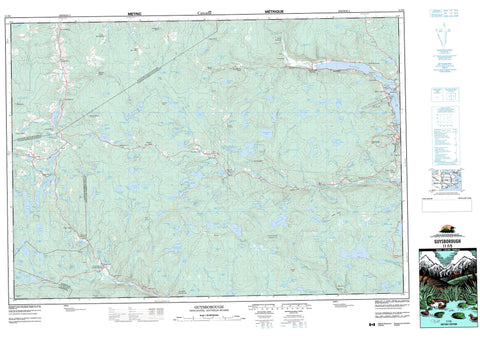
011F05 Guysborough Canada topo map, 1:50,000 scale
011F05 Guysborough NRCAN topographic map.
Includes UTM and GPS geographic coordinates (latitude and longitude). This 50k scale map is suitable for hiking, camping, and exploring, or you could frame it as a wall map.
Printed on-demand using high resolution, on heavy weight and acid free paper, or as an upgrade on a variety of synthetic materials.
Topos available on paper, Waterproof, Poly, or Tyvek. Usually shipping rolled, unless combined with other folded maps in one order.
- Product Number: NRCAN-011F05
- Parent Topo: TOPO-011F
- Map ID also known as: 011F05, 11F5, 11F05
- Unfolded Size: Approximately 26" high by 36" wide
- Weight (paper map): ca. 55 grams
- Map Type: POD NRCAN Topographic Map
- Map Scale: 1:50,000
- Geographical region: Nova Scotia, Canada
Neighboring Maps:
All neighboring Canadian topo maps are available for sale online at 1:50,000 scale.
Purchase the smaller scale map covering this area: Topo-011F
Spatial coverage:
Topo map sheet 011F05 Guysborough covers the following places:
- Big Cove - Broad Cove - Cutler Cove - Cutlers Cove - Guysborough Harbour - Guysborough Harbour - Mill Cove - Mill Cove - Mussel Cove - Northwest Cove - Bowles Point - Glebe Point - Hartshorne Point - Star Point - The Narrows - Antigonish - Guysborough - Sydney - Priest Island - Archibalds Big Lake - Barren Lake - Barren Lake - Beans Lake - Beaver Dam Lakes - Beech Hill Lake - Big Beaver Dam Lake - Big Cameron Lake - Big Lake - Black Hole - Black Lake - Black Lakes - Bobsled Lake - Bordens Lake - Bruce Lake - Bruce Lake - Brymer Lake - Burnt Lake - Butler Lake - Cameron Lake - Cameron Lakes - Camerons Lake - Camp Lake - Campbell Lakes - Cargill Lake - Charlie Lake - Chisholms Lake - Christie Lake - Christy Lake - Clam Harbour Lake - Cochran Lake - Cooks Lake - Copper Lake - Costley Lake - Country Harbour Lake - Croak Lake - Crooked Lake - Cross Lake - Cuddihy Lake - Cupboard Lake - Cutler Lake - Cutlers Lake - Dan Archies Pond - Desbarres Lake - Dickies Lake - Donahue Lake - Doyles Lake - Duck Lake - Duggans Lake - Dummy Gillis Lake - Eight Island Lake - Eight Mile Lake - Ephraims Lake - Ephriam Lake - Fish Lake - Fitzgerald Lake - Five Island Lake - Flat Lake - Forbes Lake - Fraser Lake - Freds Lakes - Frog Lake - Frog Pond - G Lake - Garnet Ponds - Garry Lakes - Giant Lake - Giants Lake - Gillis Lake - Goal Lake - Godfry Lake - Goose Lake - Gooseneck Lake - Goshen Lake - Gouin Lake - Grant Lake - Grassy Lake - Grassy Lake - Grassy Lake - Green Barren Lake - Hanrahan Lake - Hardwood Lake - Harper Pond - Hart Lake - Horse Hill Ponds - Horseshoe Lake - Hughie Lake - Hurley Lake - Indian Man Lake - Irving Lake - Island Lake - Island Lake - Jake Lakes - Jakes Lakes - Jenkins Barren Pond - Jim Lake - Jim Sinclairs Lake - Joe Lake - Joes Lakes - John Browns Lake - Johns Lake - Johnsons Lake - Johnsons Lake - Juniper Lake - Kells Lake - Kelly Lake - Kellys Lake - Kellys Lake - Kennedys Lake - Kimballs Lake - Lawhie Lake - Lawlor Lake - Lewis Lake - Lily Lake - Lily Lake - Lion Lake - Lithgow Lake - Little Beech Hill Lake - Little Horseshoe Lake - Little Hurley Lake - Little Lake - Little Lake - Little Loon Lake - Little Three Cornered Lake - Loch Sheelah - Long Lake - Longs Lake - Loon Lake - Lost Lake - Lost Lake - Lower Long Lake - Lower Pringle Lake - Lyons Lake - MacDonald Lake - MacDonalds Lake - MacGillivrays Lake - MacGregors Lake - MacInnis Lake - MacKeen Lake - MacKinnons Lake - Magginist Lake - Mallow Lake - Mann Lake - McMullin Lake - Meaghers Lake - Mels Lake - Middle Lake - Middle Lake - Mile Lake - Mill Dam Pond - Miller Lake - Millers Lake - Mink Lakes - Moose Lake - Morrison Lake - Moshers Lake - Mud Lake - Mud Lake - Mud Lake - Mud Lake - Mud Lake - Mud Lake - Mud Lake - Muddy Lake - Mulgaman Lake - Narrow Lake - Neds Lake - Nelsons Lake - New Harbour Lake - Nickerson Lake - North Branch Lake - Northeast Branch Lake - Ocean Lake - Ogden Lake - Ogden Round Lake - Olson Lake - Otter Lake - Otter Lake - Otter Lake - Palmer Lake - Poder Lake - Polson Lake - Polson Lake - Porcupine Lake - Porcupine Lake - Priest Lake - Pringle Lake - Punchs Pond - Robinson Lake - Rocky Lake - Rocky Lake - Roger Lake - Ross Lakes - Round Lake - Salmon River Lake - Sandy Lake - Sangster Lake - Shea Lake - Sheas Lake - Shingle Lake - Shoal Lake - Silver Lake - Skinner Lake - Sloans Pond - Smiths Lake - South River Lake - Square Lake - Square Lake - Stewart Lake - Stewart Lake - Stewarts Lake - Sugar Valley Lake - Sullivan Lake - Susies Lake - Tate Lake - Taylor Lake - Taylor Lake - The Lagoon - The Millpond - The Three Ponds - Three Cornered Lake - Three Cornered Lake - Three Cornered Lake - Three Cornered Lake - Three Island Lake - Timber Lake - Timber Lake - Tom Lake - Tom Mann Lake - Triangle Lake - Trout Lake - Twin Lakes - Unknown Lake - Upper Long Lake - Ushtons Lake - Weasel Lake - Wells Lake - Whites Lake - Yellow Bog Lake - Yellow Lakes - Beech Hill - Bowles Mountain - Buchanans Mountain - Cochrane Hill - Dickies Mountain - Antigonish - Guysborough - St. Mary's - Boylston Provincial Park - Alder River - Atwater Brook - Bass Brook - Black Avon River - Black River - Brandy Brook - Brymer Brook - Butler Brook - Campbells Brook - Canters Lake Run - Carding Mill Brook - Church Brook - Costley River - Country Harbour River - Cutler Brook - Cutlers Lake Brook - Desbarres Brook - Desbarres Brook - DesBarres Brook - Doctor Brook - Doctors Brook - Dunraven Brook - East Branch - Eastern Fork Stream - Eastern Forks Stream - Fraser Brook - Garry River - Georges Brook - George's Brook - Giant Lake Brook - Giants Lake Brook - Godfry Brook - Gum Brook - Gunns Brook - Gusset Brook - Guysborough River - Hallett Brook - Hattie Millstream - Horton Brook - Howlett Brook - Hurlbert Brook - Ingersol Creek - Isaacs Harbour River - Isaac's Harbour River - Leets Brook - Lewis Brook - McAllister Brook - McKeen Brook - McNaughton Brook - McPhee Brook - Meagher Brook - Meaghers Brook - Milford Haven River - Mill Brook - Minister Brook - Mink Brook - New Harbour River - North Branch Salmon River - North Brook - North Intervale Brook - Northeast Branch New Harbour River - Northwest Branch Salmon River - Patterson Brook - Pinevale Brook - Polsons Brook - Pomquet River - Porter River - Rocky Brook - Rocky Lake Brook - Roman Valley River - Roman Valley River - Salmon River - Salmon River - Shaw Brook - Shingle Brook - Sinclair Brook - Sinclairs Brook - Smiths Brook - South Brook - South River - Southwest Brook - Sutherland Brook - Three Ponds Brook - Walsh Brook - West Pomquet River - Big Stillwater - Church Hole - Costley Stillwaters - Dickies Stillwater - Hudsons Pool - Ledge Hole - Levis Stillwater - Lower Stillwater - Prong Hole - Salmon Hole - Salmon Hole - The Stillwaters - Alder River - Argyle - Black Settlement - Borneo - Boylston - BuchanansMountain - Caledonia Mills - Copper Lake - Country Harbour Lake - Cross Roads Country Harbour - Donahue Lake - East Erinville - East Roman Valley - Eight Island Lake - Erinville - Fisher Mills - Forest Hill - Fraser Mills - Frasers Mills - Giant Lake - Giant Porter River - Giants Lake - Glencoe - Goshen - Great Lake - Guysborough - Guysborough Intervale - Havendale - Hoppenderry - Lakedale - Lesterdale - Loch Katrine - Long - Lower Glencoe - Lower Glencove - Lower Springfield - Lundy - McNaughton - McNaughton - Meaghers Hill - Middleton - Milford Haven - Milford Haven Bridge - North Intervale - North Ogden - North Riverside - Ogden - Polson Brook - Polsons Brook - Roachvale - Rogerton - Roman Valley - Salmon River Lake - South River Lake - Springfield - Sunnyvale - Sunnyville - Tomkinville - Tracadie Road - Upper South River - Upper Springfield - Vernal - West Cooks Cove - West Erinville - West Intervale - West Roachvale - West Side Country Harbour - Bakeapple Glade - Jenkins Barren - Malay Meadow - Schumakers Marsh


