
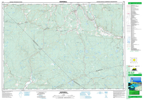
011E07 Hopewell Canada topo map, 1:50,000 scale
011E07 Hopewell NRCAN topographic map.
Includes UTM and GPS geographic coordinates (latitude and longitude). This 50k scale map is suitable for hiking, camping, and exploring, or you could frame it as a wall map.
Printed on-demand using high resolution, on heavy weight and acid free paper, or as an upgrade on a variety of synthetic materials.
Topos available on paper, Waterproof, Poly, or Tyvek. Usually shipping rolled, unless combined with other folded maps in one order.
- Product Number: NRCAN-011E07
- Parent Topo: TOPO-011E
- Map ID also known as: 011E07, 11E7, 11E07
- Unfolded Size: Approximately 26" high by 36" wide
- Weight (paper map): ca. 55 grams
- Map Type: POD NRCAN Topographic Map
- Map Scale: 1:50,000
- Geographical region: Nova Scotia, Canada
Neighboring Maps:
All neighboring Canadian topo maps are available for sale online at 1:50,000 scale.
Purchase the smaller scale map covering this area: Topo-011E
Spatial coverage:
Topo map sheet 011E07 Hopewell covers the following places:
- Colchester - Guysborough - Halifax - Pictou - Archies Lake - Barren Lake - Beaver Lake - Ben Lake - Big Brook Lake - Black Brook Lakes - Black Lake - Botany Bay Lake - Bottle Brook Lake - Calder Lake - Caribou Lake - Cranberry Lake - Cranberry Lake - Crane Pond - Dean Lake - Dickey Lake - Drug Lake - Dryden Lake - Duck Lake - Duck Lake - Dunbar Lake - Dunn Lake - East Loon Lake - Elbow Lake - Ellen Brown Lake - Fish Lake - Forbes Lake - Gairloch Lake - Gordon Lake - Grandfathers Lake - Grant Lake - Hattie Lake - Hood Lake - Island Lake - Jenny Lake - Johnson Lake - Lansdowne Lake - Little Ellen Brown Lake - Little Johnson Lake - Little Lake - Little Lake - Long John Lake - Long Lake - Loon Lakes - Loon Lakes - Loon Lakes - Loon Lakes - MacDonald Lake - MacLean Lake - MacPhersons Lake - Maple Lake - McIntosh Lake - McKinnon Lake - McQuarrie Lake - Meadow Lake - Moose Lake - Mud Lake - Murdoch Lake - Nelson Lake - North River Lake - Otter Brook Lake - Perch Lake - Perch Lake - Pictou Lake - Piper Lake - Porcupine Lake - Roops Lake - Round Lake - Round Lake - Russell Lake - Sammys Lake - Semple Lake - South Loon Lake - Speichts Lakes - Speid Lake - Sucker Lake - Sucker Lake - The Millpond - Tim Lake - West Branch Lake - West Loon Lake - Drug Brook Hill - Kincaid Mountain - Moiche Hill - Mount Thom - Colchester - Halifax - Pictou - St. Mary's - Liscomb Game Sanctuary - Sunnybrae Game Sanctuary - Archibald Brook - Beaver Brook - Bentley Brook - Big Branch Stewiacke River - Big Brook - Big Island Brook - Big Stewiacke River - Black Brook - Black Brook - Black River - Blanchard Brook - Bog Island Lake Brook - Bryden Brook - Calvary River - Calvary Stream - Cameron Brook - Castley Brook - Cox Brook - Crooked Brook - Cross Brook - Doggett Brook - Drug Brook - East Bryden Brook - East River - East River of Pictou - Fall Brook - Fulton Brook - Gairloch Brook - Glencoe Brook - Gorman Brook - Grants Brook - Holmes Brook - Jack Brook - Johnny Brook - Lime Brook - Little Branch Cox Brook - Little Branch Stewiacke River - Little Stewiacke River - Mahailas Brook - Maple Brook - McDonald Brook - McLellan Brook - McLellans Brook - Meadow Brook - Middle Bryden Brook - Middle River - Middle River of Pictou - Millstream Brook - Nelson River - North Branch Nelson River - North Nelson River - Otter Brook - Pembroke River - Sam Cameron Brook - Scrub Grass Brook - South Brook - Spring Brook - Stewiacke River - Sucker Brook - Sutherland Brook - Tannery Brook - Upper Bryden Brook - Watervale Brook - West Branch East River - West River - West River of Pictou - West River St. Mary - West River St. Marys - West River St. Mary's - Bezanson Stillwaters - Bill Weir Stillwaters - Castley Pools - Rhynos Landing Stillwater - Black Rock - Bridgeville - Brookville - Burnside - Campbells Siding - Centredale - Charcoal - Concord - Coromonie - East Loon Lake Village - Eastville - Elgin - Eureka - Ferrona - Gairloch - Glenbervie - Glencoe - Glengarry Station - Gordon Summit - Graham Hill - Hopewell - Iron Rock - Island - Island East River - Lansberg Siding - Lansdowne - Lansdowne Station - Lorne - Marshdale - Millstream - New Gairloch - New Lairg - Pembroke - Rocklin - Sheepherders Junction - Springside - Springville - St. Paul - St. Pauls - Sunny Brae - Sunnybrae - Trafalgar - Upper Burnside - Watervale - Websters Corner - West River Station - White Hill - Honeymoon Bog - Jacks Meadow


