
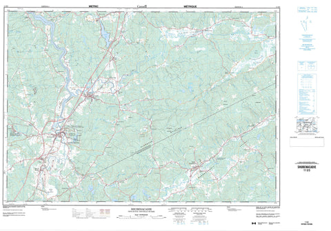
011E03 Shubenacadie Canada topo map, 1:50,000 scale
011E03 Shubenacadie NRCAN topographic map.
Includes UTM and GPS geographic coordinates (latitude and longitude). This 50k scale map is suitable for hiking, camping, and exploring, or you could frame it as a wall map.
Printed on-demand using high resolution, on heavy weight and acid free paper, or as an upgrade on a variety of synthetic materials.
Topos available on paper, Waterproof, Poly, or Tyvek. Usually shipping rolled, unless combined with other folded maps in one order.
- Product Number: NRCAN-011E03
- Parent Topo: TOPO-011E
- Map ID also known as: 011E03, 11E3, 11E03
- Unfolded Size: Approximately 26" high by 36" wide
- Weight (paper map): ca. 55 grams
- Map Type: POD NRCAN Topographic Map
- Map Scale: 1:50,000
- Geographical region: Nova Scotia, Canada
Neighboring Maps:
All neighboring Canadian topo maps are available for sale online at 1:50,000 scale.
Purchase the smaller scale map covering this area: Topo-011E
Spatial coverage:
Topo map sheet 011E03 Shubenacadie covers the following places:
- Greens Creek - Anthonys Nose - Colchester - Halifax - Hants - Indian Brook 14 - Shubenacadie Indian Reserve 14 - Black Brook Lake - Brenton Lake - Brown Lake - Brown Lake - Cook Lake - Cooks Lake - Croskill Lake - Crossgill Lake - Davis Lake - Dow Lake - Dry Lake - Fraser Lake - Fraser Lakes - Gibson Lake - Gilroy Lake - Jacks Place Lake - Lake Egmont - Lindsay Lake - Little Lake - MacKeen Lake - MacPhee Pond - McFetridges Lake - McGeorge Lake - McGeorge Lakes - Northwest Lake - Rowe Lake - Shortt Lake - Shortts Lake - Snides Lake - Watson Lake - Benvie Mountain - Glenmore Mountain - Millen Mountain - Nieforths Hill - Wittenburg Mountain - Colchester - East Hants - Halifax - Musquodoboit Valley Provincial Park - Shubenacadie Game Sanctuary - Shubenacadie Wildlife Management Area - Alder Brook - Andrew Brook - Annand Brook - Archibald Brook - Barney Brook - Barneys Brook - Bear Brook - Benvie Brook - Big Meadow Brook - Big Pond Brook - Black Brook - Black Brook - Brandy Brook - Brenton Brook - Brenton Lake Brook - Cassidy Brook - Chapman Brook - Cook Brook - Cooks Brook - Davis Lake Brook - Dickey Brook - Dry Brook - Dunlop Brook - East Brook - Ervin Brook - Far Brook - Field Brook - Fields Brook - Findlay Brook - Fisher Brook - Five Mile River - Fivemile River - Gays River - Goshen Brook - Greens Creek - Gulley Brook - Halfway Brook - Henry Brook - Higgins Brook - Indian Brook - Johnston Brook - Joudrey Brook - Kane Brook - Kent Brook - Lake Brook - Lindsay Brook - Little Brook - Little Hurd Brook - Little River - MacPhee Brook - MacPhee Brook - McCaffrey Brook - McCullough Brook - McLean Brook - McLennan Brook - McNutt Brook - Meadow Brook - Millen Brook - Millens Brook - Miller Brook - Musquodoboit River - Nelson Brook - Oliver Brook - Otter Brook - Paint Brook - Parker Brook - Putnam Brook - Red Brook - Rines Brook - Rines Creek - Rose Brook - Rutherford Brook - Ryan Brook - Scott Brook - Shea Lake Brook - Shubenacadie River - South Branch - South Branch Gays River - South Branch Stewiacke River - South Gay River - South Stewiacke River - Spring Brook - Sprott Brook - St. Andrews River - Steepbank Creek - Stewiacke River - Stillwater Brook - Storey Brook - Tracey Brook - Tupper Brook - Tupper Brook - Wallace Brook - Wallace Brook - Watering Brook - Watering Brook - Watering Brook - Wilson Brook - Withrow Brook - Corbetts Bridge Pool - DeGrootes Pool - Dickies Dam - Eddy Hole - Fishers Pool - Glen Pool - Graveyard Pool - Grecian Bend Pool - Kennedys Pool - Narrows Pool - Reynolds Bridge Pool - Rock Pile Pool - Scout Ground Pool - Taylors Pool - Stewiacke - Admiral Rock - Alton - Birch Hill - Brentwood - Brookvale - Carroll Corner - Carrolls Corner - Centre Musquodoboit - Chaswood - Cloverdale - Coldstream - Cook Brook - Cooks Brook - Dewis - East Milford - East Stewiacke - Elmsvale - Forest Glen - Fort Ellis - Gays River - Glenmore - Green Creek - Greenwood - Halfway Brook - Higginsville - Kent - Lanesville - Lindsay Lake - MacKay Siding - McKay - McKay Siding - Meadowvale - Micmac - Middle Musquodoboit - Middle Stewiacke - Milford - Milford Station - Mill Village - Miller - Newcomb Corner - North Salem - Otter Brook - Pine Grove - Pleasant Valley - Ramseys - Reid - Riverside - Rose Meadow - Roseland - Shubenacadie - Shubenacadie East - South Branch - South Maitland - South Section - Southvale - Stewiacke East - Upper Stewiacke - Urbania - West St. Andrews - Whiterock - Wittenburg - Musquodoboit Valley - Stewiacke Valley - Annand Bog - Chaswood Meadows - North Meadow - Pollys Bog - Rose Meadow - Shaky Bog - South Branch Meadows - South Meadow - St. Andrews River Meadow - The Barrens - The Bog


