
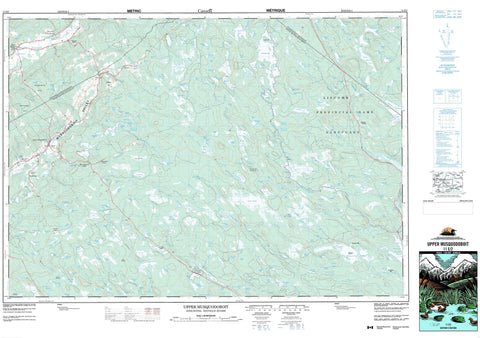
011E02 Upper Musquodoboit Canada topo map, 1:50,000 scale
011E02 Upper Musquodoboit NRCAN topographic map.
Includes UTM and GPS geographic coordinates (latitude and longitude). This 50k scale map is suitable for hiking, camping, and exploring, or you could frame it as a wall map.
Printed on-demand using high resolution, on heavy weight and acid free paper, or as an upgrade on a variety of synthetic materials.
Topos available on paper, Waterproof, Poly, or Tyvek. Usually shipping rolled, unless combined with other folded maps in one order.
- Product Number: NRCAN-011E02
- Parent Topo: TOPO-011E
- Map ID also known as: 011E02, 11E2, 11E02
- Unfolded Size: Approximately 26" high by 36" wide
- Weight (paper map): ca. 55 grams
- Map Type: POD NRCAN Topographic Map
- Map Scale: 1:50,000
- Geographical region: Nova Scotia, Canada
Neighboring Maps:
All neighboring Canadian topo maps are available for sale online at 1:50,000 scale.
Purchase the smaller scale map covering this area: Topo-011E
Spatial coverage:
Topo map sheet 011E02 Upper Musquodoboit covers the following places:
- Creek Lake Cove - McCarthys Cove - Juniper Narrows - Split Rock Narrows - Colchester - Guysborough - Halifax - Beaver Lake 17 - Big Island - Big Island - Green Island - Abraham Lake - Alex Lake - Anti Dam Flowage - Archibald Lake - Baker Lake - Barren Lake - Battery Lake - Bear Lake - Bear Lake - Beaver Lake - Beaver Pond - Beeswanger Lake - Belmore Flowage - Biggar Lake - Biggar Lake - Black Brook Lake - Black Duck Lake - Black Duck Lake - Black Lake - Blackie Lake - Bog Island Lake - Bottle Brook Lake - Brandon Lake - Bruin Lake - Burke Lake - Burkner Lake - Burnetts Pond - Butcher Lake - Butler Lake - Cameron Flowage - Cameron Lakes - Chaplin Lake - Chaplin Millpond - College Lake - Como Lake - Cope Flowage - Cope Pond - Cox Flowage - Cox Lake - Cox Lake - Cranberry Lake - Creek Lake - Crooked Lake - Crooked Lake - Crooked Lake - Cruickshank Lake - Cruickshank Lake - Cruikshank Lake - Crusher Lake - Dayspring Lake - Dean Basin - Dedication Lake - Devils Elbow Lake - Diamond Lake - Dog Lake - Dog Lake - Dollar Lake - Duck Lake - Duke Lake - Eagle Nest Basin - East Lake - East River Sheet Harbour (Reservoir) - Ellis Lake - Fairbank Lake - Farnell Lake - First Essen Lake - First Gleason Lake - First Pratt Lake - First Rocky Lake - Fisher Lake - Fisher Lake - Fraser Lake - Fraser Lake - Fraser Lake - Fraser Lakes - Governor Lake - Granite Lake - Grassy Lake - Grassy Lake - Grassy Lake - Grassy Lake - Grassy Lake - Grassy Lake - Grassy Lakes - Hamilton Lake - Hartshorne Lake - Hill Lake - Horse Lake - Hungry Lake - Indian Lake - Jakes Lake - Jed Lake - Jennings Lake - Keith Lake - Kent Lake - Kent Lake - Lake Dan - Lake Debate - Lake Fraser - Lake Little - Lake Mulgrave - Lawlor Lake - Lawson Lake - Lemmon Lake - Little Beaver Lake - Little Como Lake - Little Lake - Little Seven Mile Lake - Little Seven-mile Lake - Little Teakettle Lake - Little Ten Mile Lake - Little Ten-mile Lake - Little Yellow Lake - Logan Lake - Long Lake - Long Lake - Long Lake - Long Lake - Long Still - Loon Lake - Lower Beaver Lake - Lower Caribou Lake - Lower Rocky Lake - Lucifer Lake - Mabel Lake - MacDonald Lake - Marshall Flowage - Martin Lakes - McDonald Lake - McGrattans Pond - McGregor Lake - McGregor Lake - McLeod Lake - McMillan Lake - McNeil Dam Flowage - Middle Beaver Lake - Middle Lake - Mill Lake - Mill Lakes - Mink Lake - Moore Lake - Moose Lake - Moose Lake - Moose Lake - Mud Lake - Mud Lake - Mud Lake - Mud Lake - Mud Lake - Mud Lake - Muir Pond - North Lake - Ogden Lake - Oliphant Lake - Otter Lake - Otter Lake - Otter Lake - Parker Lake - Pat Lake - Peak Monument Lake - Pogue Lake - Pot Lake - Princess Pine Lake - Pug Lake - Pug Lake - Pug Lake - Purcell Pond - Redmond Lake - Reynolds Lake - Rider Lake - River Lake - River Lake - Rocky Brook Lake - Rocky Lake - Rocky Lake - Rocky Lake - Round Lake - Sand Lake - Sand Lake - Second Essen Lake - Second Gleason Lake - Second Pratt Lake - Second Rocky Lake - Seloam Lake - Seven Mile Lake - Sevenmile Lake - Seventeen Mile Lake - Seventeen-mile Lake - Shallow Lake - Sherlock Lake - Shingle Lake - Sloane Lake - Smith Dam Flowage - Smith Lake - South Lake - Spectacle Lakes - Square Lake - Tait Lake - Ten Mile Basin - Ten Mile Lake - Ten-mile Lake - Tent Lake - Trout Lake - Trout Lake - Trout Lake - Trout Lake - Trout Lake - Trout Pond - Twin Lakes - Twin Lakes - Union Dam Flowage - Upper Beaver Lake - Upper Caribou Lake - Upper Fisher Lake - Upper Lakes - Upper Mill Lake - Upper River Lake - West Lake - West Pogue Lake - Wire Lake - Yellow Lake - Butcher Hill - Hemlock Hill - Lemmon Hill - Mulgrave Hill - Stewarts Hill - Colchester - Halifax - St. Mary's - Liscomb Game Sanctuary - Diamond Eddy - The Rolls - Bear Brook - Beaver Brook - Big Island Brook - Black Brook - Blackie Brook - Bog Island Lake Brook - Bottle Brook - Burke Brook - Chaplin Brook - Cope Brook - Cox Brook - Deadwater Brook - East Fraser Brook - East River Sheet Harbour - East River Sheet Harbour - Fifteen Mile Stream - Fifteen-mile Stream - Fisher Brook - Fishing Brook - Fraser Brook - Fulton Brook - Gleason Brook - Goshen Brook - Grant River - Gulley Brook - Henry Brook - Higgins Brook - Horton Brook - Keef Brook - Killag River - Lake Fraser Brook - Lewis Black Brook - McNeil Brook - Middle Brook - Moose River - Morgan River - Mulgrave River - Musquodoboit River - Newton Brook - North Branch Musquodoboit River - North Brook - North Lake Brook - North Musquodoboit River - Northeast Brook - Otter Lake Brook - Paul Brook - Pembroke River - Reynold Brook - Rocky Brook - Sand Brook - Sand Lake Brook - Seven Mile Stream - Seven-mile Stream - Seventeen Mile Stream - Seventeen-mile Stream - Sherlock Brook - Smith Brook - South Branch Musquodoboit River - South Brook - South Musquodoboit River - Stewiacke River - Sticky Brook - Ten Mile Stream - Ten-mile Stream - Tent Brook - The Creek - Twelve Mile Stream - Twelve-mile Stream - West Brook - West Brook - West Killag River - West River Sheet Harbour - Bert Powers Stillwater - Big Stillwater - Corners Deadwater - Currys Deadwater - Lower Stillwater - Oxbow Stillwater - Sticky Brook Stillwaters - Upper Stewiacke Pool - Beaver Dam - Cariboo Gold Mines - Caribou Gold Mines - Caribou Mines - Chaplin - Creelmans Crossing - Cross Roads - Dean - Fraser - Fraser Settlement - Goshen - Hutchison Settlement - Markland - Newton Mills - Pleasant Valley - Pleasant Valley Settlement - Reynolds - Sheet Harbour Road - Stewiacke Cross Roads - Upper Musquodoboit - Upper Stewiacke - Musquodoboit Valley - Anderson Intervale - Miller Meadows - Pauls Meadow - Redden Meadows - Sand Lake Bog


