
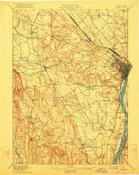
~ Albany NY topo map, 1:62500 scale, 15 X 15 Minute, Historical, 1898, updated 1922
Albany, New York, USGS topographic map dated 1898.
Includes geographic coordinates (latitude and longitude). This topographic map is suitable for hiking, camping, and exploring, or framing it as a wall map.
Printed on-demand using high resolution imagery, on heavy weight and acid free paper, or alternatively on a variety of synthetic materials.
Topos available on paper, Waterproof, Poly, or Tyvek. Usually shipping rolled, unless combined with other folded maps in one order.
- Product Number: USGS-5648103
- Free digital map download (high-resolution, GeoPDF): Albany, New York (file size: 9 MB)
- Map Size: please refer to the dimensions of the GeoPDF map above
- Weight (paper map): ca. 55 grams
- Map Type: POD USGS Topographic Map
- Map Series: HTMC
- Map Verison: Historical
- Cell ID: 50391
- Scan ID: 139146
- Imprint Year: 1922
- Visual Version Number: 1
- Survey Year: 1891
- Datum: Unstated
- Map Projection: Unstated
- Map published by United States Geological Survey
- Keywords: Overedge
- Map Language: English
- Scanner Resolution: 600 dpi
- Map Cell Name: Albany
- Grid size: 15 X 15 Minute
- Date on map: 1898
- Map Scale: 1:62500
- Geographical region: New York, United States
Neighboring Maps:
All neighboring USGS topo maps are available for sale online at a variety of scales.
Spatial coverage:
Topo map Albany, New York, covers the geographical area associated the following places:
- Unionville - Pine Ridge Estates - Beaver Dam (historical) - Fort Hunter - Voorheesville - Stony Hill - North Bethlehem - Elsmere - Parkers Corners - Newtonville - Slingerlands - Latham - Loudon Heights - Hartmans Corners - Meadowdale - Maywood - Delmar - Spawn Hollow - Selkirk - Roessleville - Glenmont - Shakers - Wemple - Karlsfeld - New Scotland - Guilderland Center - Keefers Corners - Callanans Corners - Lincoln Park Homes - Westmere - Normansville - Carmen Courts - Bethlehem Heights - Loudonville - Wackmans Mobile Home Park - Breckenridge Mobile Home Park - South Bethlehem - West Albany - Meilaks Mobile Home Court - McKownville - Guilderland - New Salem - Norton Street Mobile Home Park - Fullers - Albany - South Albany - Karner - Bethlehem Center - Beckers Corners - Colonie - Houcks Corners - Cedar Hill - Clarksville - Castleton-on-Hudson - Lone Pine Community Mobile Home Park - Feura Bush - Latham Mobile Home Court - Kenwood - Tarrytown
- Map Area ID: AREA42.7542.5-74-73.75
- Northwest corner Lat/Long code: USGSNW42.75-74
- Northeast corner Lat/Long code: USGSNE42.75-73.75
- Southwest corner Lat/Long code: USGSSW42.5-74
- Southeast corner Lat/Long code: USGSSE42.5-73.75
- Northern map edge Latitude: 42.75
- Southern map edge Latitude: 42.5
- Western map edge Longitude: -74
- Eastern map edge Longitude: -73.75


