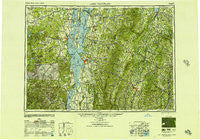
~ Lake Champlain NY topo map, 1:250000 scale, 1 X 2 Degree, Historical, 1950, updated 1951
Lake Champlain, New York, USGS topographic map dated 1950.
Includes geographic coordinates (latitude and longitude). This topographic map is suitable for hiking, camping, and exploring, or framing it as a wall map.
Printed on-demand using high resolution imagery, on heavy weight and acid free paper, or alternatively on a variety of synthetic materials.
Topos available on paper, Waterproof, Poly, or Tyvek. Usually shipping rolled, unless combined with other folded maps in one order.
- Product Number: USGS-5454865
- Free digital map download (high-resolution, GeoPDF): Lake Champlain, New York (file size: 17 MB)
- Map Size: please refer to the dimensions of the GeoPDF map above
- Weight (paper map): ca. 55 grams
- Map Type: POD USGS Topographic Map
- Map Series: HTMC
- Map Verison: Historical
- Cell ID: 68864
- Scan ID: 130169
- Imprint Year: 1951
- Woodland Tint: Yes
- Visual Version Number: 1
- Aerial Photo Year: 1945
- Datum: NAD27
- Map Projection: Transverse Mercator
- Map published by United States Army Corps of Engineers
- Map published by United States Army
- Map Language: English
- Scanner Resolution: 600 dpi
- Map Cell Name: Lake Champlain
- Grid size: 1 X 2 Degree
- Date on map: 1950
- Map Scale: 1:250000
- Geographical region: New York, United States
Neighboring Maps:
All neighboring USGS topo maps are available for sale online at a variety of scales.
Spatial coverage:
Topo map Lake Champlain, New York, covers the geographical area associated the following places:
- Willoughby - Foxville - Downingville - Sheffield Square - Fonda - Alder Bend - Barton - Monkton Ridge - West Brookfield - Worcester - Washington Heights - Cleveland Corners - Panton - Perkinsville - Hill Farm Estates - Adams Landing - East Beekmantown - Dannemora - Ellenburg Center - Nashville - Au Sable Forks - Lowell - Cliff Haven - Ewells Mills - Sheffield - Passumpsic - Westmore - Mackville - Rouses Point - Alburg Springs - Irasburg - Craftsbury - Swanton - South Starksboro - Westfield - Mill Village - Websterville - Checkerberry Village - Dows Crossing - Salmon River (historical) - New Russia - Elizabethtown - West Newbury - Union Falls - Merrill Corner - East Orange - Cambridge Junction - Grand Isle - North Danville - Carter's Mobile Home Park - Elsinore - Huntington - Cabot - Burlington - Robinson - Winooski - Redford - Warren - Palmer Corner - East Topsham - Morses Mill - Upper Graniteville - West Addison - Essex - Alburg Center - West Lincoln - Graniteville - Morrisville - Perry - Cascade Acres Mobile Home Park - Hinesburg - Cumberland Head - Gebbie Corner - New Haven Mills - Sheldon - South Barre - South Woodbury - East Fletcher - Lake Elmore - Sunmit - Champlain - Beaulieus Corner - South Plattsburgh - Port Douglass - Four Seasons Mobile Home Park - East Brookfield - Brookfield - Pleasant Valley - East Fairfield - Waterville - Peach Four Corners - Black Brook - Morses Mills - Tolman Corner - Swanton Junction - Willsboro - LTS Mobile Home Park - South Acres Mobile Home Park - Shady Corner Curve - Lincoln
- Map Area ID: AREA4544-74-72
- Northwest corner Lat/Long code: USGSNW45-74
- Northeast corner Lat/Long code: USGSNE45-72
- Southwest corner Lat/Long code: USGSSW44-74
- Southeast corner Lat/Long code: USGSSE44-72
- Northern map edge Latitude: 45
- Southern map edge Latitude: 44
- Western map edge Longitude: -74
- Eastern map edge Longitude: -72

