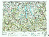
~ Elmira NY topo map, 1:250000 scale, 1 X 2 Degree, Historical, 1962, updated 1978
Elmira, New York, USGS topographic map dated 1962.
Includes geographic coordinates (latitude and longitude). This topographic map is suitable for hiking, camping, and exploring, or framing it as a wall map.
Printed on-demand using high resolution imagery, on heavy weight and acid free paper, or alternatively on a variety of synthetic materials.
Topos available on paper, Waterproof, Poly, or Tyvek. Usually shipping rolled, unless combined with other folded maps in one order.
- Product Number: USGS-5454847
- Free digital map download (high-resolution, GeoPDF): Elmira, New York (file size: 20 MB)
- Map Size: please refer to the dimensions of the GeoPDF map above
- Weight (paper map): ca. 55 grams
- Map Type: POD USGS Topographic Map
- Map Series: HTMC
- Map Verison: Historical
- Cell ID: 68766
- Scan ID: 138227
- Imprint Year: 1978
- Woodland Tint: Yes
- Visual Version Number: 1
- Photo Revision Year: 1978
- Aerial Photo Year: 1976
- Edit Year: 1978
- Field Check Year: 1962
- Datum: Unstated
- Map Projection: Transverse Mercator
- Map published by United States Geological Survey
- Map Language: English
- Scanner Resolution: 600 dpi
- Map Cell Name: Elmira
- Grid size: 1 X 2 Degree
- Date on map: 1962
- Map Scale: 1:250000
- Geographical region: New York, United States
Neighboring Maps:
All neighboring USGS topo maps are available for sale online at a variety of scales.
Spatial coverage:
Topo map Elmira, New York, covers the geographical area associated the following places:
- Erwins - Campville - Adrian - Fowlerville - Brooks Grove - Shamrock - Troupsburg - Maxwell - Dalton - Westview - Marietta - Greenwood - Hunt Hollow - Bristol - Marysville - Sherwood - Marcellus - Barefoot Mobile Home Park - College View Trailer Park - Glenora - Union Corners - Birdsall - Baltimore - Lisle - Fallbrook Mobile Home Park - Clifton Springs - Oakwoods Mobile Home Court - McDuffie Town - Pratt Corners - Maplehurst Park - Rogersville - Caledonia Mobile Home Park - Airways Mobile Home Park - Whipple Corner - Grotto - South Troupsburg - Townsend - Toll Gate Corners - North Spencer - Hemlock - Assembly Park - Glen Aubrey - Cohocton - Groveland - Erin Estates - Second Milo - Mayweed Corner - LaFayette - Renchans - Poags Hale Mobile Home Court - Scio - Brookhaven - Barney Mills - Bush Corner - Baileys Settlement - Riverside Mobile Home Park - Catlin Hill - Craigs - Harper Park - Van Etten Junction - West Elmira - Knickerbocker Corner - Fleming - Vestal - Mendon - Corning Manor - Pleasant Valley - Lodi Center - Weekes Corner - Fitts Corners - Rochester Junction - Caroline Center - Wheeler - Tully Mobile Home Park - Gregory Landing - South Pulteney - Ithaca - Lakemont - Spaulding Corner - East Lindley - Livonia - Union Springs - Jewell Mobile Home Park - Log City (historical) - West Newark - Big Creek - Lake Country Estates Mobile Home Park - Cheshire - McLean - Crystal Spring - Dineharts - Thorn Hill - Throopsville - Bromley - Sunny Shores - Denison Corner - Country Manor Estates - Altay - Auburn - Nedrow
- Map Area ID: AREA4342-78-76
- Northwest corner Lat/Long code: USGSNW43-78
- Northeast corner Lat/Long code: USGSNE43-76
- Southwest corner Lat/Long code: USGSSW42-78
- Southeast corner Lat/Long code: USGSSE42-76
- Northern map edge Latitude: 43
- Southern map edge Latitude: 42
- Western map edge Longitude: -78
- Eastern map edge Longitude: -76

