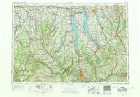
~ Elmira NY topo map, 1:250000 scale, 1 X 2 Degree, Historical, 1962, updated 1969
Elmira, New York, USGS topographic map dated 1962.
Includes geographic coordinates (latitude and longitude). This topographic map is suitable for hiking, camping, and exploring, or framing it as a wall map.
Printed on-demand using high resolution imagery, on heavy weight and acid free paper, or alternatively on a variety of synthetic materials.
Topos available on paper, Waterproof, Poly, or Tyvek. Usually shipping rolled, unless combined with other folded maps in one order.
- Product Number: USGS-5454839
- Free digital map download (high-resolution, GeoPDF): Elmira, New York (file size: 19 MB)
- Map Size: please refer to the dimensions of the GeoPDF map above
- Weight (paper map): ca. 55 grams
- Map Type: POD USGS Topographic Map
- Map Series: HTMC
- Map Verison: Historical
- Cell ID: 68766
- Scan ID: 138221
- Imprint Year: 1969
- Woodland Tint: Yes
- Visual Version Number: 1
- Edit Year: 1968
- Field Check Year: 1962
- Datum: Unstated
- Map Projection: Transverse Mercator
- Map published by United States Geological Survey
- Map Language: English
- Scanner Resolution: 600 dpi
- Map Cell Name: Elmira
- Grid size: 1 X 2 Degree
- Date on map: 1962
- Map Scale: 1:250000
- Geographical region: New York, United States
Neighboring Maps:
All neighboring USGS topo maps are available for sale online at a variety of scales.
Spatial coverage:
Topo map Elmira, New York, covers the geographical area associated the following places:
- Ross Corners - Moran Corner - Stanley - Canoga Springs - Hermitage - Pine City - Jewell Mobile Home Park - Alpine - Vestal Center - Marietta - Pompey - Mapes - Pine Creek - Stratton - Tinkertown - Oakwood - Sunflower Acres Mobile Home Park - Hillview Terrace Mobile Home Park - York Center (historical) - Freetown Corners - North Cameron - Rolling Hills Mobile Home Park - Lake Country Estates Mobile Home Park - Tully Lake Park - Marcellus - Second Milo - Toggletown - Mitchellsville - Sheldrake Springs - Reniff - Denison Corner - Sonyea - Thomas Estates Mobile Home Park - Harford Mills - Big Creek - Peruville - South Hornell - Hoopers Valley - Hillside Acres Mobile Home Park - Portland - Gabriels Junction - Goff Road Mobile Home Park - Springbrook Mobile Home Park - Bennetts - Townsendville - Countryside Mobile Home Park - Mosher Corners - Wildwood Mobile Home Park - Willets - Catatonk - Post Creek - Clifton Springs - Johnson Mobile Home Park South - Hunt - Hamar Estates - Hornell Mobile Home Park - Edgeview Estates - Renchans - South Spafford - Lansingville - Conesus Lake Junction - West Sparta - Cayuga Lake Estates Mobile Home Park - Ingleside - Newfield - East Lansing - Pine Corners - Ennerdale - Chemung - Troupsburg - Goodrich - Skaneateles Falls - Omro - Upper Fairfield - Airways Mobile Home Park - Alpine Junction - West Rush - Swift Corner - Taughannock Falls - Paynesville - Mays Point - Golden Glow Heights - Nedrow - Brooks Grove - Kintner Estates Mobile Home Park - Catharine - Retirement Estates - Harford - Valley View - Roseland Park - Eagle Point - Waterloo - Cumminsville - Indian Hills Mobile Home Community - Straits Corners - Old Orchard Point - Cross Roads - Mottville - West Union - Van Vleet - Pebble Beach
- Map Area ID: AREA4342-78-76
- Northwest corner Lat/Long code: USGSNW43-78
- Northeast corner Lat/Long code: USGSNE43-76
- Southwest corner Lat/Long code: USGSSW42-78
- Southeast corner Lat/Long code: USGSSE42-76
- Northern map edge Latitude: 43
- Southern map edge Latitude: 42
- Western map edge Longitude: -78
- Eastern map edge Longitude: -76

