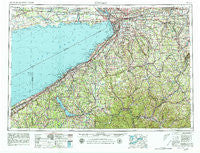
~ Buffalo NY topo map, 1:250000 scale, 1 X 2 Degree, Historical, 1962, updated 1980
Buffalo, New York, USGS topographic map dated 1962.
Includes geographic coordinates (latitude and longitude). This topographic map is suitable for hiking, camping, and exploring, or framing it as a wall map.
Printed on-demand using high resolution imagery, on heavy weight and acid free paper, or alternatively on a variety of synthetic materials.
Topos available on paper, Waterproof, Poly, or Tyvek. Usually shipping rolled, unless combined with other folded maps in one order.
- Product Number: USGS-5454825
- Free digital map download (high-resolution, GeoPDF): Buffalo, New York (file size: 19 MB)
- Map Size: please refer to the dimensions of the GeoPDF map above
- Weight (paper map): ca. 55 grams
- Map Type: POD USGS Topographic Map
- Map Series: HTMC
- Map Verison: Historical
- Cell ID: 68695
- Scan ID: 123050
- Imprint Year: 1980
- Woodland Tint: Yes
- Visual Version Number: 1
- Field Check Year: 1962
- Datum: NAD27
- Map Projection: Transverse Mercator
- Map published by United States Geological Survey
- Map Language: English
- Scanner Resolution: 600 dpi
- Map Cell Name: Buffalo
- Grid size: 1 X 2 Degree
- Date on map: 1962
- Map Scale: 1:250000
- Geographical region: New York, United States
Neighboring Maps:
All neighboring USGS topo maps are available for sale online at a variety of scales.
Spatial coverage:
Topo map Buffalo, New York, covers the geographical area associated the following places:
- Isman Mobile Home Park - Allentown - Big Tree - Petrolia - Nile - South Vandalia - Toziers Corner - Buffalo - Frinks Corner - Orchard Beach - Big Tree Mobile Home Park - Whiteford Hollow - Arcade - Delevan - Belmont - Wanakah - Griffiths - Sloan - North Clymer - Stafford - Derby - Barnum - McGrawville - Bedford Corners - Crittenden - Cheektowasa - Colburns - Balcom Corners - Van Buren Point - Marilla - Farmersville - Ellery Center - Clymer - Frontier Mobile Home Park - Wattlesburg - Sardinia - Humphrey - Keaches Corners - Angelica - Hinsdale - Kuhl - Main Settlement - Hammett - Hermitage Meadow Mobile Home Park - Bush Gardens Mobile Home Park - Laidlaw - Lakewood - Fentonville - Versailles - Cherry Creek Mobile Home Park - Warsaw - Evans Center - Hanford Bay - Irvine Mills - Sinclairville - Holland - Billington Heights - Limestone - South Dayton - Millers Crossing - Elma Center - Eagle - Newburg - Concord - Footes - Harborcreek - Shorelands - Phillips Mills - Sandusky - Five Points - Kimball Stand - Waterboro - Arkwright - Clymer Hill - Porterville - Maple Grove Mobile Home Estates - Panama - Grandyle Village - Bemus Point - Sampson - Falconer Mobile Home Park - Pearl Creek - Barcelona - Higgins - Covington - Chedwel - Maples - Alden Village Estates Mobile Home Park - McCenithans Mobile Home Park - Slab City - Centralia - Country Meadows Mobile Home Park - New Ebenezer - Rockville - North Darien - North Collins - Salamanca - Balcom Beach - Fluvanna - Bakerstand
- Map Area ID: AREA4342-80-78
- Northwest corner Lat/Long code: USGSNW43-80
- Northeast corner Lat/Long code: USGSNE43-78
- Southwest corner Lat/Long code: USGSSW42-80
- Southeast corner Lat/Long code: USGSSE42-78
- Northern map edge Latitude: 43
- Southern map edge Latitude: 42
- Western map edge Longitude: -80
- Eastern map edge Longitude: -78

