
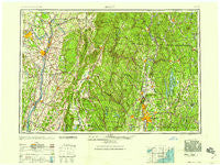
~ Albany NY topo map, 1:250000 scale, 1 X 2 Degree, Historical, 1959
Albany, New York, USGS topographic map dated 1959.
Includes geographic coordinates (latitude and longitude). This topographic map is suitable for hiking, camping, and exploring, or framing it as a wall map.
Printed on-demand using high resolution imagery, on heavy weight and acid free paper, or alternatively on a variety of synthetic materials.
Topos available on paper, Waterproof, Poly, or Tyvek. Usually shipping rolled, unless combined with other folded maps in one order.
- Product Number: USGS-5454805
- Free digital map download (high-resolution, GeoPDF): Albany, New York (file size: 18 MB)
- Map Size: please refer to the dimensions of the GeoPDF map above
- Weight (paper map): ca. 55 grams
- Map Type: POD USGS Topographic Map
- Map Series: HTMC
- Map Verison: Historical
- Cell ID: 68639
- Scan ID: 136546
- Woodland Tint: Yes
- Visual Version Number: 1
- Aerial Photo Year: 1945
- Datum: Unstated
- Map Projection: Transverse Mercator
- Map published by United States Army
- Map Language: English
- Scanner Resolution: 600 dpi
- Map Cell Name: Albany
- Grid size: 1 X 2 Degree
- Date on map: 1959
- Map Scale: 1:250000
- Geographical region: New York, United States
Neighboring Maps:
All neighboring USGS topo maps are available for sale online at a variety of scales.
Spatial coverage:
Topo map Albany, New York, covers the geographical area associated the following places:
- Guilderland - Knights Corner - Fort Morris - Rotterdam - Westbrook - Harding Crossing - Savoy Center - Roah Hook - Fiberloid - Glasco - Hillside Colony - Weed Mines - Brick Tavern - Camp Caravan - Cedar Acres Mobile Home Park - McKownville - Goulding Village - Kerleys Corners - Rock City - Blush Hollow - New Lenox - West Farms - Hannacroix - Brookside - Belchertown - Mill Village - Hemlock Brook Estates - Mount Marion Park - Hallockville - South Albany - Brainard - East Renfrew - Readsboro Falls - Brooks Village - Spencertown - Parkers Corners - Jaffrey Center - Stony Hill - Queechy - Niverville - Cold Spring - Sunnyside - Brunswick Center - Wales - Tanglewood - Suffield Corner - Athol Junction - Fryeville - Deerfield - Karlsfeld - Boght Corners - Maltaville - Golden Acres - White Valley - Easton - College Park - Normansville - Prescott Center - West Stockbridge Center - East Sullivan - Midway Park - Schodack Landing - West Rindge - Dudleyville - Van Buren Park Homes - Stillham - Meilaks Mobile Home Court - Carey Corner - Ingleside - Hampden - Gill - East Glenville - Granby - Sandersdale - South Vernon - Gomorrah - Furnace - Plainville (historical) - Speigletown - Barre Plains - Lincolnville - Rockdale Mills - Carlyle West - Spragueville - Eastover - Dunsbach Ferry - Stillwater - Harrisville - Oak Hill - Templeton - Little Rest - Whipples - Hoosick Falls - Wangum Village - Flatbush - North Germantown - South Egremont - North Pownal - Alander - Green River
- Map Area ID: AREA4342-74-72
- Northwest corner Lat/Long code: USGSNW43-74
- Northeast corner Lat/Long code: USGSNE43-72
- Southwest corner Lat/Long code: USGSSW42-74
- Southeast corner Lat/Long code: USGSSE42-72
- Northern map edge Latitude: 43
- Southern map edge Latitude: 42
- Western map edge Longitude: -74
- Eastern map edge Longitude: -72


