
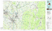
~ Albany NY topo map, 1:100000 scale, 30 X 60 Minute, Historical, 1986, updated 1986
Albany, New York, USGS topographic map dated 1986.
Includes geographic coordinates (latitude and longitude). This topographic map is suitable for hiking, camping, and exploring, or framing it as a wall map.
Printed on-demand using high resolution imagery, on heavy weight and acid free paper, or alternatively on a variety of synthetic materials.
Topos available on paper, Waterproof, Poly, or Tyvek. Usually shipping rolled, unless combined with other folded maps in one order.
- Product Number: USGS-5454627
- Free digital map download (high-resolution, GeoPDF): Albany, New York (file size: 19 MB)
- Map Size: please refer to the dimensions of the GeoPDF map above
- Weight (paper map): ca. 55 grams
- Map Type: POD USGS Topographic Map
- Map Series: HTMC
- Map Verison: Historical
- Cell ID: 72135
- Scan ID: 137056
- Imprint Year: 1986
- Woodland Tint: Yes
- Visual Version Number: 1
- Aerial Photo Year: 1982
- Edit Year: 1986
- Datum: NAD27
- Map Projection: Universal Transverse Mercator
- Planimetric: Yes
- Map published by United States Geological Survey
- Map Language: English
- Scanner Resolution: 600 dpi
- Map Cell Name: Albany
- Grid size: 30 X 60 Minute
- Date on map: 1986
- Map Scale: 1:100000
- Geographical region: New York, United States
Neighboring Maps:
All neighboring USGS topo maps are available for sale online at a variety of scales.
Spatial coverage:
Topo map Albany, New York, covers the geographical area associated the following places:
- Eastern Summit - Lansingburgh - Chuckleberry Mobile Home Park - Clifton Park - Old Bennington - Greylock - Whitcomb Summit - East Grafton - Thompson Trailer Park - East Buskirk - Terrace Haven Mobile Home Park - Oak Hill - Shaftsbury Center - Rexford - Maltaville - Pleasantdale - Cohoes - Mourningkill Estates - Renfrew - South Troy - Ballston Center - Komar Park - Melrose - Watervliet - Woodford - Southwest Hoosick - Factory Hollow - West Stephentown - Ballston Lake - Hoosick - Babcock Lake - John S Moore Homes - North Hoosick - Rosemont Park - Voorheesville - Tarrytown - Sweets Corner - West Summit - New Scotland - Sunnyside Trailer Court - Albia - Keefers Corners - South Easton - Carpenters Acres - Averill Park - Pine View Estates - Bouplon Corner - White Creek - West Albany - Halfmoon - Lanesborough - Carlyle West - West Sand Lake - Marvin Woods - Colemans Trailer Park - Pine Crest Trailer Park - Karner - Diamondwood Estates - Camshron Mobile Home Park - Defreestville - Elnora - Schaghticoke Hill - Crandall Corners - Steeles Corners - Slingerlands - Bethlehem Heights - Mohawk View - Hemlock Brook Estates - Northway Mobile Acres - Barberville - Prospect Heights - Glenmont - Martindale Mobile Home Park - Sycaway - Sodom - Briggsville - Clarksville - Stephentown Center - Walloomsac - Albany - Verdoy - East Hoosick - Brayton Hill - Willow Glen - Stephentown - Carmen Courts - Speigletown - Steeplechase At Malta - Luther - Guilderland Center - Haynersville - Windsor - Tomaselli Estates - Breckenridge Mobile Home Park - Quackenkill - Stillwater Junction - Sliters - East Schodack - Lincoln Park Homes - Wemple
- Map Area ID: AREA4342.5-74-73
- Northwest corner Lat/Long code: USGSNW43-74
- Northeast corner Lat/Long code: USGSNE43-73
- Southwest corner Lat/Long code: USGSSW42.5-74
- Southeast corner Lat/Long code: USGSSE42.5-73
- Northern map edge Latitude: 43
- Southern map edge Latitude: 42.5
- Western map edge Longitude: -74
- Eastern map edge Longitude: -73


