
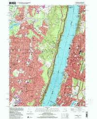
~ Yonkers NY topo map, 1:24000 scale, 7.5 X 7.5 Minute, Historical, 1998, updated 2000
Yonkers, New York, USGS topographic map dated 1998.
Includes geographic coordinates (latitude and longitude). This topographic map is suitable for hiking, camping, and exploring, or framing it as a wall map.
Printed on-demand using high resolution imagery, on heavy weight and acid free paper, or alternatively on a variety of synthetic materials.
Topos available on paper, Waterproof, Poly, or Tyvek. Usually shipping rolled, unless combined with other folded maps in one order.
- Product Number: USGS-5449544
- Free digital map download (high-resolution, GeoPDF): Yonkers, New York (file size: 18 MB)
- Map Size: please refer to the dimensions of the GeoPDF map above
- Weight (paper map): ca. 55 grams
- Map Type: POD USGS Topographic Map
- Map Series: HTMC
- Map Verison: Historical
- Cell ID: 50117
- Scan ID: 137051
- Imprint Year: 2000
- Woodland Tint: Yes
- Visual Version Number: 1
- Aerial Photo Year: 1966
- Survey Year: 1966
- Datum: NAD27
- Map Projection: Transverse Mercator
- Map published by United States Geological Survey
- Map Language: English
- Scanner Resolution: 600 dpi
- Map Cell Name: Yonkers
- Grid size: 7.5 X 7.5 Minute
- Date on map: 1998
- Map Scale: 1:24000
- Geographical region: New York, United States
Neighboring Maps:
All neighboring USGS topo maps are available for sale online at a variety of scales.
Spatial coverage:
Topo map Yonkers, New York, covers the geographical area associated the following places:
- Yonkers - Norwood - Greystone - Tenafly - Lowerre - Kinross Heights - Park Hill - Bergenfield - Riverdale - Kings Bridge - Kings Woods - Harrington Park - Demarest - Alpine - Spuyten Duyvil - Dodgewood - Cresskill - Hastings-on-Hudson - Glenwood - Englewood - Uniontown - Closter - Haworth - Englewood Cliffs - Ludlow - Dumont - Fieldston - Lincoln
- Map Area ID: AREA4140.875-74-73.875
- Northwest corner Lat/Long code: USGSNW41-74
- Northeast corner Lat/Long code: USGSNE41-73.875
- Southwest corner Lat/Long code: USGSSW40.875-74
- Southeast corner Lat/Long code: USGSSE40.875-73.875
- Northern map edge Latitude: 41
- Southern map edge Latitude: 40.875
- Western map edge Longitude: -74
- Eastern map edge Longitude: -73.875


