
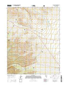
~ Lehman Caves NV topo map, 1:24000 scale, 7.5 X 7.5 Minute, 2014
Lehman Caves, Nevada, USGS topographic map dated 2014.
Includes geographic coordinates (latitude and longitude). This topographic map is suitable for hiking, camping, and exploring, or framing it as a wall map.
Printed on-demand using high resolution imagery, on heavy weight and acid free paper, or alternatively on a variety of synthetic materials.
Topos available on paper, Waterproof, Poly, or Tyvek. Usually shipping rolled, unless combined with other folded maps in one order.
- Product Number: USGS-7172982
- Free digital map download (high-resolution, GeoPDF): Lehman Caves, Nevada (file size: 23 MB)
- Map Size: please refer to the dimensions of the GeoPDF map above
- Weight (paper map): ca. 55 grams
- Map Type: POD USGS Topographic Map
- Map Series: US Topo
- Map Verison: Current
- Cell ID: 25367
- Datum: North American Datum of 1983
- Map Projection: Transverse Mercator
- Map Cell Name: Lehman Caves
- Grid size: 7.5 X 7.5 Minute
- Date on map: 2014
- Map Scale: 1:24000
- Geographical region: Nevada, United States
Neighboring Maps:
All neighboring USGS topo maps are available for sale online at a variety of scales.
Spatial coverage:
Topo map Lehman Caves, Nevada, covers the geographical area associated the following places:
- Red Hills - Bone Spring - Snake Valley Volunteer Fire Department - Lehmans (historical) - Lehman Caves National Monument (historical) - Strawberry Creek - Silver Creek Reservoir - White Pine County Emergency Medical Services - Baker - Strawberry Spring - Lower Lehman Creek Campground - Silver Creek Dam - Miller Basin Wash - Baker Maintenance Station - Bellander Ranch - Burnt Mill Canyon - Mill Creek - Upper Lehman Creek Campground - Bellander Mine - Great Basin National Park Visitor Center
- Map Area ID: AREA39.12539-114.25-114.125
- Northwest corner Lat/Long code: USGSNW39.125-114.25
- Northeast corner Lat/Long code: USGSNE39.125-114.125
- Southwest corner Lat/Long code: USGSSW39-114.25
- Southeast corner Lat/Long code: USGSSE39-114.125
- Northern map edge Latitude: 39.125
- Southern map edge Latitude: 39
- Western map edge Longitude: -114.25
- Eastern map edge Longitude: -114.125


