
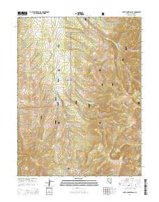
~ Cleve Creek Baldy NV topo map, 1:24000 scale, 7.5 X 7.5 Minute, 2014
Cleve Creek Baldy, Nevada, USGS topographic map dated 2014.
Includes geographic coordinates (latitude and longitude). This topographic map is suitable for hiking, camping, and exploring, or framing it as a wall map.
Printed on-demand using high resolution imagery, on heavy weight and acid free paper, or alternatively on a variety of synthetic materials.
Topos available on paper, Waterproof, Poly, or Tyvek. Usually shipping rolled, unless combined with other folded maps in one order.
- Product Number: USGS-7171388
- Free digital map download (high-resolution, GeoPDF): Cleve Creek Baldy, Nevada (file size: 29 MB)
- Map Size: please refer to the dimensions of the GeoPDF map above
- Weight (paper map): ca. 55 grams
- Map Type: POD USGS Topographic Map
- Map Series: US Topo
- Map Verison: Current
- Cell ID: 9120
- Datum: North American Datum of 1983
- Map Projection: Transverse Mercator
- Map Cell Name: Cleve Creek Baldy
- Grid size: 7.5 X 7.5 Minute
- Date on map: 2014
- Map Scale: 1:24000
- Geographical region: Nevada, United States
Neighboring Maps:
All neighboring USGS topo maps are available for sale online at a variety of scales.
Spatial coverage:
Topo map Cleve Creek Baldy, Nevada, covers the geographical area associated the following places:
- Axehandle Spring - North Mosier Spring - French Lake - McDonald Creek - Brennen Mine - Berry Creek Campground - Fera Ninetyeight - Sage Hen Summer Home Area - Bone Yard Canyon - Bone Yard Spring - Camp Success - Wellington Springs - North Fork Berry Creek - Doe Canyon - Gilford Creek - Duck Creek Mining District - Water Canyon - Davis Canyon - Gilford Meadows - Little Wellington Springs - Sage Hen Canyon - Berry Creek Forest Service Station - Peacock Spring - Canyon Spring - Cleve Creek Baldy - Five Springs - Success Summit - Kraft Spring - Pescio Ranch - Success Mine - McGill Spring - Ostergard Canyon - Worthington Canyon - Fera Ninetyseven
- Map Area ID: AREA39.37539.25-114.75-114.625
- Northwest corner Lat/Long code: USGSNW39.375-114.75
- Northeast corner Lat/Long code: USGSNE39.375-114.625
- Southwest corner Lat/Long code: USGSSW39.25-114.75
- Southeast corner Lat/Long code: USGSSE39.25-114.625
- Northern map edge Latitude: 39.375
- Southern map edge Latitude: 39.25
- Western map edge Longitude: -114.75
- Eastern map edge Longitude: -114.625


