
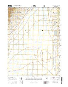
~ Ruby City Creek NV topo map, 1:24000 scale, 7.5 X 7.5 Minute, 2014
Ruby City Creek, Nevada, USGS topographic map dated 2014.
Includes geographic coordinates (latitude and longitude). This topographic map is suitable for hiking, camping, and exploring, or framing it as a wall map.
Printed on-demand using high resolution imagery, on heavy weight and acid free paper, or alternatively on a variety of synthetic materials.
Topos available on paper, Waterproof, Poly, or Tyvek. Usually shipping rolled, unless combined with other folded maps in one order.
- Product Number: USGS-7168947
- Free digital map download (high-resolution, GeoPDF): Ruby City Creek, Nevada (file size: 22 MB)
- Map Size: please refer to the dimensions of the GeoPDF map above
- Weight (paper map): ca. 55 grams
- Map Type: POD USGS Topographic Map
- Map Series: US Topo
- Map Verison: Current
- Cell ID: 38869
- Datum: North American Datum of 1983
- Map Projection: Transverse Mercator
- Map Cell Name: Ruby City Creek
- Grid size: 7.5 X 7.5 Minute
- Date on map: 2014
- Map Scale: 1:24000
- Geographical region: Nevada, United States
Neighboring Maps:
All neighboring USGS topo maps are available for sale online at a variety of scales.
Spatial coverage:
Topo map Ruby City Creek, Nevada, covers the geographical area associated the following places:
- Lurline Post Office - Smith Creek - Shorty Creek - AEC-USC Seismographic Station - Dads Creek - Dry Creek - Sharps Creek - Sharps Well - Estate Place - Ruby City Creek - Franklin - Ruby City (historical) - Millers (historical) - Robinson Creek - Ruby Valley Forest Service Station
- Map Area ID: AREA40.7540.625-115.25-115.125
- Northwest corner Lat/Long code: USGSNW40.75-115.25
- Northeast corner Lat/Long code: USGSNE40.75-115.125
- Southwest corner Lat/Long code: USGSSW40.625-115.25
- Southeast corner Lat/Long code: USGSSE40.625-115.125
- Northern map edge Latitude: 40.75
- Southern map edge Latitude: 40.625
- Western map edge Longitude: -115.25
- Eastern map edge Longitude: -115.125


