
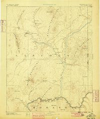
~ Saint Thomas NV topo map, 1:250000 scale, 1 X 1 Degree, Historical, 1886, updated 1900
Saint Thomas, Nevada, USGS topographic map dated 1886.
Includes geographic coordinates (latitude and longitude). This topographic map is suitable for hiking, camping, and exploring, or framing it as a wall map.
Printed on-demand using high resolution imagery, on heavy weight and acid free paper, or alternatively on a variety of synthetic materials.
Topos available on paper, Waterproof, Poly, or Tyvek. Usually shipping rolled, unless combined with other folded maps in one order.
- Product Number: USGS-6009255
- Free digital map download (high-resolution, GeoPDF): Saint Thomas, Nevada (file size: 6 MB)
- Map Size: please refer to the dimensions of the GeoPDF map above
- Weight (paper map): ca. 55 grams
- Map Type: POD USGS Topographic Map
- Map Series: HTMC
- Map Verison: Historical
- Cell ID: 322490
- Scan ID: 321775
- Imprint Year: 1900
- Datum: Unstated
- Map Projection: Unstated
- Map published by United States Geological Survey
- Map Language: English
- Scanner Resolution: 600 dpi
- Map Cell Name: Las Vegas E
- Grid size: 1 X 1 Degree
- Date on map: 1886
- Map Scale: 1:250000
- Geographical region: Nevada, United States
Neighboring Maps:
All neighboring USGS topo maps are available for sale online at a variety of scales.
Spatial coverage:
Topo map Saint Thomas, Nevada, covers the geographical area associated the following places:
- Overton - Garnet - Gold Butte (historical) - Kaolin (historical) - Hupton (historical) - Bonelli Landing - West End (historical) - Moapa Town - Henderson - Farrier - Moapa Valley - West Point (historical) - Apex - Hoya - Rioville (historical) - Arrolime - Dry Lake - Fort Callville (historical) - Crystal (historical) - Amber - Stewarts Point - Lost City (historical) - Simonsville (historical) - Old Overton (historical) - Mesquite - Bunkerville - Ute - Junction City (historical) - Lake Las Vegas - Rox - Hesse Camp (historical) - Moapa - Glendale - Jackman - Meadview - Logandale - South Cove - Glassand - Echo Bay - Saint Joseph (historical) - Arrowhead - Copper City (historical) - Victory Village - Carver Park - Saint Thomas (historical) - Riverside - Silver City (historical)
- Map Area ID: AREA3736-115-114
- Northwest corner Lat/Long code: USGSNW37-115
- Northeast corner Lat/Long code: USGSNE37-114
- Southwest corner Lat/Long code: USGSSW36-115
- Southeast corner Lat/Long code: USGSSE36-114
- Northern map edge Latitude: 37
- Southern map edge Latitude: 36
- Western map edge Longitude: -115
- Eastern map edge Longitude: -114


