
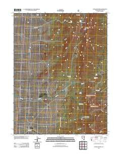
~ Schellbourne NV topo map, 1:24000 scale, 7.5 X 7.5 Minute, Historical, 2012
Schellbourne, Nevada, USGS topographic map dated 2012.
Includes geographic coordinates (latitude and longitude). This topographic map is suitable for hiking, camping, and exploring, or framing it as a wall map.
Printed on-demand using high resolution imagery, on heavy weight and acid free paper, or alternatively on a variety of synthetic materials.
Topos available on paper, Waterproof, Poly, or Tyvek. Usually shipping rolled, unless combined with other folded maps in one order.
- Product Number: USGS-5587356
- Free digital map download (high-resolution, GeoPDF): Schellbourne, Nevada (file size: 20 MB)
- Map Size: please refer to the dimensions of the GeoPDF map above
- Weight (paper map): ca. 55 grams
- Map Type: POD USGS Topographic Map
- Map Series: US Topo
- Map Verison: Historical
- Cell ID: 40175
- Datum: North American Datum of 1983
- Map Projection: Transverse Mercator
- Map Cell Name: Schellbourne
- Grid size: 7.5 X 7.5 Minute
- Date on map: 2012
- Map Scale: 1:24000
- Geographical region: Nevada, United States
Neighboring Maps:
All neighboring USGS topo maps are available for sale online at a variety of scales.
Spatial coverage:
Topo map Schellbourne, Nevada, covers the geographical area associated the following places:
- Fera One Hundred One - Lewis Springs - Lovell Peak - Schellbourne Maintenance Station - Schellbourne Post Office (historical) - Queen Springs - Cooleys Cabin - Queen Spring Mountain - Schellbourne - Long Gulch - Schellbourne Pass - The Nipple - White Horse Mine - Upper Gulch Spring - Basin Spring - Costello Place - Zips Cabin - Schell Creek Station (historical) - May Queen Mine - McMaughn Canyon - Mud Spring - Upper Long Gulch Spring - McIntosh Place - Cold Spring - North Lovell Peak - Schellbourne Station - Schellbourne Springs - Aurum Mining District
- Map Area ID: AREA39.87539.75-114.75-114.625
- Northwest corner Lat/Long code: USGSNW39.875-114.75
- Northeast corner Lat/Long code: USGSNE39.875-114.625
- Southwest corner Lat/Long code: USGSSW39.75-114.75
- Southeast corner Lat/Long code: USGSSE39.75-114.625
- Northern map edge Latitude: 39.875
- Southern map edge Latitude: 39.75
- Western map edge Longitude: -114.75
- Eastern map edge Longitude: -114.625


