
~ Blue Diamond NE NV topo map, 1:24000 scale, 7.5 X 7.5 Minute, Historical, 2012
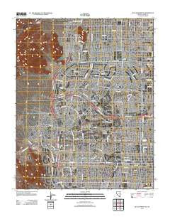
Blue Diamond NE, Nevada, USGS topographic map dated 2012.
Includes geographic coordinates (latitude and longitude). This topographic map is suitable for hiking, camping, and exploring, or framing it as a wall map.
Printed on-demand using high resolution imagery, on heavy weight and acid free paper, or alternatively on a variety of synthetic materials.
Topos available on paper, Waterproof, Poly, or Tyvek. Usually shipping rolled, unless combined with other folded maps in one order.
- Product Number: USGS-5585303
- Free digital map download (high-resolution, GeoPDF): Blue Diamond NE, Nevada (file size: 26 MB)
- Map Size: please refer to the dimensions of the GeoPDF map above
- Weight (paper map): ca. 55 grams
- Map Type: POD USGS Topographic Map
- Map Series: US Topo
- Map Verison: Historical
- Cell ID: 4484
- Datum: North American Datum of 1983
- Map Projection: Transverse Mercator
- Map Cell Name: Blue Diamond NE
- Grid size: 7.5 X 7.5 Minute
- Date on map: 2012
- Map Scale: 1:24000
- Geographical region: Nevada, United States
Neighboring Maps:
All neighboring USGS topo maps are available for sale online at a variety of scales.
Spatial coverage:
Topo map Blue Diamond NE, Nevada, covers the geographical area associated the following places:
- Walter Johnson Junior High School - Clark County Fire Department Station 28 - University Medical Center of Southern Nevada Summerlin Area Quick Care - Top Kids Learning Enrichment Center - Lit'l Scholar Summerlin - Box Canyon - Summerlin Post Office - Trails Pool - Las Vegas Fire and Rescue Station 44 - Rainbow Library - Suncoast Hotel and Casino - Whitehead Springs - Badlands Golf Course - Summerlin Community Baptist Church - Mountain Shadows Community Center - TOP Christian Learning Academy - Johnson Track Break Center - Childrens World Learning Center - Word of Life Christian Center - Unity Church of the Desert - Angel Park Golf Club - Sahara Parkway Shopping Center - University Medical Center of Southern Nevada Peccole Ranch Quick Care - Faith Lutheran Academy - Iron Age Mine - Tournament Players Club at Summerlin Golf Course - West Craig Road Baptist Church - Challenger School Lone Mountain - Desert Vista Community Center - Mountain View Presbyterian Church - Patricia A Bendorf Elementary School - International Christian Academy - Sheila R Tarr Elementary School - Summerlin Hospital Medical Center - M J Christensen Elementary School - Summerlin Evangelical Lutheran Church - Wellington Shopping Center - Saint Joseph Husband of Mary Catholic Church - Merryhill School - Eagle Crest Course - Aloha Shores Park - Grace in the Desert Episcopal Church - Walter E Jacobson Elementary School - Linda Rankin Givens Elementary School - Sun City Community Church - Crosswinds Community Church - Judy and John L Goolsby Elementary School - Palo Verde High School - Faith Lutheran Middle School and High School - Las Vegas Fire and Rescue Station 7 - Sig Rogich Middle School - Cimarron - Memorial High School - KMTW-AM (Las Vegas) - Shenker Academy - City of Las Vegas - Las Vegas Fire and Rescue Station 2 - John W Bonner Elementary School - Edith Garehime Elementary School - Shadow Hills Baptist Church - Tournament Players Club at the Canyons Golf Course - Red Rock Vista Post Office - Las Vegas Fire and Rescue Station 42 - D'Vorre and Hal Ober Elementary School - Dorothy Eisenberg Elementary School - Alexander Dawson School - W Wayne Bunker Family Park - Meadows Fellowship Foursquare Church - Saint Elizabeth Ann Seton Catholic Church - KKVV-AM (Las Vegas) - Summerlin Community Center - Lone Mountain Park - Ernest A Becker Sr Middle School - Herbert A Derfelt Elementary School - Saint Elizabeth Ann Seaton Catholic School - Saint Andrew Lutheran Church - Silver Hills Health Care Center - Harvest Church of the Nazarene - Irwin and Susan Molasky Junior High School - The Church of Jesus Christ of Latter Day Saints - Johnson Community School Park - Legacy Christian Fellowship Church - Richard H Bryan Elementary School - Childrens World Learning Center - Clarence Piggott Elementary School - Kingdom Hall of Jehovahs Witnesses - Ethel Winternheimer Staton Elementary School - Childrens World Learning Center - Newsong Christian Church - Victory Vegas Church - KIinderCare Learning Centers - Marc Kahre Elementary School - Eileen Conners Elementary School - Desert Shores Community Center - Las Vegas Fire and Rescue Station 45 - Sun Shadows Community Center - Trails Park - Desert Breeze Community Center - Word of Life Christian Academy - Community College of Southern Nevada Summerlin Center - Trails Village Center Shopping Center
- Map Area ID: AREA36.2536.125-115.375-115.25
- Northwest corner Lat/Long code: USGSNW36.25-115.375
- Northeast corner Lat/Long code: USGSNE36.25-115.25
- Southwest corner Lat/Long code: USGSSW36.125-115.375
- Southeast corner Lat/Long code: USGSSE36.125-115.25
- Northern map edge Latitude: 36.25
- Southern map edge Latitude: 36.125
- Western map edge Longitude: -115.375
- Eastern map edge Longitude: -115.25


