
~ Whistler Mtn NV topo map, 1:62500 scale, 15 X 15 Minute, Historical, 1956, updated 1978
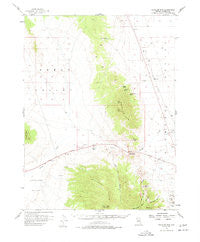
Whistler Mtn, Nevada, USGS topographic map dated 1956.
Includes geographic coordinates (latitude and longitude). This topographic map is suitable for hiking, camping, and exploring, or framing it as a wall map.
Printed on-demand using high resolution imagery, on heavy weight and acid free paper, or alternatively on a variety of synthetic materials.
Topos available on paper, Waterproof, Poly, or Tyvek. Usually shipping rolled, unless combined with other folded maps in one order.
- Product Number: USGS-5573402
- Free digital map download (high-resolution, GeoPDF): Whistler Mtn, Nevada (file size: 6 MB)
- Map Size: please refer to the dimensions of the GeoPDF map above
- Weight (paper map): ca. 55 grams
- Map Type: POD USGS Topographic Map
- Map Series: HTMC
- Map Verison: Historical
- Cell ID: 64463
- Scan ID: 321448
- Imprint Year: 1978
- Woodland Tint: Yes
- Aerial Photo Year: 1954
- Survey Year: 1956
- Datum: NAD27
- Map Projection: Polyconic
- Map published by United States Geological Survey
- Map Language: English
- Scanner Resolution: 600 dpi
- Map Cell Name: Whistler Mountain
- Grid size: 15 X 15 Minute
- Date on map: 1956
- Map Scale: 1:62500
- Geographical region: Nevada, United States
Neighboring Maps:
All neighboring USGS topo maps are available for sale online at a variety of scales.
Spatial coverage:
Topo map Whistler Mtn, Nevada, covers the geographical area associated the following places:
- Eureka Township - Price and Davis Mine - Eureka Airport - Devon Peak - Lees Spring (historical) - Wales Mine - Swallow Canyon - Chance Mine - Eureka Division - Whistler Range - Little Reilley Canyon - Signal Peak - Anchor Peak - Hay Meadow - Yahoo Canyon - Stinking Spring - Modoc Peak - Whistler Mountain - U'ans-in-dame Creek - Trap Corral Spring - Zulu Canyon - Diamond (historical) - Silver Lick Mine - Spring Valley Mining District - Hay Ranch - Diamond Valley Volunteer Fire Department - Kobeh Valley - Railroad Spring - Hash Spring - Big Reilley Canyon - Devils Gate
- Map Area ID: AREA39.7539.5-116.25-116
- Northwest corner Lat/Long code: USGSNW39.75-116.25
- Northeast corner Lat/Long code: USGSNE39.75-116
- Southwest corner Lat/Long code: USGSSW39.5-116.25
- Southeast corner Lat/Long code: USGSSE39.5-116
- Northern map edge Latitude: 39.75
- Southern map edge Latitude: 39.5
- Western map edge Longitude: -116.25
- Eastern map edge Longitude: -116


