
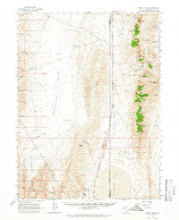
~ Kumiva Peak NV topo map, 1:62500 scale, 15 X 15 Minute, Historical, 1964, updated 1966
Kumiva Peak, Nevada, USGS topographic map dated 1964.
Includes geographic coordinates (latitude and longitude). This topographic map is suitable for hiking, camping, and exploring, or framing it as a wall map.
Printed on-demand using high resolution imagery, on heavy weight and acid free paper, or alternatively on a variety of synthetic materials.
Topos available on paper, Waterproof, Poly, or Tyvek. Usually shipping rolled, unless combined with other folded maps in one order.
- Product Number: USGS-5572720
- Free digital map download (high-resolution, GeoPDF): Kumiva Peak, Nevada (file size: 8 MB)
- Map Size: please refer to the dimensions of the GeoPDF map above
- Weight (paper map): ca. 55 grams
- Map Type: POD USGS Topographic Map
- Map Series: HTMC
- Map Verison: Historical
- Cell ID: 56318
- Scan ID: 321029
- Imprint Year: 1966
- Woodland Tint: Yes
- Aerial Photo Year: 1962
- Field Check Year: 1964
- Datum: NAD27
- Map Projection: Polyconic
- Map published by United States Geological Survey
- Map Language: English
- Scanner Resolution: 600 dpi
- Map Cell Name: Kumiva Peak
- Grid size: 15 X 15 Minute
- Date on map: 1964
- Map Scale: 1:62500
- Geographical region: Nevada, United States
Neighboring Maps:
All neighboring USGS topo maps are available for sale online at a variety of scales.
Spatial coverage:
Topo map Kumiva Peak, Nevada, covers the geographical area associated the following places:
- Threemile Canyon Well - White Sage Flat Well - Thrabert Mine - Trail Canyon - Hooker Mining District - Little Jenny Creek - Jackass Spring - Empire Farms Landing Strip (historical) - Rodeo Creek - Purgatory Peak - San Emidio Spring - Stag Spring - Luxor Peak - Little Rattlesnake Canyon - Jenny Creek - Kumiva Peak - Cowles Ranch - Mount Limbo - Wildcat Peak - Rattlesnake Canyon - Kits Peak - Falcon Hill - Boiling Spring - San Emidio Canyon - White Sage Flat - Coyote Creek - Trail Canyon - Bull Creek - San Emidio Desert - Poito Valley - Rosebud Spring - Stormy Day Mine - Jayhawk Creek - Stag Canyon - Rock Spring - Thrasher Mine - Mountain Spring - U S Gypsum Mine - Threemile Canyon
- Map Area ID: AREA40.540.25-119.5-119.25
- Northwest corner Lat/Long code: USGSNW40.5-119.5
- Northeast corner Lat/Long code: USGSNE40.5-119.25
- Southwest corner Lat/Long code: USGSSW40.25-119.5
- Southeast corner Lat/Long code: USGSSE40.25-119.25
- Northern map edge Latitude: 40.5
- Southern map edge Latitude: 40.25
- Western map edge Longitude: -119.5
- Eastern map edge Longitude: -119.25


