
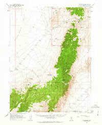
~ Fencemaker NV topo map, 1:62500 scale, 15 X 15 Minute, Historical, 1961, updated 1963
Fencemaker, Nevada, USGS topographic map dated 1961.
Includes geographic coordinates (latitude and longitude). This topographic map is suitable for hiking, camping, and exploring, or framing it as a wall map.
Printed on-demand using high resolution imagery, on heavy weight and acid free paper, or alternatively on a variety of synthetic materials.
Topos available on paper, Waterproof, Poly, or Tyvek. Usually shipping rolled, unless combined with other folded maps in one order.
- Product Number: USGS-5572502
- Free digital map download (high-resolution, GeoPDF): Fencemaker, Nevada (file size: 8 MB)
- Map Size: please refer to the dimensions of the GeoPDF map above
- Weight (paper map): ca. 55 grams
- Map Type: POD USGS Topographic Map
- Map Series: HTMC
- Map Verison: Historical
- Cell ID: 54115
- Scan ID: 320901
- Imprint Year: 1963
- Woodland Tint: Yes
- Aerial Photo Year: 1957
- Survey Year: 1961
- Datum: NAD27
- Map Projection: Polyconic
- Map published by United States Geological Survey
- Map Language: English
- Scanner Resolution: 600 dpi
- Map Cell Name: Fencemaker
- Grid size: 15 X 15 Minute
- Date on map: 1961
- Map Scale: 1:62500
- Geographical region: Nevada, United States
Neighboring Maps:
All neighboring USGS topo maps are available for sale online at a variety of scales.
Spatial coverage:
Topo map Fencemaker, Nevada, covers the geographical area associated the following places:
- Root Spring Canyon - Fencemaker Camp - Dago Spring - Fencemaker Mine - Root Spring - Twin Springs - Pleasant Valley Beacon - Big Ben Canyon - Gilberts Mine - Grayson Spring - Band M Mine - Logan Spring - Red Hill - Ladd Canyon - Buena Vista Windmill - Fencemaker Pass - Kitten Springs - Kitten Springs Canyon - Hot Spring - Logan Canyon - Polkinghorne Spring - Fencemaker - Victory Mine - Freckles Mine - Susie Mine - Logan Peak - Grayson Canyon - Gamble Basin - Reed Canyon - Table Mountain Mining District - Table Mountain - Ringling Ranch - Storm Mine - McKinney Pass - Kyle Spring - Fencemaker Canyon - Mustang Spring - Old Man Canyon
- Map Area ID: AREA40.2540-118-117.75
- Northwest corner Lat/Long code: USGSNW40.25-118
- Northeast corner Lat/Long code: USGSNE40.25-117.75
- Southwest corner Lat/Long code: USGSSW40-118
- Southeast corner Lat/Long code: USGSSE40-117.75
- Northern map edge Latitude: 40.25
- Southern map edge Latitude: 40
- Western map edge Longitude: -118
- Eastern map edge Longitude: -117.75


