
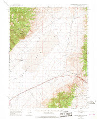
~ Edwards Creek Valley NV topo map, 1:62500 scale, 15 X 15 Minute, Historical, 1966, updated 1968
Edwards Creek Valley, Nevada, USGS topographic map dated 1966.
Includes geographic coordinates (latitude and longitude). This topographic map is suitable for hiking, camping, and exploring, or framing it as a wall map.
Printed on-demand using high resolution imagery, on heavy weight and acid free paper, or alternatively on a variety of synthetic materials.
Topos available on paper, Waterproof, Poly, or Tyvek. Usually shipping rolled, unless combined with other folded maps in one order.
- Product Number: USGS-5572476
- Free digital map download (high-resolution, GeoPDF): Edwards Creek Valley, Nevada (file size: 7 MB)
- Map Size: please refer to the dimensions of the GeoPDF map above
- Weight (paper map): ca. 55 grams
- Map Type: POD USGS Topographic Map
- Map Series: HTMC
- Map Verison: Historical
- Cell ID: 53755
- Scan ID: 320882
- Imprint Year: 1968
- Woodland Tint: Yes
- Aerial Photo Year: 1964
- Field Check Year: 1966
- Datum: NAD27
- Map Projection: Polyconic
- Map published by United States Geological Survey
- Map Language: English
- Scanner Resolution: 600 dpi
- Map Cell Name: Edwards Creek Valley
- Grid size: 15 X 15 Minute
- Date on map: 1966
- Map Scale: 1:62500
- Geographical region: Nevada, United States
Neighboring Maps:
All neighboring USGS topo maps are available for sale online at a variety of scales.
Spatial coverage:
Topo map Edwards Creek Valley, Nevada, covers the geographical area associated the following places:
- Healys Creek - Augusta Mining District - Straight Canyon - Edwards Creek - Smooth Canyon - Abel Spring - Bob Spring - Overland Stage Station - New Pass Spring - Willow Cañon Creek - New Pass - Upper Lower Jordan Valley Spring - Tungsten Mountain Mine - Tungsten Mountain - Rocky Canyon - Augusta Canyon - Stone Canyon - New Pass Mining District - Nevada Gold Group Mine - Tungsten Mountain Mining District - Smooth Canyon Spring - Edwards Creek Valley - Byers Ranch - New Pass Well - Rocky Creek - Eagle Springs - Scotts Camp - Overland Stage Station - New Pass Creek - Hudson Airport - Edwards Creek Well Number One - Horse Canyon - Shoshone Pass - Horseshoe Well
- Map Area ID: AREA39.7539.5-117.75-117.5
- Northwest corner Lat/Long code: USGSNW39.75-117.75
- Northeast corner Lat/Long code: USGSNE39.75-117.5
- Southwest corner Lat/Long code: USGSSW39.5-117.75
- Southeast corner Lat/Long code: USGSSE39.5-117.5
- Northern map edge Latitude: 39.75
- Southern map edge Latitude: 39.5
- Western map edge Longitude: -117.75
- Eastern map edge Longitude: -117.5


