
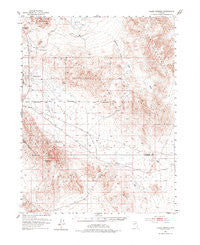
~ Allen Springs NV topo map, 1:62500 scale, 15 X 15 Minute, Historical, 1951, updated 1977
Allen Springs, Nevada, USGS topographic map dated 1951.
Includes geographic coordinates (latitude and longitude). This topographic map is suitable for hiking, camping, and exploring, or framing it as a wall map.
Printed on-demand using high resolution imagery, on heavy weight and acid free paper, or alternatively on a variety of synthetic materials.
Topos available on paper, Waterproof, Poly, or Tyvek. Usually shipping rolled, unless combined with other folded maps in one order.
- Product Number: USGS-5572090
- Free digital map download (high-resolution, GeoPDF): Allen Springs, Nevada (file size: 9 MB)
- Map Size: please refer to the dimensions of the GeoPDF map above
- Weight (paper map): ca. 55 grams
- Map Type: POD USGS Topographic Map
- Map Series: HTMC
- Map Verison: Historical
- Cell ID: 50437
- Scan ID: 320669
- Imprint Year: 1977
- Aerial Photo Year: 1948
- Survey Year: 1951
- Datum: NAD27
- Map Projection: Polyconic
- Map published by United States Geological Survey
- Map Language: English
- Scanner Resolution: 600 dpi
- Map Cell Name: Allen Springs
- Grid size: 15 X 15 Minute
- Date on map: 1951
- Map Scale: 1:62500
- Geographical region: Nevada, United States
Neighboring Maps:
All neighboring USGS topo maps are available for sale online at a variety of scales.
Spatial coverage:
Topo map Allen Springs, Nevada, covers the geographical area associated the following places:
- Red Ridge - Allen Springs - Rawhide Flats - Brown Knob - Cocoon Mountains - Diamond Field Jack Wash - Camp Terrill - Barnett Hills - Terrill Mountains - Blow Sand Mountains - Black Butte Mine - Stinking Springs - Holy Cross Mining District - Bimetal Mine - Russell Pass - Pyramid Mine - Cox Station (historical) - Lee Hot Springs - Cinnebar Hill Mine - Deep Hollow (historical)
- Map Area ID: AREA39.2539-118.75-118.5
- Northwest corner Lat/Long code: USGSNW39.25-118.75
- Northeast corner Lat/Long code: USGSNE39.25-118.5
- Southwest corner Lat/Long code: USGSSW39-118.75
- Southeast corner Lat/Long code: USGSSE39-118.5
- Northern map edge Latitude: 39.25
- Southern map edge Latitude: 39
- Western map edge Longitude: -118.75
- Eastern map edge Longitude: -118.5


