
~ Wheeler Peak NV topo map, 1:24000 scale, 7.5 X 7.5 Minute, Historical, 1990, updated 1995
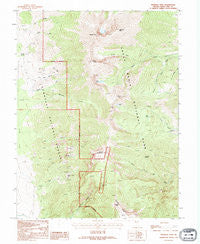
Wheeler Peak, Nevada, USGS topographic map dated 1990.
Includes geographic coordinates (latitude and longitude). This topographic map is suitable for hiking, camping, and exploring, or framing it as a wall map.
Printed on-demand using high resolution imagery, on heavy weight and acid free paper, or alternatively on a variety of synthetic materials.
Topos available on paper, Waterproof, Poly, or Tyvek. Usually shipping rolled, unless combined with other folded maps in one order.
- Product Number: USGS-5571876
- Free digital map download (high-resolution, GeoPDF): Wheeler Peak, Nevada (file size: 16 MB)
- Map Size: please refer to the dimensions of the GeoPDF map above
- Weight (paper map): ca. 55 grams
- Map Type: POD USGS Topographic Map
- Map Series: HTMC
- Map Verison: Historical
- Cell ID: 48557
- Scan ID: 320542
- Imprint Year: 1995
- Woodland Tint: Yes
- Aerial Photo Year: 1990
- Datum: NAD27
- Map Projection: Transverse Mercator
- Provisional map: Yes
- Map published by United States Geological Survey
- Map Language: English
- Scanner Resolution: 600 dpi
- Map Cell Name: Wheeler Peak
- Grid size: 7.5 X 7.5 Minute
- Date on map: 1990
- Map Scale: 1:24000
- Geographical region: Nevada, United States
Neighboring Maps:
All neighboring USGS topo maps are available for sale online at a variety of scales.
Spatial coverage:
Topo map Wheeler Peak, Nevada, covers the geographical area associated the following places:
- Shoshone Campground - Wheeler Peak Scenic Area (historical) - Tungsten Mines Post Office (historical) - Box Canyon - Bristlecone Pine Interpretive Trail - Mount Washington Mining District - Jeff Davis Peak - Big Wash Spring - Hub Mine - Tungsten Mining District - Dead Lake - Johnson Mine - Williams Canyon - Pyramid Peak - Great Basin National Park - Mount Washington - North Fork Baker Creek - Treasure Lake - Raised Spring - Mount Wheeler Mine - Pine Creek - Saint Lawrence Mine - Hub Mine Basin - Pole Canyon - Baker Shoshone Trail - Lincoln Peak - Johnson Lake - Wheeler Peak - Baker Peak - Baker Lake - Dry Canyon
- Map Area ID: AREA3938.875-114.375-114.25
- Northwest corner Lat/Long code: USGSNW39-114.375
- Northeast corner Lat/Long code: USGSNE39-114.25
- Southwest corner Lat/Long code: USGSSW38.875-114.375
- Southeast corner Lat/Long code: USGSSE38.875-114.25
- Northern map edge Latitude: 39
- Southern map edge Latitude: 38.875
- Western map edge Longitude: -114.375
- Eastern map edge Longitude: -114.25


