
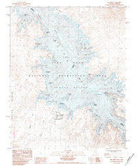
~ The Temple NV topo map, 1:24000 scale, 7.5 X 7.5 Minute, Historical, 1983, updated 1984
The Temple, Nevada, USGS topographic map dated 1983.
Includes geographic coordinates (latitude and longitude). This topographic map is suitable for hiking, camping, and exploring, or framing it as a wall map.
Printed on-demand using high resolution imagery, on heavy weight and acid free paper, or alternatively on a variety of synthetic materials.
Topos available on paper, Waterproof, Poly, or Tyvek. Usually shipping rolled, unless combined with other folded maps in one order.
- Product Number: USGS-5571378
- Free digital map download (high-resolution, GeoPDF): The Temple, Nevada (file size: 14 MB)
- Map Size: please refer to the dimensions of the GeoPDF map above
- Weight (paper map): ca. 55 grams
- Map Type: POD USGS Topographic Map
- Map Series: HTMC
- Map Verison: Historical
- Cell ID: 44801
- Scan ID: 320292
- Imprint Year: 1984
- Aerial Photo Year: 1978
- Edit Year: 1983
- Field Check Year: 1982
- Datum: NAD27
- Map Projection: Universal Transverse Mercator
- Provisional map: Yes
- Map published by United States Geological Survey
- Map Language: English
- Scanner Resolution: 600 dpi
- Map Cell Name: The Temple
- Grid size: 7.5 X 7.5 Minute
- Date on map: 1983
- Map Scale: 1:24000
- Geographical region: Nevada, United States
Neighboring Maps:
All neighboring USGS topo maps are available for sale online at a variety of scales.
Spatial coverage:
Topo map The Temple, Nevada, covers the geographical area associated the following places:
- Temple Bar Marina - Napoleons Tomb - Boat Wreck Point - The Campanile - Houseboat Island - Teal Coves - Gateway Cove - Decision Island - Temple Basin - Temple Basin - Temple Bar Airport - Wild Burro Bay - Sawtooth Bay - Trail Rapids Bay - Striper Bay - The Head - Delmar Bay - The Haystacks - Temple Bay - Temple Wash - Monkey Cove - Plane Crash Island - Delmar Butte - Trail Rapids Wash - Mesa Cove - Grebe Bay - Haystack Bay - Monkey Cove Spring - Temple Bar - Temple Bar Mill (historical) - Virgin Canyon - The Temple - Ladder Cove - Temple Bar Boat Anchorage - Temple Bar (historical) - Heron Point - Mushroom Reef - The Jawbone
- Map Area ID: AREA36.12536-114.375-114.25
- Northwest corner Lat/Long code: USGSNW36.125-114.375
- Northeast corner Lat/Long code: USGSNE36.125-114.25
- Southwest corner Lat/Long code: USGSSW36-114.375
- Southeast corner Lat/Long code: USGSSE36-114.25
- Northern map edge Latitude: 36.125
- Southern map edge Latitude: 36
- Western map edge Longitude: -114.375
- Eastern map edge Longitude: -114.25


