
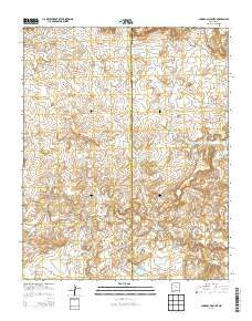
~ Canada Calladita NM topo map, 1:24000 scale, 7.5 X 7.5 Minute, Current, 2013
Canada Calladita, New Mexico, USGS topographic map dated 2013.
Includes geographic coordinates (latitude and longitude). This topographic map is suitable for hiking, camping, and exploring, or framing it as a wall map.
Printed on-demand using high resolution imagery, on heavy weight and acid free paper, or alternatively on a variety of synthetic materials.
Topos available on paper, Waterproof, Poly, or Tyvek. Usually shipping rolled, unless combined with other folded maps in one order.
- Product Number: USGS-7791079
- Free digital map download (high-resolution, GeoPDF): Canada Calladita, New Mexico (file size: 32 MB)
- Map Size: please refer to the dimensions of the GeoPDF map above
- Weight (paper map): ca. 55 grams
- Map Type: POD USGS Topographic Map
- Map Series: US Topo
- Map Verison: Current
- Cell ID: 6996
- Datum: North American Datum of 1983
- Map Projection: Transverse Mercator
- Map Cell Name: Canada Calladita
- Grid size: 7.5 X 7.5 Minute
- Date on map: 2013
- Map Scale: 1:24000
- Geographical region: New Mexico, United States
Neighboring Maps:
All neighboring USGS topo maps are available for sale online at a variety of scales.
Spatial coverage:
Topo map Canada Calladita, New Mexico, covers the geographical area associated the following places:
- 10009 Water Well - Cañon de Alamo - Arroyo la Azabache - County Line Pit - Rattlesnake Tank - Sand Column Tank - Cañada Salada - Cholla Tank - Arroyo Empedrado Water Well - Arroyo Gallina - R-24 Water Well - Cañada Bernardino - Mud Flat Tank - R-23 Water Well - E Montoya Dam Number Nine - Lost Tank - Cañon Ignacio Rico - County Line Dam - Cholla Water Well - Rancho De Stephan - Cañon Blanco - B P Hovey Ranch Prospect - Saddle Tank - County Line Tank - Arroyo Seccion - Cañada Alimento - Cañoncito - Cañada Calladita - Tucker Ranch - Cañada Lagunita - 15B-32 Water Well
- Map Area ID: AREA35.7535.625-107.375-107.25
- Northwest corner Lat/Long code: USGSNW35.75-107.375
- Northeast corner Lat/Long code: USGSNE35.75-107.25
- Southwest corner Lat/Long code: USGSSW35.625-107.375
- Southeast corner Lat/Long code: USGSSE35.625-107.25
- Northern map edge Latitude: 35.75
- Southern map edge Latitude: 35.625
- Western map edge Longitude: -107.375
- Eastern map edge Longitude: -107.25


