
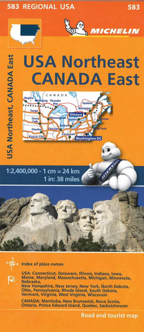
USA northeast : Canada east
Part of the orange regional series from Michelin, this Northeastern USA, Eastern Canada map shows this part of North America in excellent detail. Primary & secondary road networks are clearly marked out with indications of the number of lanes, intermediate distances and various possible road obstacles or things you should know including steep hills, height limits, toll barriers, prohibited roads and roads subject to restrictions.
The map also includes small insets with street plans of the regions major towns, showing road names, one way streets and various places of interest (tourist sights, hospitals, parking, railway stations, etc.). Scenic routes on the map are marked out in green and an extensive index of place names is included.
The map also features:
Administrative boundaries
Railways, Airports and Ferry Services
Important sights such as castles, ruins, and churches
Driving Times and Distance Charts
Road Safety Information
A legend in French, G
- Product Number: M_583_19
- Reference Product Number: 2327734M
- ISBN: 9782067175235
- Date of Publication: 6/1/2018
- Folded Size: 9.84 inches high by 4.33 inches wide
- Unfolded (flat) Size: 52.36 inches high by 39.37 inches wide
- Map format: Folded
- Map type: Trade Maps - Road
- Geographical region: Canada,United States
- Geographical subregion: Connecticut,Delaware,Illinois,Indiana,Iowa,Maine,Maryland,Massachusetts,Michigan,Minnesota,Nebraska,New Hampshire,New Jersey,New York,North Dakota,Ohio,Ontario,Pennsylvania,Quebec,Rhode Island,South Dakota,Vermont,Virginia,West Virginia,Wisconsin


