
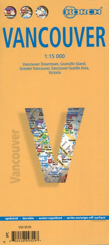
Vancouver, Canada City Map
Very clear, indexed, tourist street plan on durable laminated paper showing Downtown Vancouver at 1:15,000, with more general road map of the greater Vancouver area on the reverse. Street map detail includes one-way streets, notable buildings, shopping malls, pedestrian zones, railway lines and stations, and ferry links. Symbols denote information centres, monuments, places of worship, theatres, sites of interest, car parks, hotels, bus stations, etc.
The main map coverage extends from the Vancouver General Hospital in the south Beach to Capilano Highlands in North Vancouver and spans approx. 7km E-W, thus including Stanley Park. A small inset at 1:5,500 shows Granville Island in greater detail. The Greater Vancouver road map is at 1:125,000 and shows the main road and rail communications, municipal divisions and notable sites, covering an area from Delta in the south east to Horseshoe Bay in the north west. A 1:1,800,000 road map shows the Seattle / Vancouver region, and there
- Product Number: BOR_VANC_17
- Reference Product Number: 2259765M
- ISBN: 9783866093294
- Date of Publication: 6/1/2017
- Folded Size: 9.84 inches high by 4.33 inches wide
- Unfolded (flat) Size: 19.69 inches high by 25.98 inches wide
- Map format: Folded
- Map type: Trade Maps - City Maps
- Geographical region: Canada
- Geographical subregion: British Columbia


